
Feds, State share data AIMing to save resources
Data and assessments are crucial in science. What and how information is gathered can vary when used with other datasets and can determine how useful the information is across multiple objectives. The Bureau of Land Management aimed to provide a way for information to be collected once and used repeatedly for many reasons across multiple programs. That strategy is called AIM.
The Assessment, Inventory and Monitoring, or AIM, Strategy provides several basic tenets to ensure that BLM’s inventory and monitoring efforts benefit the agency and public. One key element is standardized measures for monitoring the conditions of resources, such as water and vegetation, on public lands. Standardization allows for easy comparisons of data collected in different places and over time. Standardization also helps inform management decisions to support diverse multiple uses on public lands – weighty stuff. The protocol helps ensure the data gathered, whether it’s by the state, a university, or federal agencies, are compatible with each other.
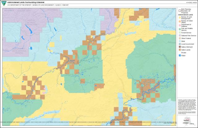
Why does data similarity matter? Well, Alaska’s a big state. A very big state and the millions of acres of streams, habitat, plants and soils don’t recognize map boundaries or the complexities of land ownership. For scientists to provide accurate information about the health and trends of Alaska’s ecosystems, they need data that also cross map boundaries and jurisdictions.
The BLM started developing AIM in the early 2000s. The BLM scientists looked at several different data collection methods to figure out what would make the most sense, given resources found on public lands, and what method would best help to understand the current condition of those resources. The protocol BLM adopted needed to be scalable because that allows data to be collected by a local resource manager and, if needed, combined with data collected elsewhere to address larger reporting needs – even at the national level. It also made sense, in time, money and resources, to collect the data once and use it to answer a variety of questions in multiple areas.
Through BLM’s research, they noticed the Environmental Protection Agency’s approach to their national rivers and streams assessments made a lot of sense and might just work, with slight modifications, for their own aquatic habitat assessments under AIM.
Approximately 90% of the EPA’s methodology and statistical design was incorporated into the AIM’s framework, allowing BLM’s data to pool together with other agencies using the same data collection protocols. In essence, apples to apples and not apples to orangutans.
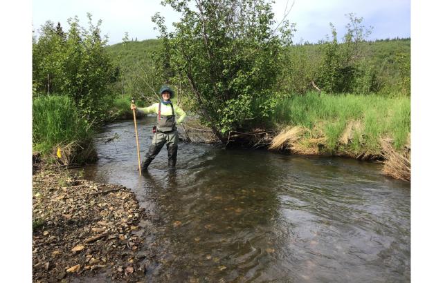
“It's very powerful,” said Matt Varner, fisheries and riparian resource lead for BLM Alaska. “We can collect data at maybe 50 sites within a fairly large geographic area and use the results to describe aquatic resources across the entirety of that area. So, it's very scalable, and we can use that data locally or regionally to meet resource information needs.”
Varner continued that this data collection process allows for cooperation and partnership beyond simple information flow. It also provides the very practical cost-saving advantage (on many levels) of everyone using the same protocol.
“The Alaska Department of Environmental Conservation [DEC] was a natural partner because they were already doing similar work,” said Varner, noting the National Park Service and the University of Alaska researchers are also using the AIM protocols.
The state has used EPA components of AIM for several years now, according to Meredith Witte, an environmental program specialist with DEC Water Division’s Monitoring and Assessment Group. She said the protocol has helped her agency plug its data into Alaska-related programs, as well as larger, national EPA surveys.
“We don’t want to reinvent the wheel here, we want to add to it,” said Witte. “We find there’s a lot of value in that.”
“Our partnership with federal agencies, as well as the state, is critical because we don't have infinite [labor and fiscal] resources,” said Varner. “We have to leverage what we all bring to the table so that we can better understand the conditions of the [natural] resources on the landscape.”
What this means is that if DEC has already collected data the BLM needs, there’s no need to send another team, provided the protocols for collecting the data are the same. In a state where roads are the exception and aviation is a costly necessity, cooperation like this can pay huge dividends for already stretched budgets. AIM protocols allow multiple agencies to share each other’s data and work towards a more statewide approach through coordinated field efforts.
In fact, getting everyone on the “AIM” page is why BLM Alaska hosts aquatic AIM-based training sessions every year.
For Deanna Strohm-Klobucar, an aquatic biologist and lab manager with the Alaska Cooperative Fish and Wildlife Research Unit at the University of Alaska, Fairbanks, the BLM AIM training is critical to her team’s success.
“We have a future grad student who will quantify habitat characteristics in Interior Alaska and [the training] taught him about geomorphology and how to identify core characteristics, such as bankfull channel dimensions, pools, bank stability and foliage cover,” said Strohm-Klobucar. “These topics are very subjective, so having training is really important.”
To learn more about AIM or to inquire about the upcoming training, currently scheduled for May 16 - 21, contact Matt Varner at [email protected]. All available AIM data may be found on the BLM Landscape Approach Data Portal.
Related Stories
- Dino-Mite Story Time in Pinedale
- Reel Partners: BLM and Wyoming Game and Fish Cast a Line for Kemmerer’s Next Generation
- To what degree do livestock stocking rates alter nesting bees and flowers?
- Hooked on stewardship: Lake Havasu Field Office celebrates Fisheries Improvement Program volunteers
- BLM-managed lands support NASA’s autonomous lunar rover testing in Imperial County, California
Office
222 W 7th Avenue #13
Anchorage, AK 99513
United States