
The Flight of the Nez Perce
This week's story map features the Nez Perce War of 1877. This was an armed conflict between the US Army and the several bands of the Nez Perce or Nimiipuu Tribe of Native Americans. The conflict arose when the United States altered a previously agreed upon treaty by reducing the area of the established Nez Perce Reservation by approximately 90%. The new treaty was known to the Nez Perce as the "Thief Treaty." The conflict is also known as the Nez Perce Flight of 1877, as the objective of the Nez Perce combatants was to ultimately find a new place outside the forced reservation boundaries to settle. Read more on ArcGIS Story Maps.
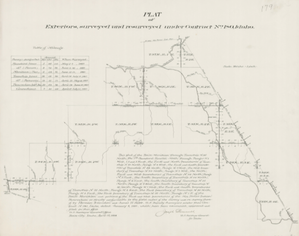
The GLO website provides live access to Federal land conveyance records for the Public Land States, including image access to more than 12 million federal land title records issued between 1788 and the present.
The site also hosts images of survey plats and field notes, land status records, and control document index records, and is the most visited website in the Department of the Interior. Visit glorecords.blm.gov for more information.
Related Stories
- Sharing the Spirit of America: A Celebration on the Snake River Canyon Rim
- BLM Launches a Modernized General Land Office Records System
- BLM, Partners Enhance Public Access at Popular Recreation Area
- Framed for Freedom: Bureau of Land Management Eastern States and the Legacy of National Historic Trails
- BLM Celebrates America’s 250th Anniversary in Oregon
Office
5275 Leesburg Pike
Falls Church, VA 22041
United States