
Steele Creek: History in the heart of the Alaska’s Fortymile region
The Fortymile region, the scene of Interior Alaska’s first gold rush in 1886, played a central role in the early history of mining in Alaska. For those willing to stray slightly from the beaten path, the former community of Steele Creek offers a fascinating glimpse into the Fortymile’s vibrant past.
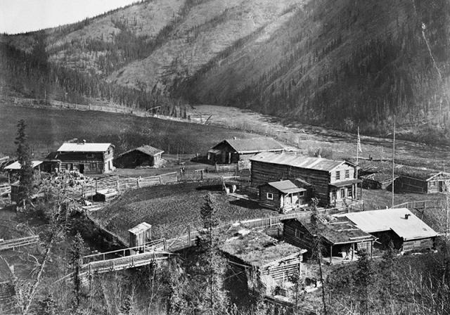
In the early 1900s the Steele Creek community included a post office, roadhouse, farm fields, and a ferry for crossing the Fortymile River, now a designated wild and scenic river. Miners stopped here to pick up mail and hear the latest news while traveling to and from their remote mines or the Yukon River community of Eagle. The community began its decline in the 1950s, when the opening of the Taylor Highway brought road access during summer months.
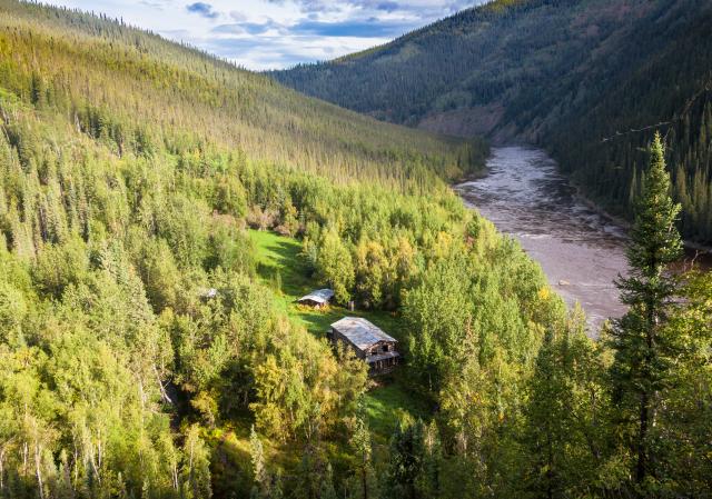
Today several cabins and the roadhouse, an unusual, two-story log structure, sit surrounded by tall grass and encroaching willows next to a rushing stream. Since 2002 the BLM, aided by volunteers and historic building experts, have undertaken several projects to stabilize Steele Creek’s buildings, which have suffered from the elements and a lack of maintenance. The rest of the site has been left as it was.
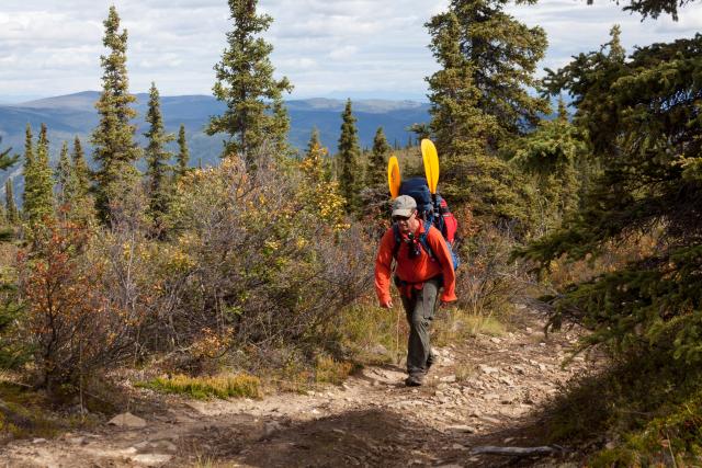
Reaching Steele Creek isn’t easy – you’ll need to hike or ride an off-highway vehicle about 5.5 miles from the Taylor Highway (plan on camping overnight) or stop by the site on a multi-day float trip down the lower Fortymile River. Or you can paddle a packraft from the Taylor Highway – an easy afternoon float -- and hike out to the highway.
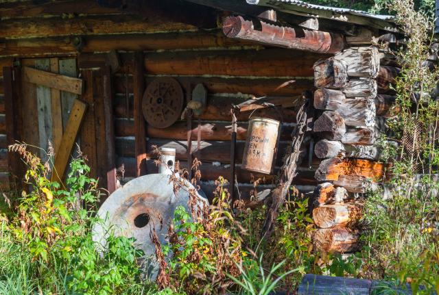
Despite BLM’s restoration efforts, the roadhouse remains unsafe to enter, but several of the cabins are open for the public to explore. Remember that the site’s historic buildings and objects are protected by law – please leave the site exactly as you found it for the next visitors to enjoy! For more information, contact the Eastern Interior Field Office at 907-474-2200/1-800-437-7021 or [email protected].
Some #KnowBeforeYouGo
- The overland trail to Steele Creek starts at Milepost 105 of the Taylor Highway, and is ~5.8 miles long. Of that, the first ~3.8 miles cross State land before entering the Fortymile Wild and Scenic River corridor for the final ~2 miles.
- ATV and UTV traffic inside the Fortymile Wild & Scenic corridor is only allowed with vehicles up to 1500 lb. curb weight, and must keep to the existing trail to Steel Creek once inside the corridor.
- Prepare accordingly for the ~12 mile round trip hike with food, water, and proper gear for any changes in the weather and remote camping.
- Be bear aware, you are hiking in bear country.
- Three of the buildings are unsafe and closed to the public, only Structure B is open. For your safety and the safety of others, do not enter these locked and secured structures.
- Remember to practice the seven Leave No Trace Principles and always Recreate Responsibly.
Get more #KnowBeforeYouGo at the BLM Website.
Related Stories
- A New Chapter on the Missouri: Community Celebrates Expanded Lewis and Clark Paddlers’ Trail
- Sharing the Spirit of America: A Celebration on the Snake River Canyon Rim
- BLM, Partners Enhance Public Access at Popular Recreation Area
- Birding Aravaipa Canyon: A morning of songs, color, and creekside adventure
- Framed for Freedom: Bureau of Land Management Eastern States and the Legacy of National Historic Trails