Armchair Adventures
America’s public lands offer some of the most spectacular and interesting places you’ll ever see. While everyone is encouraged to stay at home, the BLM Blog will feature "Armchair Adventures." This is your opportunity to travel virtually and learn a bit about these amazing places. Today, follow along with the ninth installment of Armchair Adventures.
South Pass, Wyoming
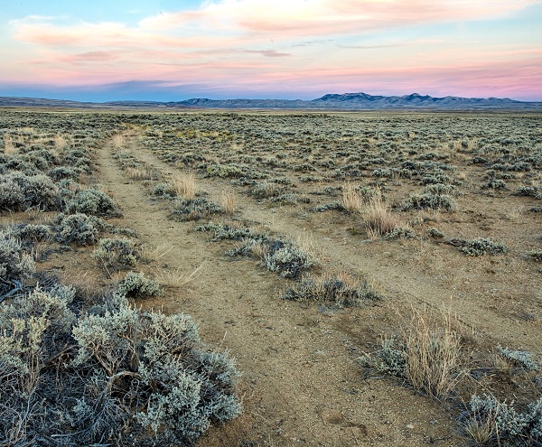
Beginning with Lewis and Clark’s exploration, the effort to find a route through the American West to the Pacific eventually focused on a gentle, almost featureless crossing of the Continental Divide at South Pass Wyoming.
The pass, at an elevation of 7,500 feet, furnished a natural crossing point of the Rockies and became the main route for emigrants on the Oregon, California, and Mormon trails to the West during the 19th century.
Without South Pass, the entire history of the United States’ expansion west of the Mississippi would have been different. South Pass received its name to distinguish it from the tedious and difficult northern route through the Rocky Mountains taken in 1805 and 1806 by Lewis and Clark through the Bitterroot Mountains. A tiny trickle of emigrants using the pass would become a flood in the 1850s and 1860s. Between 1841, when the first Oregon-bound wagon train was organized, and 1869 when the transcontinental railroad was completed, somewhere between 350,000 and 500,000 emigrants crossed South Pass on the trails bound for Oregon, California, or Utah’s valley of the Great Salt Lake. The Pony Express Trail also crossed South Pass during its short life from 1860-1861.
After 1862, much of the westward traffic moved south to the Overland Trail through southern Wyoming, which became the route of the Union Pacific Railroad and Interstate 80. The telegraph continued to follow the South Pass route until the late 1860s, when it was moved south to the railroad line.
Black-Tailed Prairie Dogs, Las Cienegas, Arizona
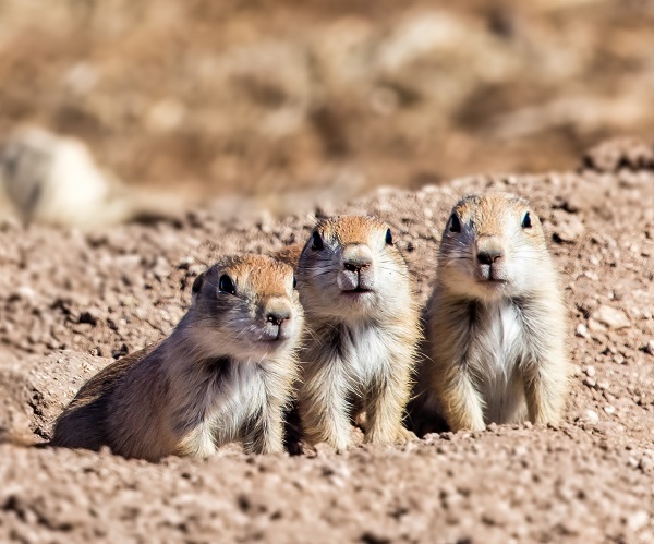
In the below photo, three Black-Tailed Prairie Dog pups stand beside their burrow ready to retreat underground if a threat approaches. These very social rodents live in colonies that can reach many thousands of individuals and have an intricate social structure that includes subgroups and families.
Prairie dogs have very sensitive hearing that allows them to detect predators early, even while they are in their burrows. Researchers have observed prairie dogs using a sophisticated system of vocal communication to identify specific predators, as well as the predators' locations and approach speed. The system of calls and warnings allow others in the colony to feed knowing that they will be alerted in time by their neighbors to retreat to the safety of their burrows.
Black-tailed prairie dogs once covered a swath of the Midwest and Intermountain West stretching from Canada to Mexico. Their numbers are much reduced and the last colony in Arizona disappeared in 1960. Fortunately, multiple agencies and partners have worked together to re-establish the species not just in Arizona, but across their historic range. In Arizona, Black-tailed Prairie Dogs were first re-introduced in 2008, and since then three colonies have been successfully established at Las Cienegas National Conservation Area southeast of Tucson, Arizona.
Prairie dogs are a grassland dependent keystone species; that is, they have a big impact on their ecosystem, and other species depend on them for food and shelter.
Gulkana Wild and Scenic River, Alaska
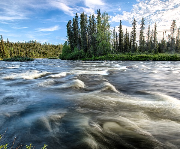
The Gulkana Wild and Scenic River flows south from the eastern Alaska Range and is a tributary to the famed Copper River. Known as a “clearwater” river, the Gulkana does not contain suspended glacial sediments that make many northern rivers appear milky or muddy. With some of the best Arctic grayling fishing in Alaska, the Gulkana can be floated in four to six days through a roadless setting with class 1-IV rapids and spectacular views of the Wrangell Mountains to the south.