
There’s tough, then there’s survey tough
For BLM Alaska surveyor’s, there is no typical day when plotting out sections of America’s vast public lands in the last frontier.
Surveying for the BLM isn’t easy because the mission is far-flung, remote, and often involves rugged or difficult terrain. The work is also varied – BLM surveyors could be doing anything from surveying for a land patent (deed) to helping with disaster recovery imagery.
The work environment is a mix of stunning beauty and hazards. It’s a true adventure for those who prefer to work with chainsaws, GPS, and trigonometry, and the BLM is frequently looking for surveyors with the mettle to join the team.
But all that remoteness and rugged terrain means logistics can be expensive and sometimes difficult to plan, and the survey work itself can be challenging, if not outright dangerous. It takes both physical endurance and strong wits to safely and successfully survey Alaska, and BLM Alaska surveyor Seth Kiester wouldn’t have it any other way.
“I love the physical and mental challenge,” Kiester explained, “especially when we’re running line in the southeast (Alaska).”
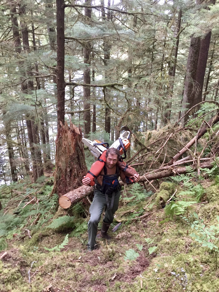
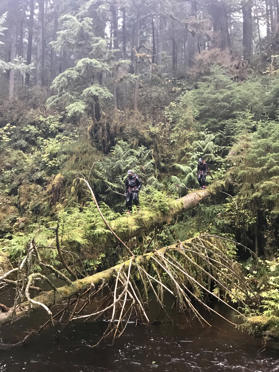
‘Running line’ for surveyors literally means cutting a path through an area to delineate the survey line. Brush and small trees have to be cut down, cut up and moved off the line. But immovable objects like large trees or dangerous terrain have to be surveyed around, and the survey team then continues the line on the other side of the obstacle.
Kiester remembers working through obstacles in southeast Alaska involved a pile of large logs deposited across a line they were surveying. The 36-inch diameter logs were from a previous logging operation and, according to regulations, they had to be removed from the line. So, the team removed them … by hand, with nothing but chainsaws, brains, and muscle.
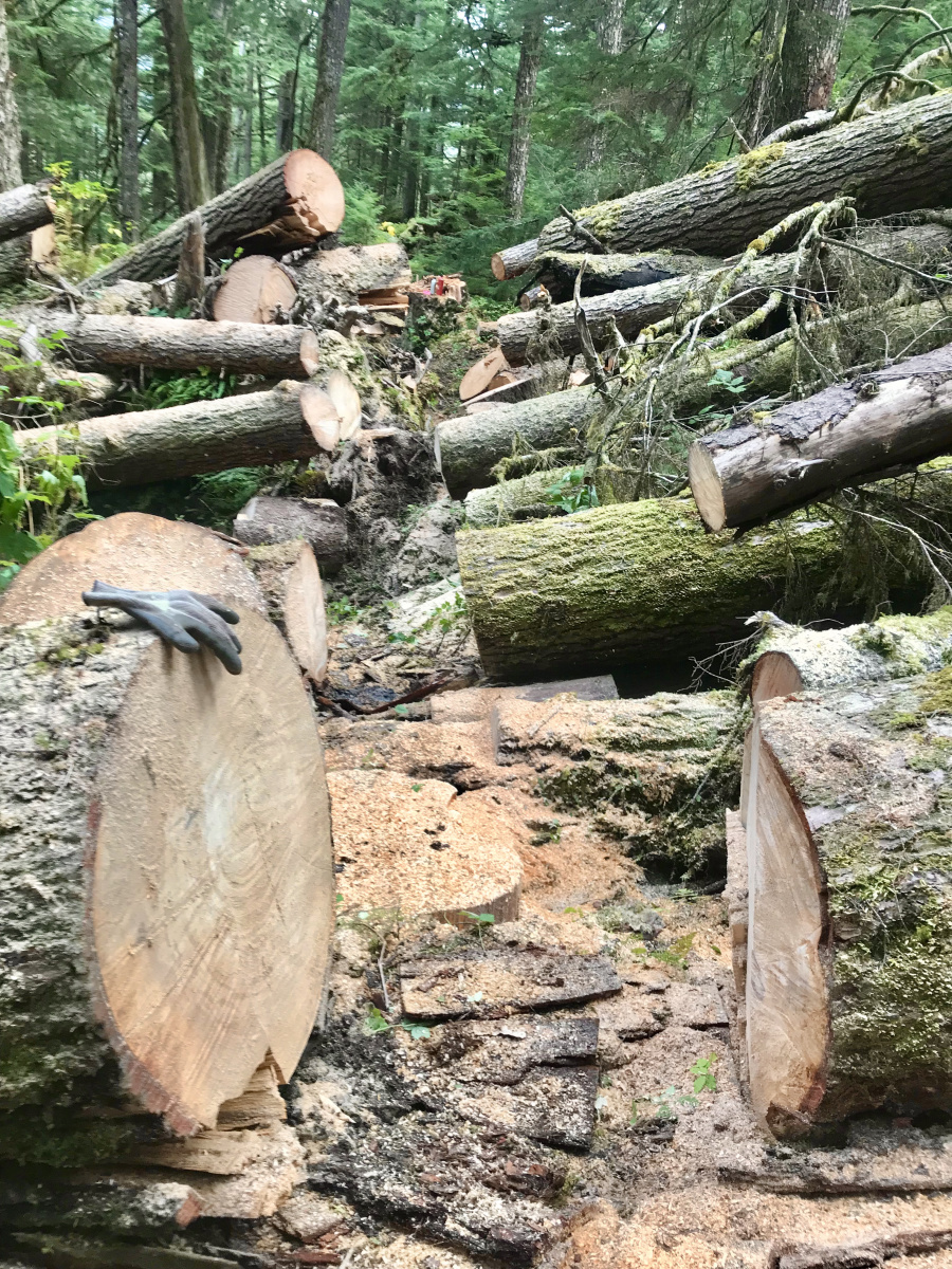
“The lines need to be a clear path you can walk on,” Kiester expanded.
Sometimes the apparently simple jobs can be comically painful.
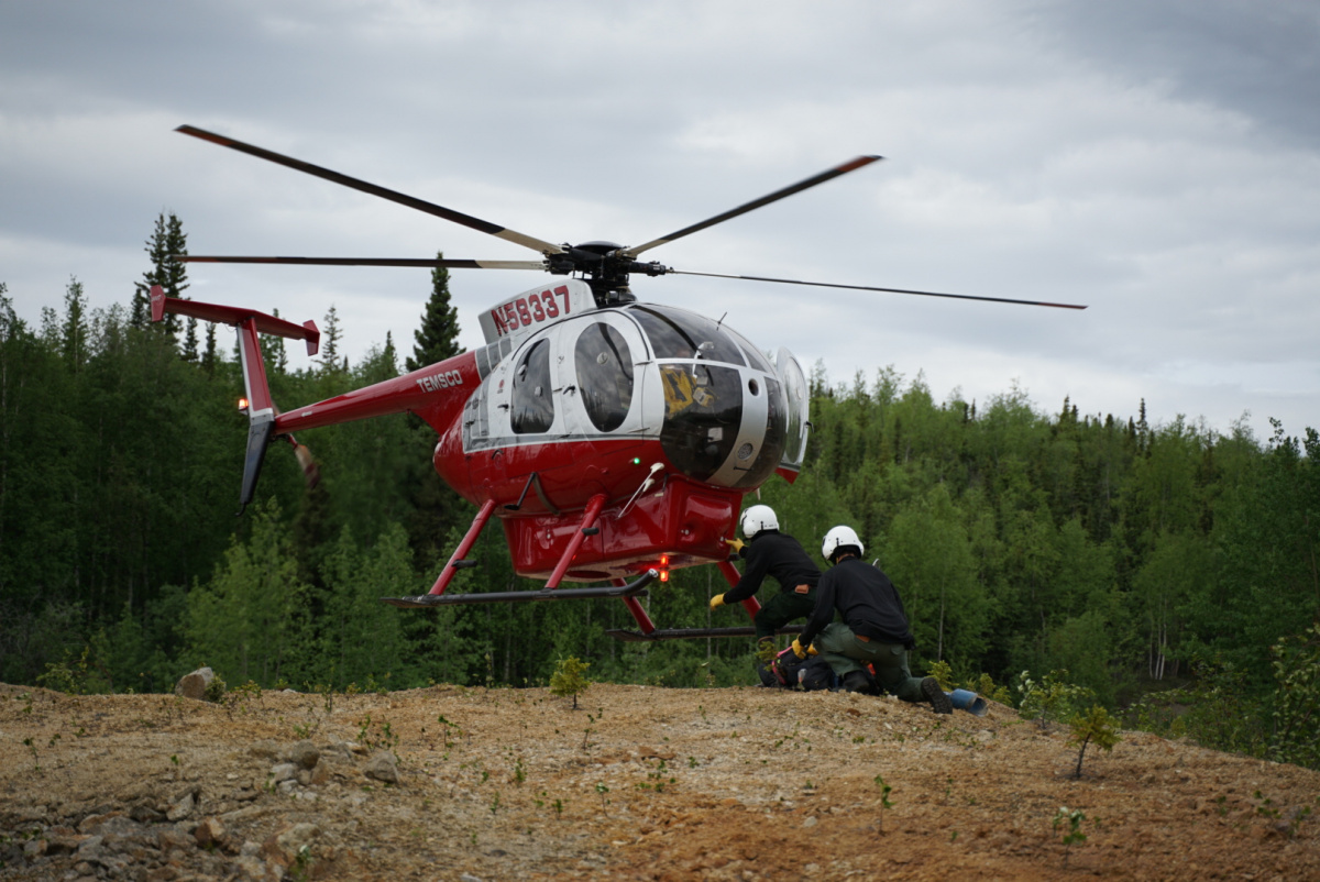
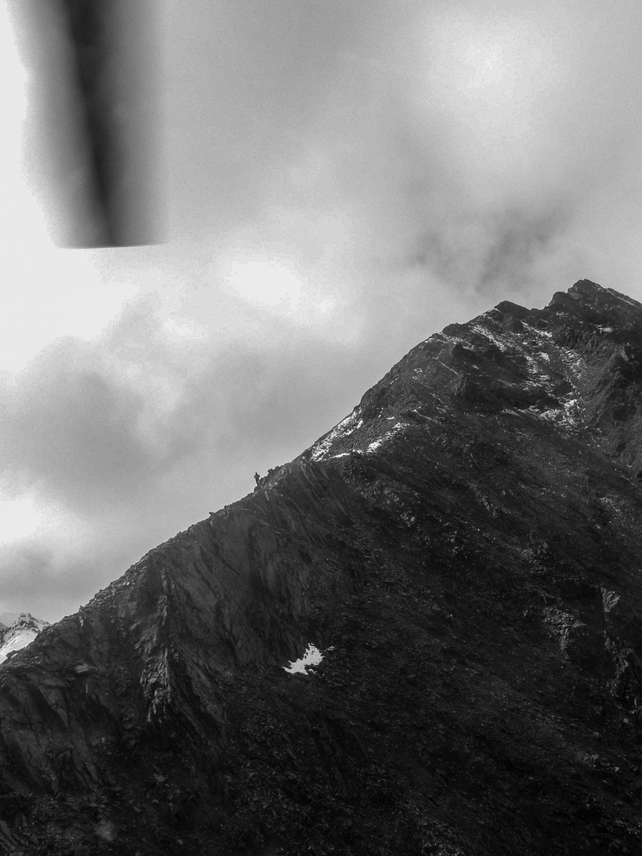
On a 2017 survey in Haines, Keister recalled the helicopter dropping the team off on the top of a hill. They only had a half mile to get to the corner they had to survey.
Easy.
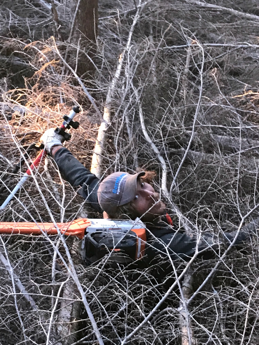
“It took us an hour and a half because the brush was so thick,” Kiester reflected, “and we had gone through every kind of (cow parsnip), devil’s club, stinging nettle, salmon berry brush, thick briars, and then we got stung by yellow jackets on the way down.”
The challenge didn’t end there. By the time they made it to the corner, the trees were so large and the canopy so thick they couldn’t shoot it with GPS gear.
“We had to leave [the area] and come back with a laser instrument,” Kiester remembered. “But when we went down to the lake, there wasn’t a good landing zone for the helicopter, so we had to walk a quarter mile through the lake to the other side where we could clear out an LZ with the chainsaws.”
The helicopter picked them up three hours after they had started.
“When we thought about it, all we had accomplished was going down this horrible hillside and getting torn up by the brush and yellowjackets,” Keister laughed.
Surveying is rewarding work, according to Kiester. He said multiple times how much he enjoys the challenges of the job itself, but what’s his favorite part?
“The camaraderie,” Keister said emphatically. “It’s the relationships with my coworkers. [Cadastral survey] is a tight group, and we have a lot of these shared experiences – it’s a family.”
Last season, Kiester’s team surveyed roughly 80 townships (totaling almost 2 million acres) setting corners every two miles. It took months to complete. Many of these surveys support land patents pursuant to either the Alaska Statehood Act or the Alaska Native Claims Settlement Act — two laws that shape a major part of BLM Alaska’s mission.
It's all about the technique
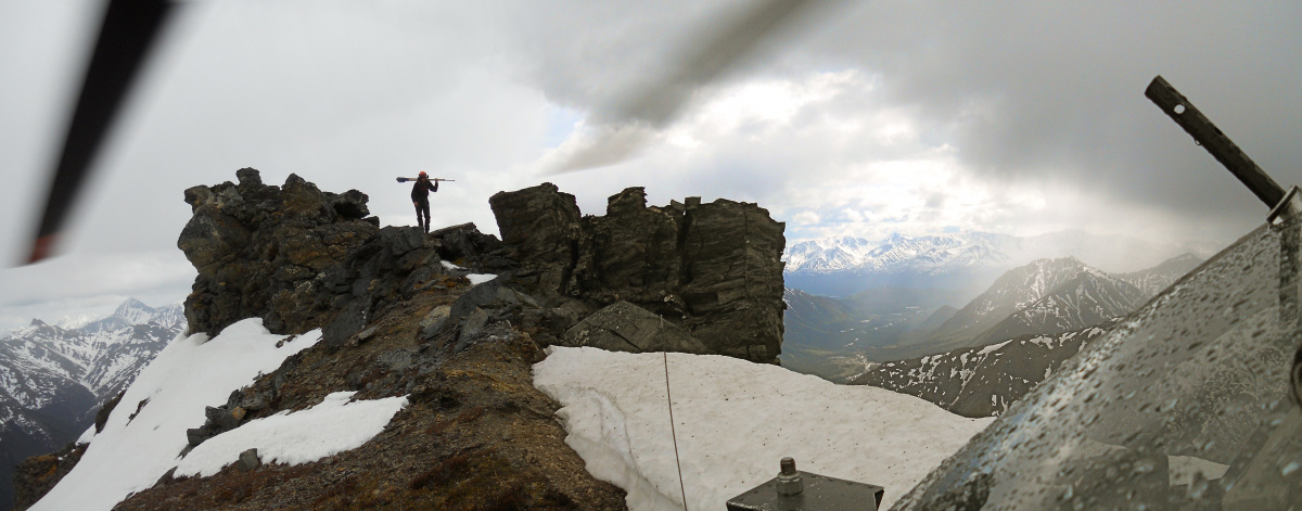
BLM Alaska survey jobs can be broken down into three areas: U.S. surveys, townsites, and large rectangular survey. Photogrammetry (surveying using specialized GPS enabled photographic gear) and line running are specialized techniques that can be used to complete these surveys if necessary, though they are not always required.
U.S. survey is an official survey of federal land boundaries performed by the U.S. government. Though other federal agencies survey the lands they manage, only the BLM does U.S. survey.
“U.S. Surveys are typically smaller metes-and-bounds surveys that often grant ownership to a single individual,” Kiester explained. “We are using them in Alaska most often to designate Native Allotments, although they can be used to survey and transfer ownership of other lands as well.”
Townsite survey is where the BLM surveys lands conveyed for use as a townsite. While this kind of survey work is uncommon or rare in the Lower 48, it still happens in Alaska because of lands conveyed under the Alaska Native Claims Settlement Act or the 1926 Alaska Native Townsite Act.
“Townsites are federal land boundary, subdivision-type surveys,” Kiester expanded. “At this point, we aren't surveying new townsites, rather our goal is to re-survey the Native Trust lots within the townsite and look for trespass issues.”
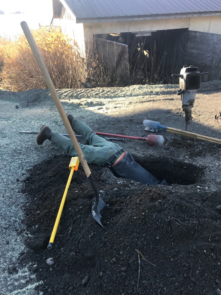
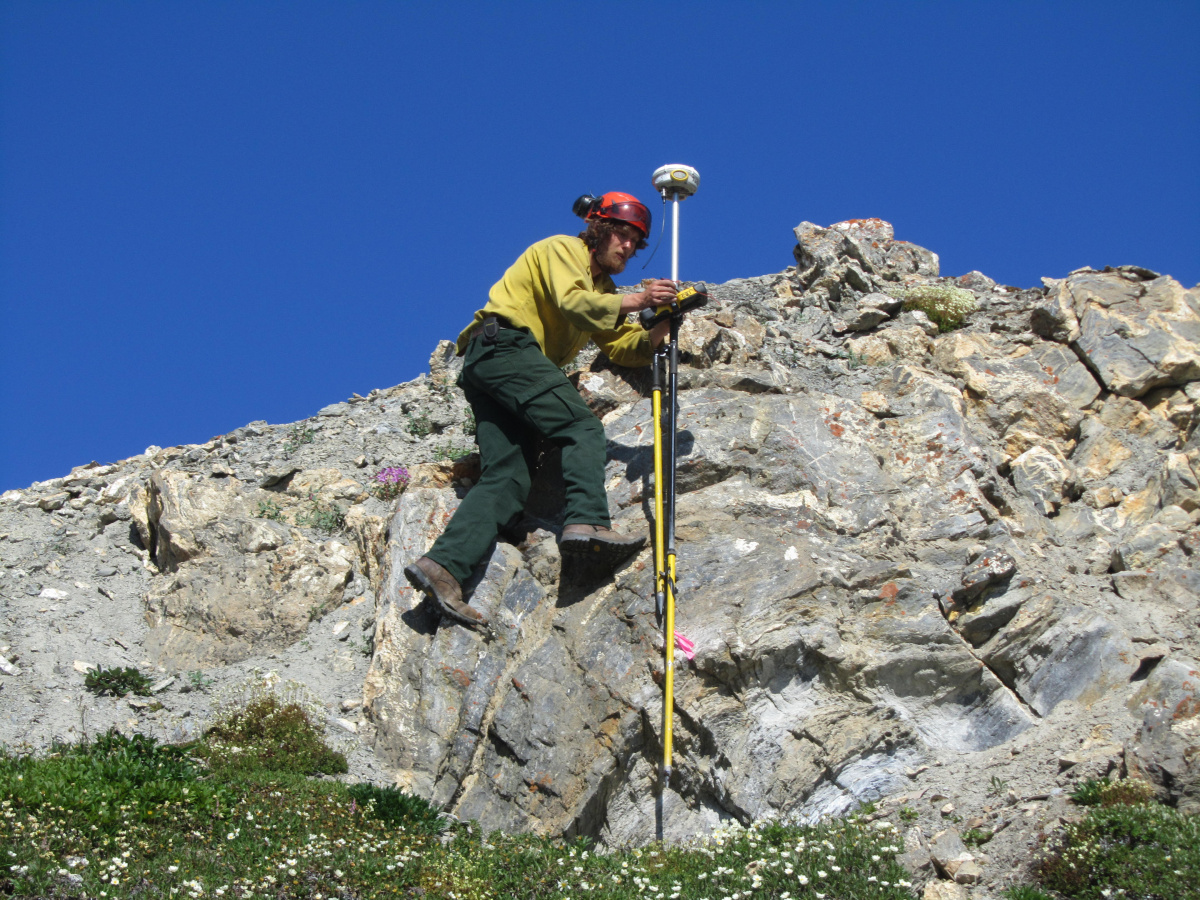
Rectangular survey in Alaska is performed using a helicopter because of the size of the area being covered. It’s most often original survey work and involves multiple townships (each township is 36 square miles). This is usually shot using GPS instruments that are precise within fractions of an inch. Calibrating them involves the GPS unit collecting satellite data from a known location for several hours, but once calibrated, they’re among the most accurate instruments available.
Photogrammetry is more recent addition to the survey arsenal, and it’s incredibly efficient. Kiester is one of two people in BLM Alaska who is trained in the technique.
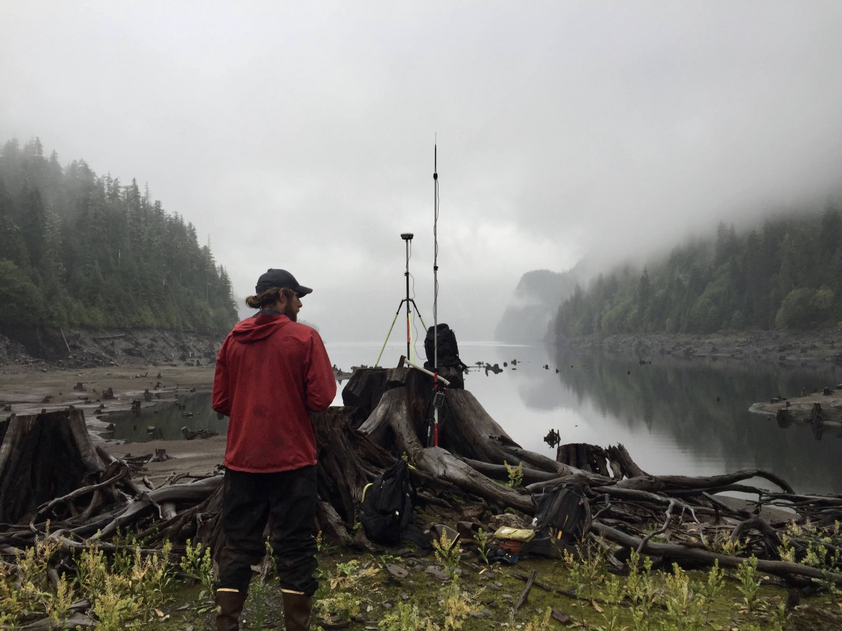
“We have to measure a lot of the water boundaries in Alaska,” Kiester explained. “The way we were doing that is a surveyor would literally walk along the bank of a [waterbody] with a GPS or fly over it with a helicopter super low and slow, which is kind of dangerous.”
Kiester said they now fly in a Cessna 180 at higher altitudes with a belly-mounted camera shooting photos every 1-4 seconds. They later stitch all the photos together using known reference points (usually landmarks associated with a GPS coordinate).

“We end up with really accurate representations of those water boundaries,” Kiester said.
The photogrammetry work pays off when it’s used to confirm water boundary descriptions in survey records, but it’s also helpful in other ways.
A BLM Alaska survey team used photogrammetry in a joint mission with the state of Alaska to support damage assessments following a 7.1 magnitude earthquake that struck near Anchorage. The technique was used to measure how far the ground shifted in some areas, especially along roadways.
The requirements for surveyors vary, and you don’t necessarily need a degree right away to come into the career field (the BLM does hire survey techs and aids). Check regularly for job announcements on USAJobs. Full time and seasonal work are often available.
Related Stories
- BLM law enforcement medical rescue team brings advanced care to public lands
- Meet Dashiell Gould Lagoyda, fisheries biologist intern at the Safford Field Office
- Colorado River District employees gather to celebrate service and teamwork
- BLM, U.S. Wildland Fire Service celebrate more than 20 years of wildland fire training partnership with Phoenix schools
- Colorado River District law enforcement: Honoring service, strengthening communities
Office
222 W 7th Avenue #13
Anchorage, AK 99513
United States