
Saddleback Mountain Recreational Shooting Site Map
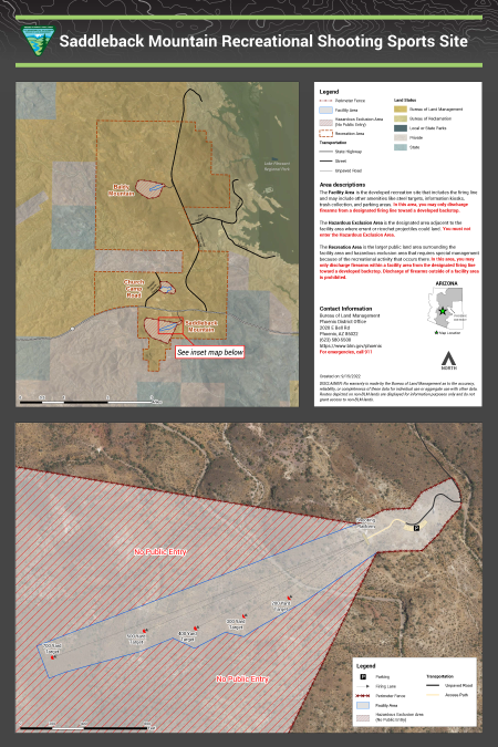
Saddleback Mountain Recreational Shooting Site is north of Phoenix in Maricopa County, about 0.8 miles south of State Route 74. The sites will allow for active management and increased safety for shooting sports enthusiasts and other public land users near one of the most populated metro areas in the nation. These areas range from minimally developed to fully developed.
No warranty is made by the Bureau of Land Management as to the accuracy, reliability, or completeness of these data for individual use or aggregate use with other data. Routes depicted on non-BLM lands are displayed for information purposes only and do not grant access to non-BLM lands.
Download Files
Publication Date
Region
Arizona
Organization
Collection: Public Room
Category: Map
Keywords
Map
Recreational Shooting