
La Posa Travel Management Area Access Map
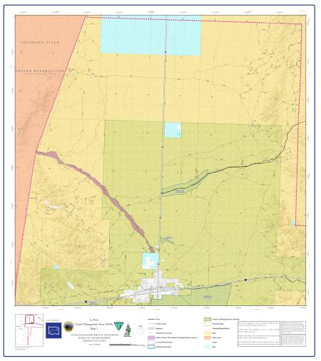
The La Posa Travel Management Area (TMA) encompasses Bureau of Land Management (BLM)-managed public lands surrounding Quartzsite in La Paz County in western Arizona.
This is a four-map series. Each map covers a different portion of the La Posa TMA and should be used together for complete coverage of the area. An inset locator map on each sheet shows the location of that map within the full series.
Travel within the La Posa TMA is restricted to designated roads and trails as defined on these maps. The La Posa TMA boundary is shown as a dashed pink line on each map.
All four maps use the same road classification system. Roads are routes designated for use by low-clearance vehicles having four or more wheels and maintained for regular continuous use. Primitive roads are routes designated for use by four-wheel-drive and high-clearance vehicles (two-track). Motorized trails are single-track routes designated for use by motorcycles and E-bikes and are not present within the La Posa Travel Management Area. Non-motorized trails are single-track routes managed for use by human-powered and stock forms of transportation or for historical or heritage values.
BLM route numbers are labeled throughout all four maps for navigation reference.
All four maps use the NAD 1983 UTM Zone 12N coordinate system with a Transverse Mercator projection and North American 1983 datum.
For questions, contact the Yuma Field Office.
Travel routes depicted on these maps across Arizona State Trust Lands or private lands do not imply legal public access to use or cross those lands. Any public use of State trust lands is strictly under the jurisdiction of the Arizona State Land Department and use of private lands requires permission of the land owner. All users must comply with State policies and regulations and private land owner rights in order to legally use or traverse non-BLM lands.
No warranty is made by the Bureau of Land Management as to the accuracy, reliability, or completeness of these data for individual use or aggregate use with other data. Original data were compiled from various sources. As a result, routes shown on non-BLM land may not be accounted for and/or depicted. This information may not meet National Map Accuracy Standards. This product was developed through digital means and may be updated without notification.