
Willow Creek WSA | Colorado
The Willow Creek WSA is more characteristic of the arid canyon ecosystems found in the Colorado Plateau than in the Rocky Mountain Forest Province eco-region, where it exists.
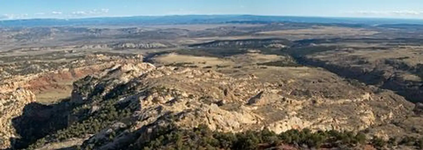
Geographically, the area generally lies within the Skull Creek Basin. The area is cut by steep, colorful ridges, hogbacks, deep gullies, unique rock formations, and canyons of sandstone eroded by rain and snowmelt waters. A 1,000-foot cliff dominates the north end of the WSA. The steep and rugged terrain and numerous canyons provide outstanding scenery and recreation opportunities. In addition, the area contains some of the oldest known pinyon pine trees, as well as numerous and significant archaeological resources dating back 10,000 years. Activities include hiking, backpacking, camping, rock climbing, horseback riding, hunting, and photography.
Vegetation consists mainly of pinyon-juniper, sagebrush, saltbush, native grasses and forbs, boxelder, cottonwoods, and willows. Fauna includes elk, mule deer, golden eagles, various other raptors, and numerous smaller mammals, birds, and reptiles. For more information, please contact the White River Field Office.
Photos
Contact Us

Activities


Addresses
White River Field Office
220 E. Market Street
Meeker
Colorado
81641
Directions
The Willow Creek WSA is located in Moffat County, approximately five miles northeast of Dinosaur, CO and eight miles south of Dinosaur National Monument. The eastern boundary of the WSA is shared with the Skull Creek WSA.