Wallowa & Grande Ronde Wild and Scenic Rivers

Attention Boaters:

BOATER ADVISORY, 7/31/23:

There is a report of a log across the Grande Ronde River channel on the right side (looking downstream) of the island at River Mile 60.

Tree across Grande Ronde River at River Mile 60 - July 2023, looking downstream.
Tree across Grande Ronde River at River Mile 60 - July 2023. (Photo courtesy of The Minam Store)

Although river flows are often very low in late summer months, boaters should always carefully evaluate both sides of islands to determine the best route of travel, and be prepared to portage boats if necessary. Boaters are reminded that logs and other river hazards may exist at any time. Boaters should always be prepared to stop within half the distance they can see ahead, and remember:

"When in doubt, stop and scout!"
"Always look downstream!"

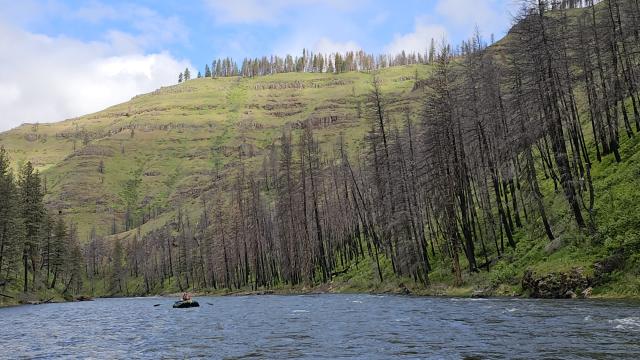
The Elbow Creek Fire started on July 15, 2021 and burned 22,960 acres on both sides of the Grande Ronde River, between Bear Creek (river mile 66.5) and Wildcat Creek (river mile 53.5).

  • AVOID ENTERING BURNED AREAS. Soils, plants, wildlife, and other natural resources need time to recover after a wildfire event. Visitors can easily stress both animal and plant life whose landscape has already been disrupted. If you have the option of cancelling or rescheduling your trip, please consider doing so. Fewer people on the river will reduce overcrowding and take pressure off the fragile resources trying to recover.
  • Public land managers continue to assess and monitor post-fire conditions and need your help in reducing impacts and risks. For more information please see: Rivers and Wildfire: Boating in the Burn

The rivers are a very popular outdoor destination for thousands of people every year. Increasing numbers of visitors can result in user conflicts and cause harmful impacts to fragile natural resources. Please remember the following:

  • To prevent overcrowding and reduce campsite competition, plan your trip to avoid weekends and holidays and keep your group as small as possible.
  • Anticipate sharing the river with others. Plan ahead, be flexible, respect others, and allow plenty of extra time at the put-in and take-out points.
  • Some Oregon and Washington State lands are closed for overnight use and are open for Day-Use only. Please contact the respective State(s) for more information. Most private lands are closed to public entry; do not trespass.
  • Visitors are required to practice Leave No Trace to minimize impacts to the river resources.

For more river information, please call the BLM Baker Field Office at 541-523-1256.

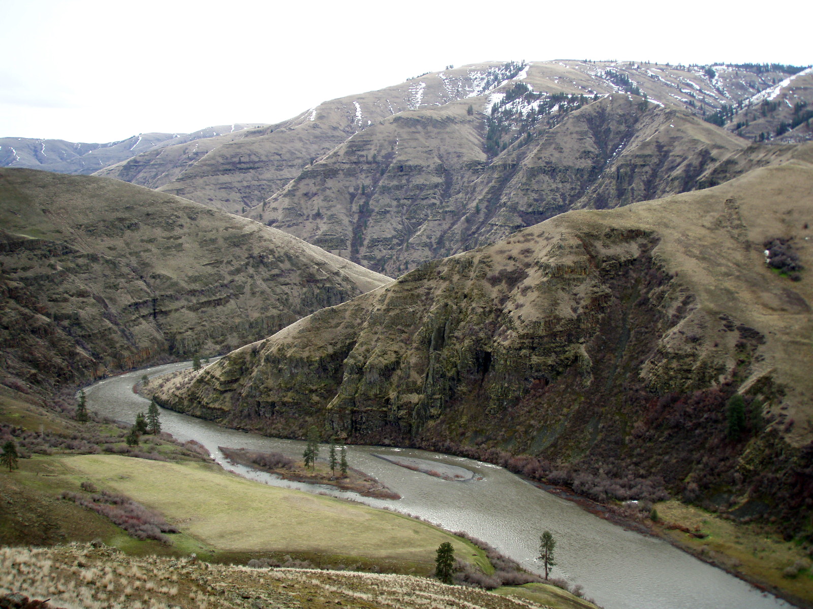
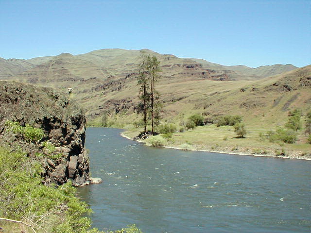
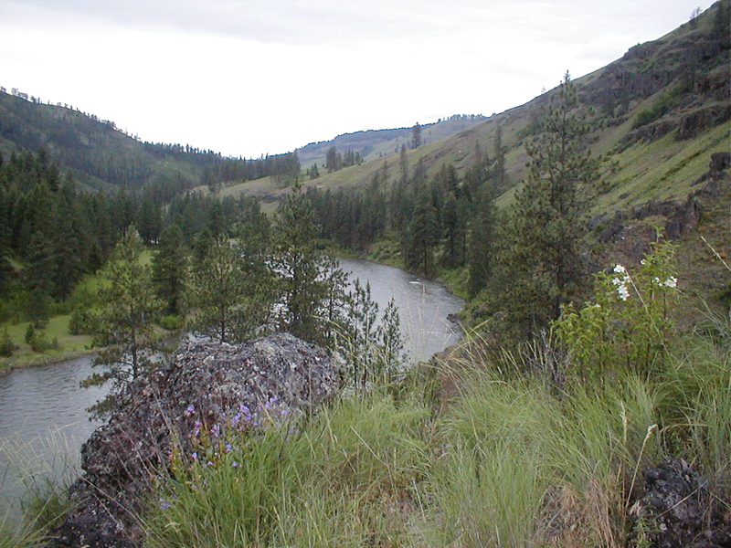
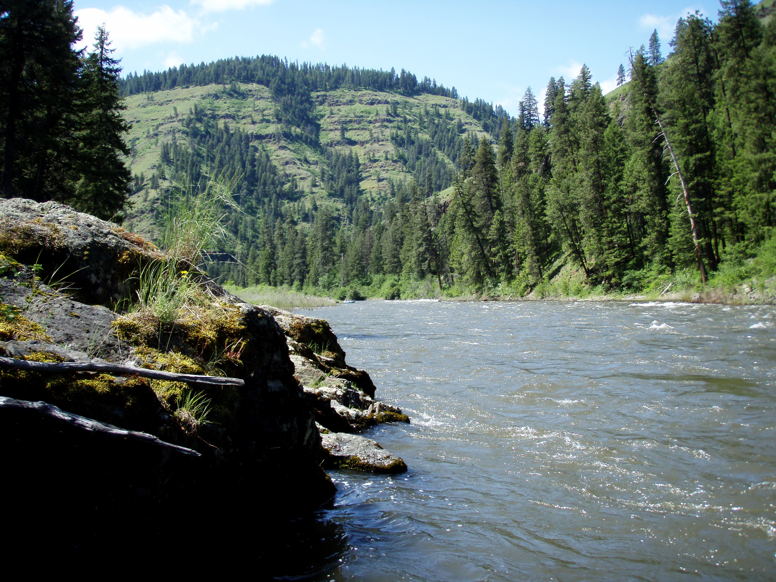
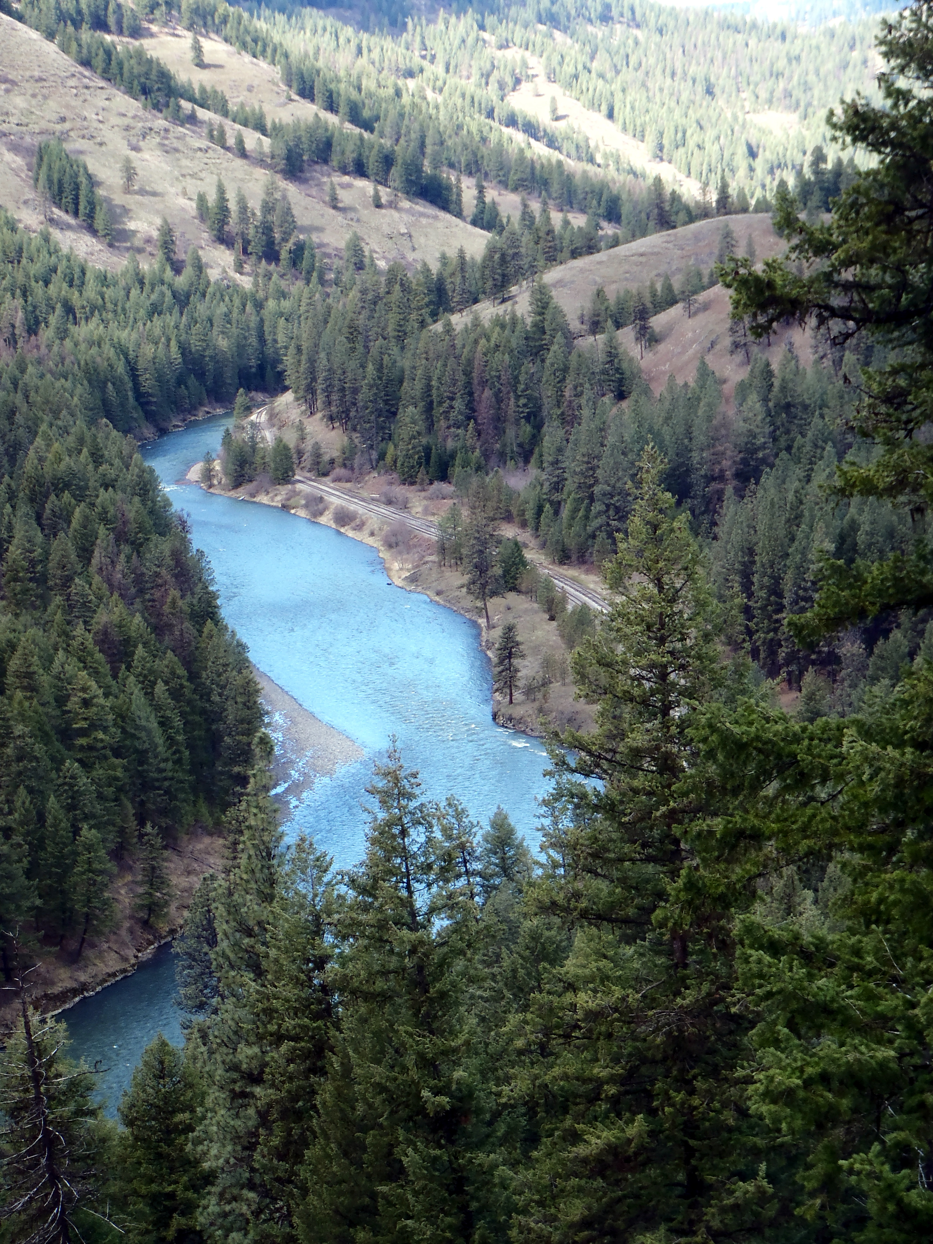
The Wallowa and Grande Ronde Rivers from Minam, Oregon to Heller Bar, Washington include 10 miles of the Wallowa River, and 80 miles of the Grande Ronde River. Due to topography, access and river character, these river segments are managed as one river corridor. The rivers between Minam and the Oregon-Washington state line are designated National Wild & Scenic Rivers and Oregon State Scenic Waterways and are cooperatively managed by the Bureau of Land Management, U.S. Forest Service, and Oregon Parks & Recreation Department.
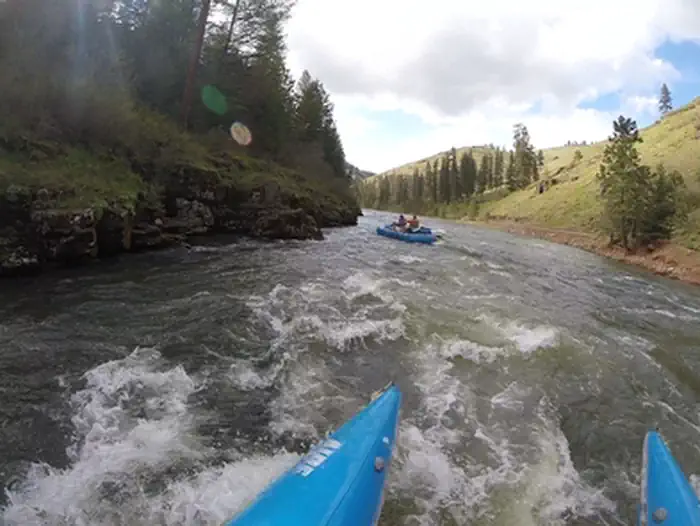
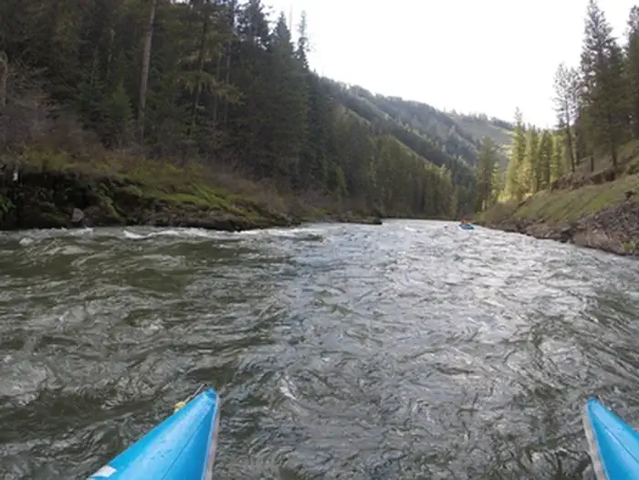
Many boaters start their trip on the Wallowa River at Minam, Oregon, a tributary of the Grande Ronde river. Trips launched from here typically last 2 to 3 days, although shorter or longer trips are possible with proper planning. Other river access points include Wildcat (or Powwatka) Bridge, Mud Creek, Troy, Boggan’s Oasis, and Shumaker.

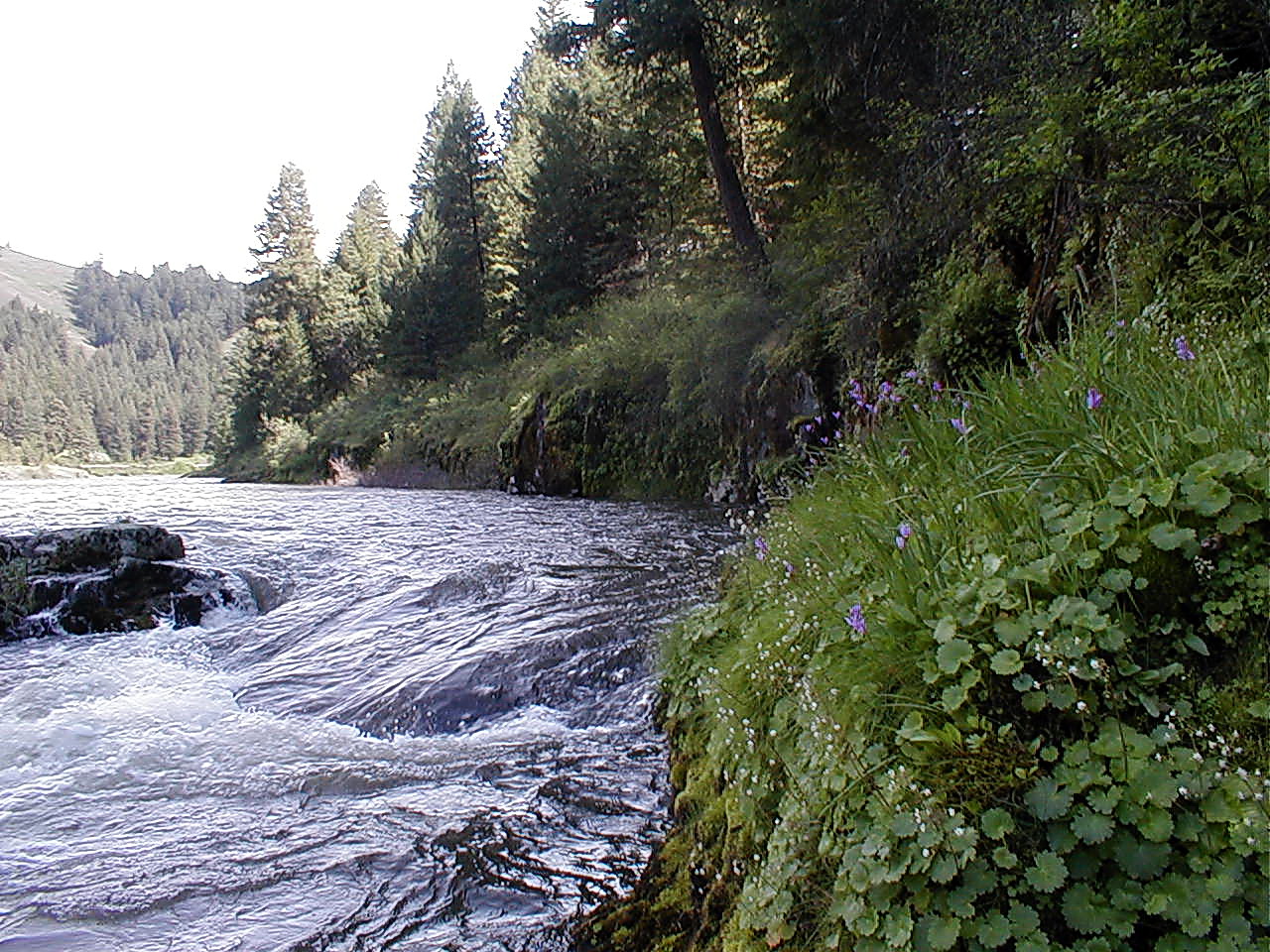
Because the rivers are free-flowing, water level and river character can change suddenly and dramatically depending on the time of year, weather, and snowpack. Typical river levels during the primary floating season range between 2,000 and 10,000 cf/s. (cubic feet per second). High, fast water conditions usually occur in the spring and early summer as warmer temperatures and rainfall melt mountain snow. Shallow, slower conditions typically occur by mid-July and remain through the fall and winter months, with less water and more exposed rocks being common. Boaters are strongly advised to obtain up-to-date river conditions and weather information when planning their trip. Visitors wishing to avoid crowds are advised to plan their trip to avoid weekends and holidays between mid-May and early July.
Vehicle shuttle routes often include rough roads and may require good map reading skills and/or GPS to follow. Some roads may be unmaintained or impassable inquire locally for current conditions. Gasoline, food, and other services are often not available in rural areas. Cell phone service is generally not available in the remote, rugged terrain of the river corridor. Drivers should be well prepared, and carry extra fuel, food, water, and a spare tire. For safety, always tell someone where you are going and when you expect to return.

Know Before You Go:

  • Free, self-issued river permits are required for all boating on the Wallowa & Grande Ronde rivers in Oregon, and when using BLM lands above the high-water mark in Washington.
  • Primitive, undeveloped river camping is available on a first-come, first-serve basis and campsite competition can be high during peak boating season. To maximize your feeling of privacy, avoid trips on holidays and busy weekends or take a trip during the off season.
  • Visitors are required to follow low impact, “Leave No Trace” principles to minimize the traces of their stay and help preserve the natural resources. Mandatory fire pan and portable toilet use, as well as packing out all garbage and treading lightly on vegetation, helps keep the river corridor clean and healthy for present and future generations. Heavily impacted areas can often lead to further restrictions and may need to be temporarily closed until they can recover.
  • No amenities or improvements exist in much of the river corridor. Natural and human-created hazards exist, including falling trees, rapids, wildlife, bridge abutments, inclement weather, primitive roads, and rugged terrain. Search and rescue assistance in the canyons is very difficult, dangerous, costly, and time-consuming. Plan ahead, use caution, and be prepared.
  • For a developed camping experience, consider the Oregon State Parks campground at Minam State Recreation Area, two miles north of Minam, Oregon. Open seasonally.
     

Photos

Grande Ronde Lower Section in Washington State
Bureau of Land Management
Close up view of the Grande Ronde Lower Section in Washington State
Bureau of Land Management
View of the Grande Ronde Middle Section
Bureau of Land Management
River level view of the Grande Ronde Lower Section in Washington State
Bureau of Land Management
View of Grande Ronde River Upper Section
Bureau of Land Management
View of bend in the Wallowa River.
Bureau of Land Management
Upland view of the Wallowa River
Bureau of Land Management
Wallowa Wild and Scenic River
Bureau of Land Management
Wallowa Wild and Scenic River
Bureau of Land Management
Wallowa Wild and Scenic River
Bureau of Land Management

Adventure is at Your Fingertips

Point of Interest:

The Wallowa-Grande Ronde River corridor provides an exceptional diversity of species affording excellent wildlife viewing opportunities for game and nongame species. Major species include waterfowl, herons, shorebirds, raptors, upland birds, perching birds, river otters, mink, black bear, and turkey. Lucky observers may even spot a mountain lion, bobcat, moose, or mountain goat. The is also a highly sensitive wintering area for the bald eagle, bighorn sheep, elk, mule deer, and whitetail deer.

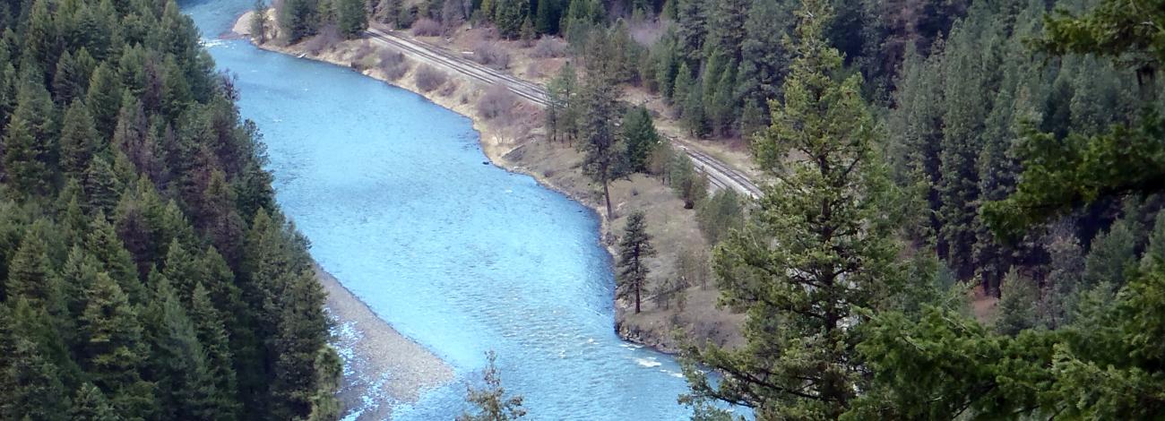
Completed in 1908, the rail line known as the "Joseph Branch" transported goods and people, shutting down in the early 2000s. Today, one can get a close-up view of the Wallowa River on the seasonally-operated Eagle Cap Excursion Train, a heritage railroad service.

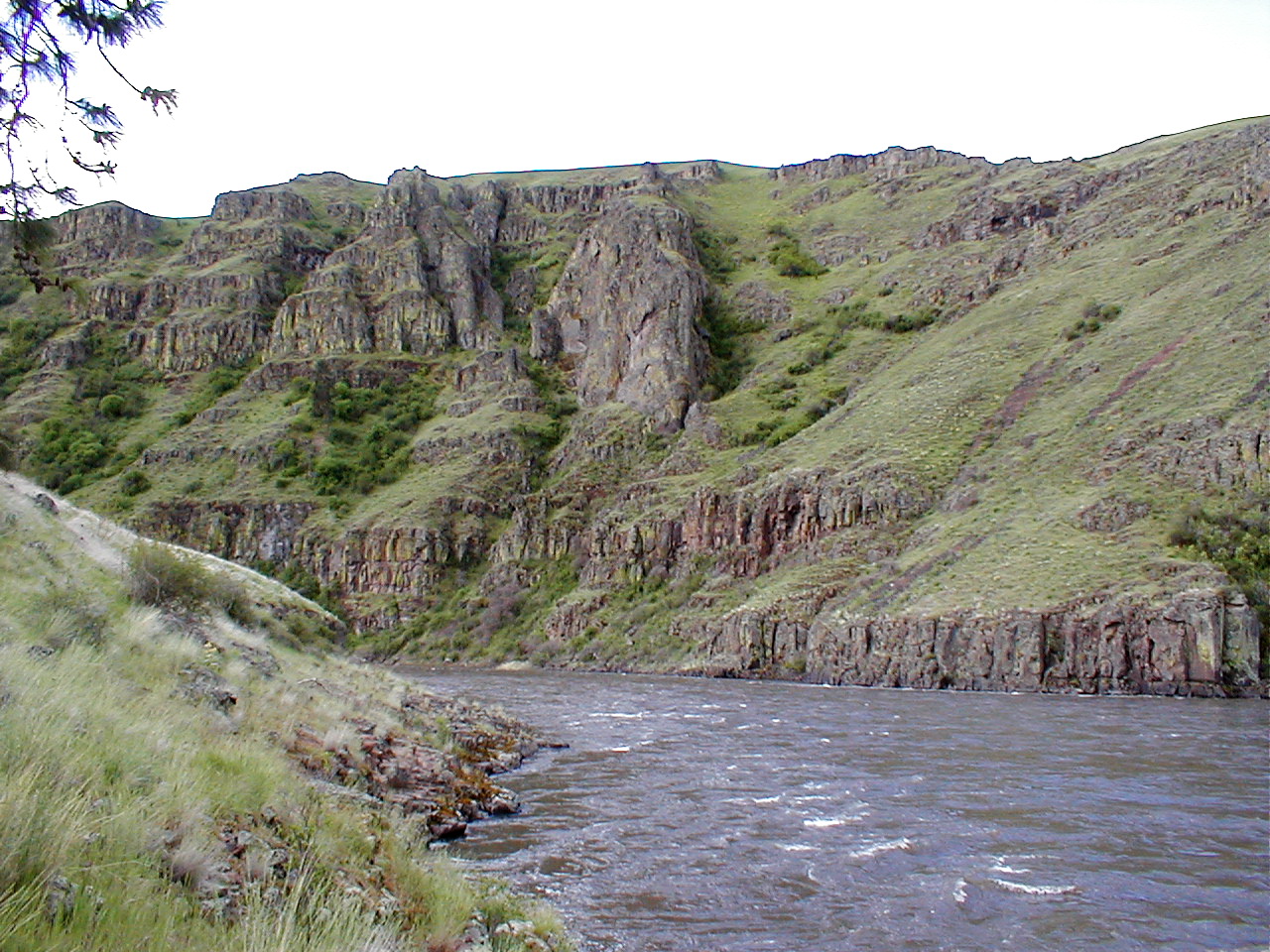
The geology of the Washington segment of the Grande Ronde River includes two National Natural Landmarks: the Grande Ronde Feeder Dikes and the Grande Ronde Goosenecks. Washington State public lands are managed by the Washington Department of Fish and Wildlife (WDFW). Note that a Washington Discover Pass may be required to park at these locations.