Poison Creek Trail | Wyoming
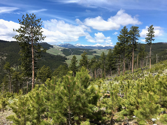
The two mile long Poison Creek Trail ambles through mountain meadows before descending steeply to Poison Creek. The first part of the trail provides spectacular views of the Bighorn Mountains and the valley below. Hikers who make it to the end are rewarded with a secluded spot along the Poison Creek. Backcountry camping is allowed in the recreation area.
Photos

BLM WYOMING KNOW BEFORE YOU GO
Contact Us
This site is managed by Buffalo Field Office; visit their page for office hours and directions.

Activities


Addresses
Buffalo Field Office
1425 Fort Street
Buffalo
Wyoming
82834
Geographic Coordinates
44.093646, -106.8451119
Directions
From Buffalo, take Highway 16 West to Hazelton Road. Turn south onto Hazelton Road and travel approximately 0.7 mile, then turn left onto FS Road 466(sign for Johnson County Youth Camp). After about 3 miles, turn left onto Billy Creek Road. The trailhead and parking area will be about 3.5 miles on your right.
Fees
No Fee.
Additional Information
POISON CREEK TRAIL PHOTOS