
McCullough Peaks Wild Horse Herd Management Area | Wyoming
The McCullough Peaks Wild Horse Herd Management Area (HMA) is located 12 to 27 miles east of Cody (70 miles east of Yellowstone National Park) and encompasses 109,814 acres of land, including the McCullough Peaks Wilderness Study Area. The climate is typical of a cold desert with annual precipitation averaging five to nine inches. Stock reservoirs and intermittent streams fed by winter snows and spring runoff provide adequate water for the HMA. Topography is highly variable, ranging from mostly flat to slightly rolling foothills carved by drainages, to colorful badlands and desert mountains featuring steep slopes, cliffs and canyons.
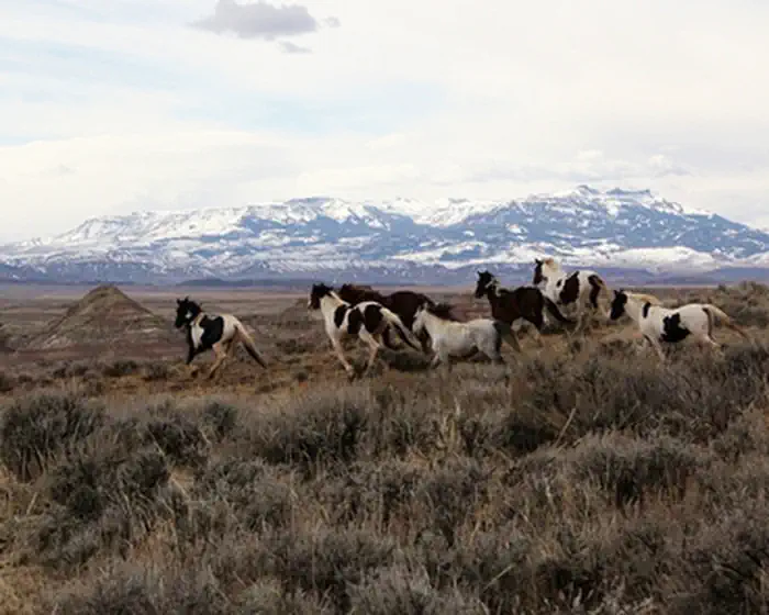
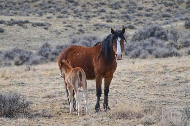
A diversity of coat colors (bay, brown, black, sorrel, chestnut, white, buckskin, gray, palomino, and blue, red and strawberry roans) and patterns such as piebald and skewbald are found in the McCullough Peaks wild horses. The animals tend to be moderate- to large-sized and habitat conditions are such that the horses are in very good condition. The combination of size, conformation, coat colors and patterns, and excellent physical condition have become a draw for potential adopters and a matter of reputation for McCullough Peaks horses.
Be sure to bring your binoculars and always look on both sides of the roads for both the mustangs and other wildlife!
Photos
McCullough Peaks HMA Photos
BLM Wyoming Know Before You Go
Contact Us

Activities


Addresses
Directions
Travel east from Cody on Highway 14-16-20 to mile marker 72 (about 18 miles). On the left you will see a gate; horses are often in this area and you can enter if you choose. If not, continue to near mile marker 74 where you will see a kiosk and the Whistle Creek road sign on your left; enter, proceed to pipeline marker 75 (about 6 miles) and enjoy the remarkable panoramic view of the badlands.
Fees
No Fee.