
King Range National Conservation Area |
Overview
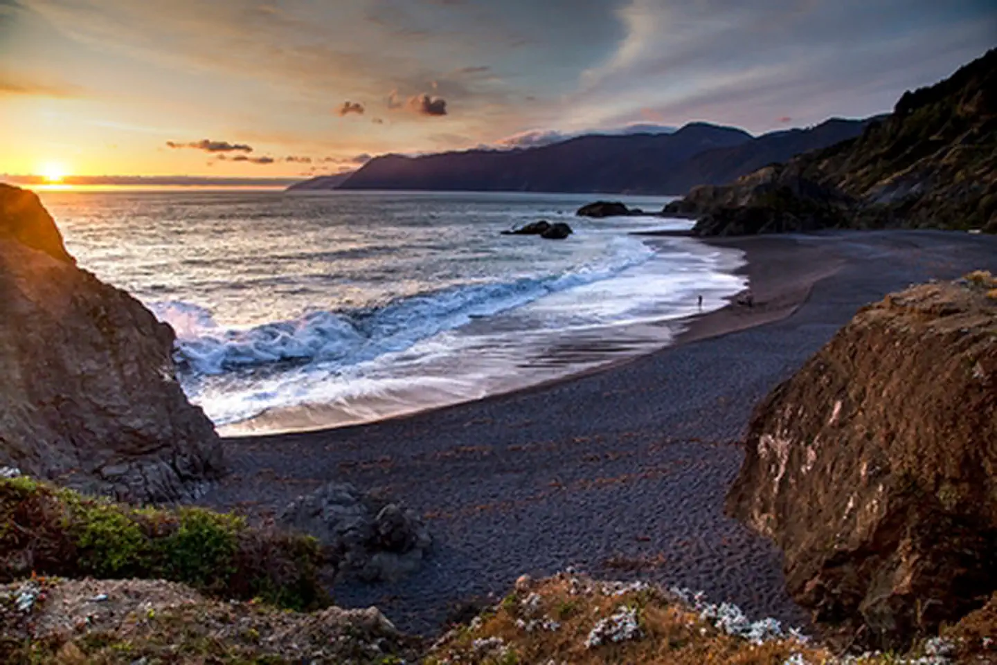
A spectacular meeting of land and sea, the King Range National Conservation Area seems to thrust straight out of the surf. King Peak, the highest point at 4,088 feet, is only 3-miles from the ocean. King Range is the Nation's very first National Conservation Area, designated in 1970.
The King Range encompasses 68,000 acres along 35-miles of California's dramatic north coast, where the landscape was too rugged for highway building, forcing State Highway 1 inland. Accessible by only a few back roads, this remote region of mountains and seascapes is also known as California's Lost Coast.
The King Range's Douglas fir-covered peaks attract hikers, hunters, and campers, while the coast beckons to surfers, anglers, beachcombers, and many others. World-class mountain bike trails, and 42,585 acres of coastal wilderness are two of the highlights of this incredibly unique area.
The King Range NCA contains over 80 miles of hiking trails spanning from the beach to the highest peaks. Most of the upland trails are strenuous due to the steep rugged nature of the area. In addition to mileage, pay attention to the elevation changes listed in the trail descriptions. A number of connector trails allow for loop hikes.
The backcountry was designated as official wilderness on October 17, 2006 and the BLM manages it accordingly, so expect no facilities and minimal signing on trails. Some of the lesser used trails (such as Rattlesnake Ridge, Spanish Ridge and Cooskie Creek) may be somewhat overgrown and difficult to follow. Its best to carry a map and compass with you, and call the BLM office before your trip to get the latest trail conditions.
Winter Weather & Ocean Advisory: Winter storms & waves in the King Range NCA can make portions or all of the Lost Coast Trail dangerous and even impossible to traverse, regardless of tidal level. Additionally, heavy rains may cause downed trees or landslides along upland trails. Heavy rains may cause stream crossings to become hazardous and may impede travel. We at BLM recommend that you do not cross creeks that are above your knee. Be patient. Wait for water level to subside. Please contact the King Range Project Office at (707) 986-5400 or the Arcata Field Office at (707) 825-2300 for updates on current conditions and check The National Weather Service (http://www.weather.gov/eka/) for current coastal conditions.
Photos
Contact Us

Directions
The King Range National Conservation Area (NCA) is located about 230 miles north of San Francisco and 60 miles south of Eureka. All roads leading to the King Range NCA are narrow, steep and winding. Allow plenty of time between destinations, have a full tank of gas, and be alert to oncoming traffic. All main roads are normally accessible to passenger cars except during heavy winter storms. Primitive roads may be closed seasonally. Directional signs mark all major intersections in the King Range NCA giving the road name and distances to primary recreation sites. NORTH ACCESS: U.S. 101 to the Ferndale exit. Once in Ferndale, follow signs to Petrolia. One mile past Petrolia, turn right on Lighthouse Road; it is 5 more miles to the Mattole Recreation Site. Allow 1 1/2 hours for the 42 mile trip. CENTRAL ACCESS: U.S. 101 to South Fork - Honeydew exit. Follow the signs to Honeydew (23 Miles). Turn left in Honeydew to Honeydew Creek Recreation Site and Smith-Etter Road. Allow 1 hour for the 24 mile trip. Turn right to Mattole Beach and Trailhead. Allow 45 minutes for the 18.5 mile trip. SOUTH ACCESS: U.S. 101 to the Redway/Garberville exit. Follow signs to Shelter Cove/King Range NCA. Allow 45 minutes for the 22 mile trip to Shelter Cove.