
Grand Gulch | Utah
Grand Gulch is a serpentine canyon entrenched into the otherwise gently sloping surface of Cedar Mesa in the southwest part of the Bureau of Land Management's Monticello Field Office. It is famous for its Ancestral Puebloan cliff ruins and rock art.
The Kane Gulch Ranger Station is located on the mesa near Kane Gulch, which is a major tributary and access point to Grand Gulch. The southern end of the gulch flows into the San Juan River, in the Glen Canyon National Recreation Area.
BLM manages recreational activity in this area through a joint agreement with the National Park Service. Grand Gulch is a Wilderness Study Area (WSA) and is managed by the BLM as part of the Cedar Mesa Special Recreation Management Area (SRMA).
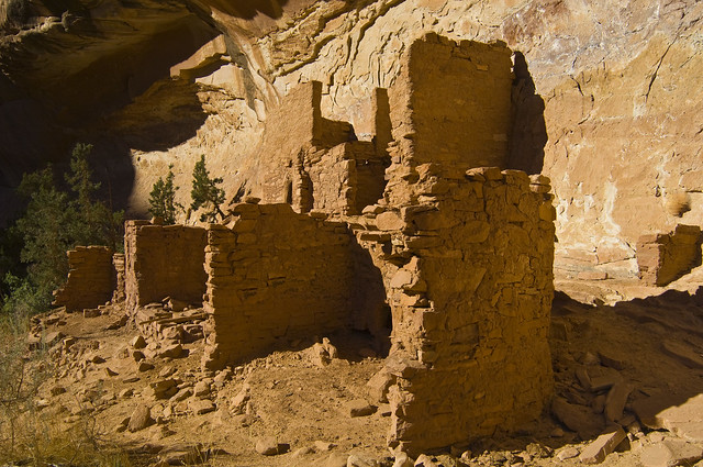
Grand Gulch is a popular area for hiking and backpacking to see Ancestral Puebloan cliff ruins and rock art in a natural setting. Grand Gulch and its tributaries feature miles of winding canyons lined with cliffs that provided sheltered overhangs to people in the past.
Some ruins are amazingly inaccessible, perched high on ledges and under overhangs. Other attractions include the scenery and wildlife, as well as the solitude of desert canyons. A permit to hike or backpack is required.
Photos: Grand Gulch | Flickr
Flickr Album:
Contact Us

Addresses
Directions
Access to the area is from State Highway 95 (SR 95) between Blanding and Hite, or on SR 261 between SR 95 and Mexican Hat. The Kane Gulch Ranger Station is on SR 261 about four miles south of the junction with SR 95.
The trailhead is located adjacent to the Kane Gulch Ranger Station which has a paved parking lot and restroom. Dirt roads lead to many trailheads at the heads of canyons and at the mouths of some canyons draining off the east side of the mesa into Comb Wash. Many of these roads can be recommended only for high clearance vehicles.
Detailed maps showing road access are available at the offices of the BLM or the U.S. Forest Service in Monticello, at the Blanding Visitor Center, the Monticello Multi-Agency Visitor Center or the Moab Information Center, and at the Canyonlands Natural History Association.