
Gardner Mountain WSA | Wyoming
The Gardner Mountain Wilderness Study Area (WSA) encompasses 6,423 acres of public land with no state or private inholdings.
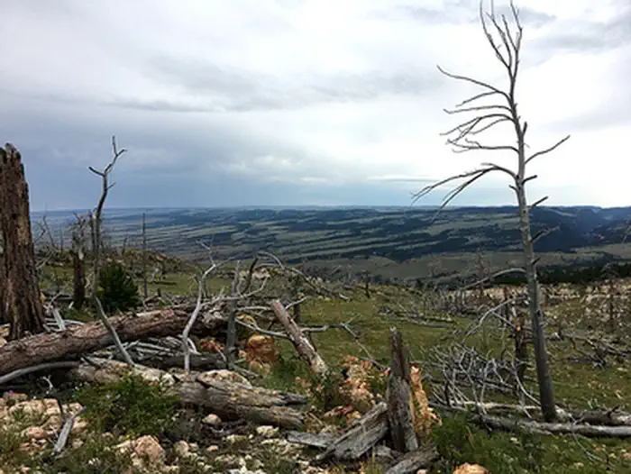
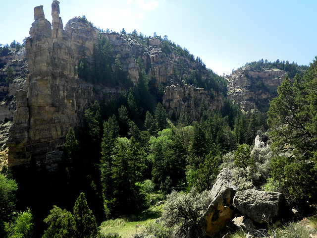
The area is generally rugged terrain of the southern Bighorn Mountains dominated by pine, scattered mountain mahogany, and meadows. Beartrap Creek and the North Fork of the Red Fork of the Powder River flow through the area in deep, steep-walled canyons.
Part of the Dull Knife Battlefield, a National Historic Site, extends into the southern part of the area.
The Gardner Mountain WSA offers outstanding opportunities for primitive and unconfined recreation in the forms of hiking, fishing, hunting, and sightseeing. The steep canyon walls, limited number of access points and steep mountainous terrain are natural barriers that affect human movement within the WSA and enhance the primitive character.
There is no direct public access to the Gardner Mountain WSA. Access is predominately controlled by adjacent private landowners and landowner permission is required to cross any private lands. However, the area may be legally accessed via the Gardner Mountain Trail in combination with cross-country travel through steep topography.
The Gardner Mountain Foot and Horse Trail is open to hikers and horseback riders. It ambles through a mountain meadow and then follows a ridgeline overlooking the Gardner Mountain WSA.
Please respect private property boundary signs and practice Leave No Trace! A land status map and compass or GPS unit are strongly recommended.
Photos
GARDNER MOUNTAIN WSA PHOTOS
BLM WYOMING KNOW BEFORE YOU GO
Contact Us

Activities


Addresses
Directions
The Gardner Mountain WSA may be legally accessed via the Gardner Mountain Foot and Horse Trail in combination with cross-country travel through steep topography. The trail is accessed via Interstate 90, exit 254 (Kaycee). Head west on WY-191/Mayoworth-Slip Road for about 14 miles. Fork left onto Slip Road and continue 6.7 miles up a series of switchbacks. Turn left at a two-track almost at the top of the hill and head downhill to the parking area. The route to the WSA requires hiking or horseback riding approximately seven miles from the Gardner Mountain Trailhead.