
Cross Bar Management Area | Texas
A hidden gem lies just north of Amarillo – nearly twelve thousand acres of BLM-managed public land known as the Cross Bar Management Area (CBMA). Approximately fifteen miles northwest of Amarillo, Texas, the BLM administers 11,883 acres of surface estate on the Cross Bar. The Cross Bar is the only BLM-managed surface estate in Texas. Since 1996, the BLM has been diligently investing and improving public recreation opportunities on these lands. Additional work will need to be accomplished prior to the BLM Oklahoma Field Office (OFO) fulfilling its land management duties. The Oklahoma, Kansas, and Texas Final Joint Environmental Impact Statement, BLM Resource Management Plan (OKT RMP) was approved March 11, 2020- officially designating 9,900-acres of the CBMA as a BLM Special Recreation Management Area (SRMA).
Photos
Accessibility Description (ABA/ADA)
The area to access the Cross Bar is challenging to navigate and requires a 4WD vehicle with high clearance or the ability to walk several miles along a sandy, uneven OHV trail.
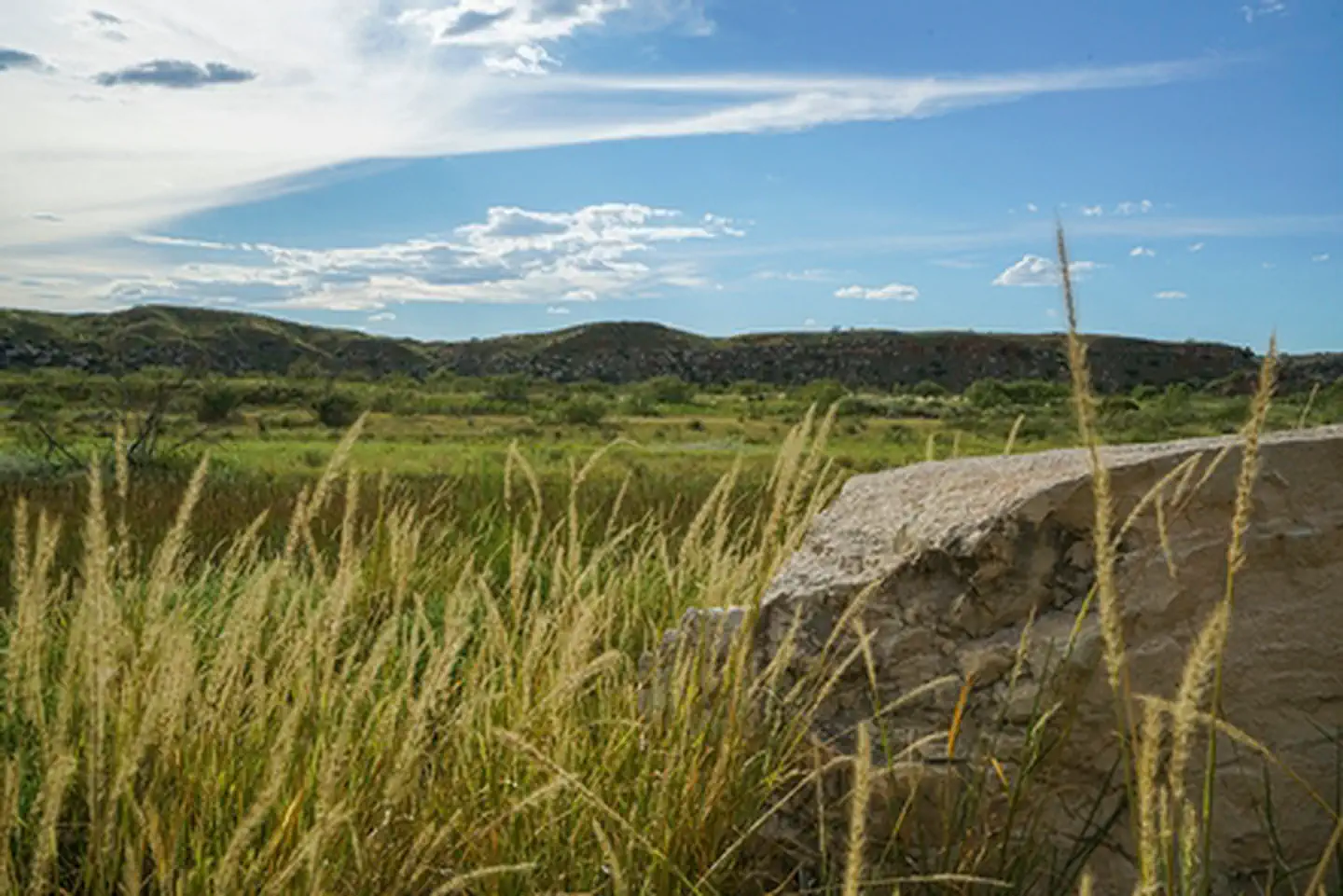
Currently, the Cross Bar SRMA offers primitive recreation opportunities, solitude, and is a mostly undeveloped area.
- As a result, this area does not have any facilities or interpretive signage to make the area easier to navigate.
- The developed trails can be navigated by foot, bike, or horseback. To enjoy this area, one needs to be able to either walk, bike, or ride a horse for several miles across uneven trails that go up and down hill, navigate around other recreators, and spend hours recreating in a primitive environment in various weather conditions.
History
The CBMA was acquired from Humble Oil & Refining Company on March 6, 1931, under the Acts of 1925 and 1929. This legislation provided the DOI authority to acquire helium-rich lands and produce and transport helium gas to industry in support of strategic national interests. In 1996, the BLM Amarillo Field Office began administering the Federal Helium Program. In 2018, the BLM OFO started managing the CBMA. The CBMA lands and resources were managed in accordance with the 2000 Texas RMP, as amended, until March 2020, whereupon the land use allocations and resource management goals and objectives were updated to reflect current land use management decisions.
Background
The Cross Bar SRMA will be developed to allow for specifically identified and planned outdoor recreational uses: mountain biking, horseback riding, hiking, hunting, fishing, and camping. Currently, the Cross Bar is mostly used by hunters through a cooperative effort with the Texas Parks and Wildlife Department. Additionally, several Special Recreation Permits (SRPs) have been issued to the public for mountain biking races and horseback trail riding events. Although access to the property is difficult, the Cross Bar is open for outdoor recreation.
For many years, outdoor enthusiasts in the Texas Panhandle have advocated for safe, reliable, and permanent access to the recreation opportunities the Cross Bar offers. Rugged canyons, sweeping vistas, bountiful wildlife, and remnants of the only remaining virgin shortgrass prairie on the Southern Great Plains make the Cross Bar an attractive recreation venue for the region. Each year, the Cross Bar witnesses an increase in visitations and a growing demand for public access. Private and public stakeholders have voiced overwhelming support for development of the Cross Bar as a destination choice.
Management of the Cross Bar has been an ongoing multiple use undertaking. Abandoned gas wells have been plugged to safeguard groundwater sources. Volunteers have built multiple miles of hiking, biking, and horse trails (motorized vehicles are prohibited on the Cross Bar). Encroachment of mesquite and cholla cactus have been mitigated through a combination of herbicide and mechanical treatments, prescribed burns, and livestock grazing. Feral hogs are being proactively managed through a cooperative agreement with the Texas Wildlife Services.
The Cross Bar also serves as an outdoor classroom for West Texas A&M students seeking degrees in natural resource management and environmental science. Texas State University hosts yearly archaeology and paleontology research initiatives on the property. Seismologists from the University of Texas monitor the property for seismic activity. Texas Tech University Mesonet collects weather data through a state-of-the-art weather station. The area serves as an important big game corridor and transition zone for both whitetail and mule deer. Elk have moved into the property, a welcome presence. Upland game species include robust populations of bobwhite quail and scaled quail. The Cross Bar also serves as an important migratory corridor for hundreds of migratory birds. Pronghorn also occupy its habitat. Wildlife surveys are conducted annually with West Texas A&M University and Master Naturalist organizations cooperating with these surveys.
In 2019, Texas A&M University conducted a socioeconomic impacts analysis indicating the Cross Bar SRMA, once opened, would yield $13 million worth of positive economic impact annually to the local economy. Regional residents have limited opportunities for recreation. Lake Meredith, operated by the National Park Service, and Palo Duro Canyon State Park, administered by Texas Parks and Wildlife Department, serve as two of some of the only accessible recreational opportunities for nearly 750,000 Panhandle residents. Stakeholders have formally voiced an opinion that the Cross Bar SRMA would serve as a welcome recreation opportunity.
Issues
Public Access
There is no safe, reliable, and permanent access to the Cross Bar. The Cross Bar is land-locked. These public lands are surrounded on three sides by private land and bounded on the north by the Canadian River and the east by an aged Burlington Northern Santa Fe (BNSF) train trestle. To access and recreate on the Cross Bar today, the public must seek access to cross private land, then traverse unpredictable and potentially treacherous conditions along the south bank of the Canadian River. The current pathway is not ADA compliant. To alleviate our access issues for large events, local BLM staff and volunteers must escort permitted groups in and out of the property, when group functions are planned and authorized.
Funding
In FY 2020, the Cross Bar received $100K from the Recreation budget, in addition to the annual Restoration funding. The BLM Engineering program appropriated $450K in FY 2021 to contract the development of a Master Plan. In FY 2022, the BLM Transportation program funded $130K for the development of the Travel and Transportation Management Plan. To put these plans into practice, much more funding and support will be needed to move forward with onsite development, however. Without an increased and consistent annual allotment of funding, improving the site could take another decade or more. The total estimated construction cost for the road on the donated easement is estimated at approximately $8M (pre-COVID estimate). Interior roads and campsite developments are expected to exceed $5M. The BNSF trestle replacement estimated at $1.5M is an additional necessity for access. The master plan determined that 125 campsites will be suitable to meet demand. Overall estimates for complete development is estimated at $26 million.
In 2021, local stakeholders attended a workshop hosted by The Great Outdoors Fund (TGOF). Although local buy in for the Cross Bar SRMA development was already very strong, we lacked a mechanism for fundraising and holding private money in a 501C for future development purposes. As a result of this workshop, stakeholders agreed to hire local professionals ($250K) to manage project specific fundraising efforts, where the money raised would be solely utilized for Cross Bar development purposes. An OFO BLM fundraising MOU between the Friends of Cross Bar SRMA and the Amarillo Area Foundation has been initiated. A fundraising kickoff is expected in October 2022.
Moving Forward
Through the support of our local stakeholders the Cross Bar will be developed into a first-rate outdoor recreation destination. The BLM and its partners are coordinating efforts to secure public and private funds to complete all stages of the development process. Keep checking for updates.
How to Access the Property
From the intersection of HWY 87/287 and the Canadian River head west through the Canadian River bottom. Numerous off-road tracks (two-tracks) have been established over the past several decades. River conditions are unpredictable so be prepared with four-wheel drive. Immediately west of the spanning BNSF railroad trestle is where the property boundary begins (IF YOU ARE NOT WEST OF THE TRESTLE AND ON THE SOUTH SIDE OF THE RIVER, YOU ARE ON PRIVATE PROPERTY!). For approximately 7.25 miles, visitors with permits can climb over the wildlife friendly fence and explore the property.
MOTORIZED VEHICLES ARE STRICTLY PROHIBITED ON THE CROSS BAR.
Permits are required for any recreation activity on the Cross Bar. To obtain a permit, simply call (806) 356 – 1008.
What You Can and Cannot Do on the Cross Bar
Trails (MOTORIZED VEHICLES ARE PROHIBITED)
Multiple-use trails are available on the Cross Bar. Hiking, mountain biking, and horseback riding are allowed on trails. Ebikes are currently not allowed.
Camping
Dispersed primitive camping is allowed throughout the property. Please pack out what you pack in and practice a good land ethic. The Cross Bar follows Potter County outdoor burning guidance. Most of the time, campfires are prohibited.
Hunting (FIREARMS OF ANY KIND ARE PROHIBITED)
Update July 2024:
Hunting reservations will no longer be accepted over the phone and all hunters’ names must be drawn through the Texas Parks and Wildlife (TPWD) Lottery.
All hunters wishing to hunt the Cross Bar must enter their names into the TPWD Lottery Draw Hunt System. The TPWD Drawn Hunt Catalog is anticipated to be available beginning July 1, 2024. Hunting on the Cross Bar remains limited to archery and legal harvesting of white-tailed deer, mule deer, and feral pigs only. Drawn hunters must comply with all TPWD hunting rules and regulations and abide by 43 CFR Part 8360 “Enforcement and Compliance” guidelines.
Contact Us

Directions
From downtown Amarillo, head north on Fillmore Street/Dumas Hwy/87. Drive for approximately 18 miles to the intersection of the Canadian River and HWY 87. Walk or drive west through the River for 1.5 miles to the railroad trestle. The Cross Bar property boundary is begins at the fence line south of the river bottom and immediately west of the railroad trestle.
Fees
Contact the field office for more information.