
Black River Recreation Area |
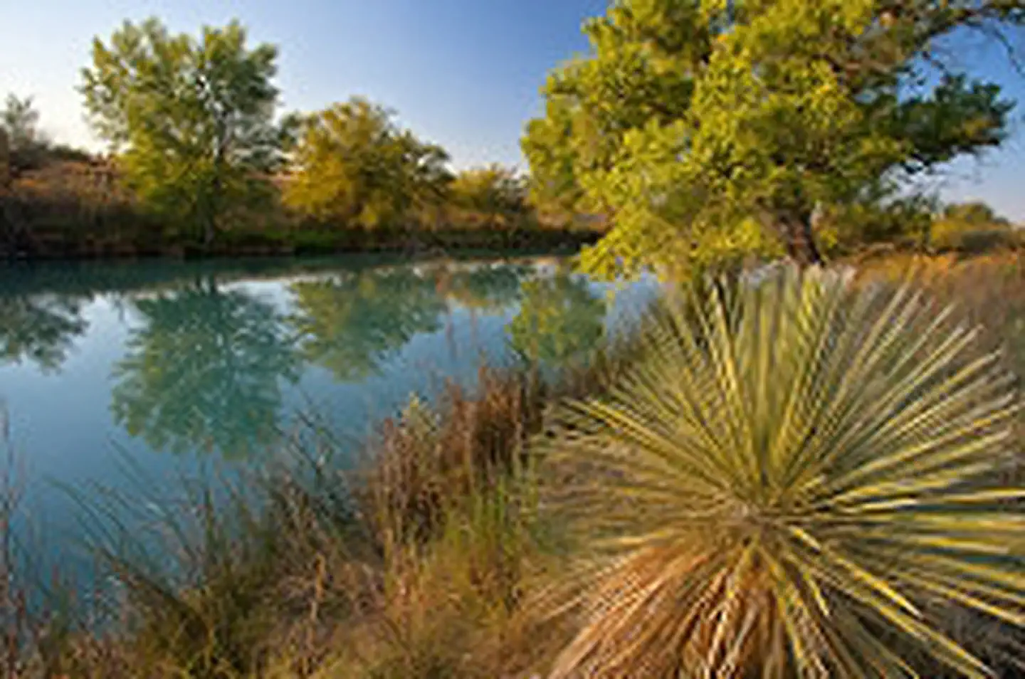
The 1,200-acre Black River Recreation Area is managed to provide low-impact recreation and environmental education opportunities while maintaining a healthy river system and riparian habitat. This river corridor acts as a transition zone between the limestone foothills of the Guadalupe Escarpment and the southern gypsum soils to the east. Several spring-fed pools within the area comprise the headwaters of the Black River. The area includes a series of deep, elongated pools interconnected by a shallow, narrow stream.
The Black River, an oasis in the Chihuahuan Desert, is home to rare species of plants, fish and reptiles in and around the river. During migration seasons, the area teems with birds, including waterfowl, shorebirds and songbirds. Bird populations in this small area fluctuate daily and seasonally. Visitors may observe green-backed herons, orchard orioles, yellow-billed cuckoos, and roadrunners. Lush desert vegetation and clear pools of water provide excellent opportunities for viewing wildlife.
The recreation area's most frequently visited site is the Cottonwood Day Use Area, which includes a wildlife viewing platform, picnic tables, and a toilet. The parking area is approximately 500 feet from the water's edge.
Facilities include a restroom and picnic tables. Drinking water is not available.
Photos
Accessibility Description (ABA/ADA)
The parking lot is loosely packed dirt and small gravel. There are no designated handicap spots, but there is plenty of parking near the entrance of the Wildlife Viewing Platform.
The concrete path leading to the Wildlife Viewing Platform is marked with a brown sign. The path is about 2 feet wide, uneven in spots, and slopes towards edges.
The Wildlife Viewing Platform itself is a wide, wooden deck that has interpretive displays with large print and pictures.
The restroom has a wide door, but there is a lip on the concrete pad that is about 1-to-2-inches in size.
The picnic area is off to the right in an uneven grassy field with several covered picnic tables and trashcans.
Know Before You Go
Fees
None.
Facilities
Parking lot
- Attached to the parking lot is a paved trail leading down to a wildlife viewing platform.
- There are interpretive displays along the path to the wildlife viewing platform and two on the platform.
A restroom and picnic tables in a grassy area adjacent to the parking lot.
Drinking water is not available.
Nearby Amenities
The nearest location to acquire food, gas, and water is in Whites City, ~9 miles away via Washington Ranch Road and U.S. Highway180/62 East.
Season/Hours
Open year-round.
Special Rules
Please make sure to carry out any litter.
No overnight camping, or OHV use is permitted within the Black River Recreation Area.
No fireworks, discharge or use of firearms, or any other weapons.
No glass bottles on the path, on the platform, or along the river.
No motorized boating.
Pets must be on a 6-foot leash.
Brochures, Maps, and Publications
Wildlife
Several fish species
Rio Grande River Cooter
Roadrunners
Turkey vultures
Waterfowl
YouTube Video
Contact Us

Directions
The Black River Recreation Area is located about 26 miles southwest of Carlsbad, NM. From Carlsbad, take US 62/180 south for about 25 miles and turn west onto CR 418. Travel another 2 miles and turn left at the fork.
Fees
No