
Apache Box Wilderness Study Area | New Mexico
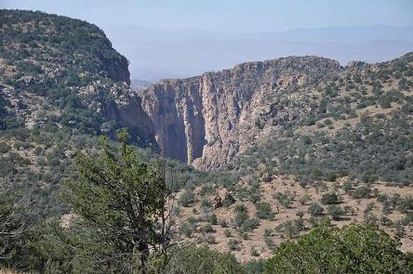
The Apache Box WSA is located in southwestern New Mexico. The namesake feature, Apache Box, is a deep narrow canyon carved by Apache Creek. Sheer cliffs rise 600 feet above the canyon floor and give way to rolling hills above the canyon. Diverse riparian trees are found in the canyon while the uplands are a mix of grassland and juniper and piñon woodlands, with occasional ponderosa stands on northern aspects.
Photos
Contact Us

Activities


Addresses
Directions
From the intersection of highways 180 and 78 (approximately 46 miles west of Silver City), drive just over 9 miles west on 78 to Mule Creek and turn south on Brushy Mountain Road. Drive 15 miles on Brushy Mountain Road, passing numerous marked and unmarked intersecting routes (most notably passing Radar Station Road at 12.2 miles). At 15 miles you will come to a locked gate. Park clear of the gate and follow the fence line to the west to avoid the private land. Staying on National Forest land north of the fence, eventually turn south into the WSA. You'll need to be able to read a map to navigate into the WSA as this is rugged terrain without a trail.
Fees
Contact the field office for more information.