CRACK CANYON WILDERNESS STUDY AREA
Values
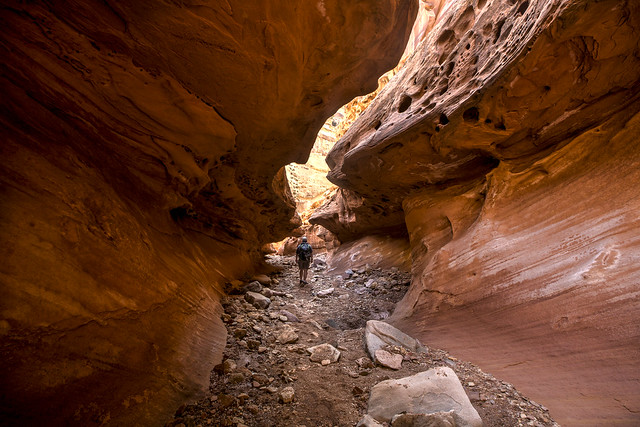
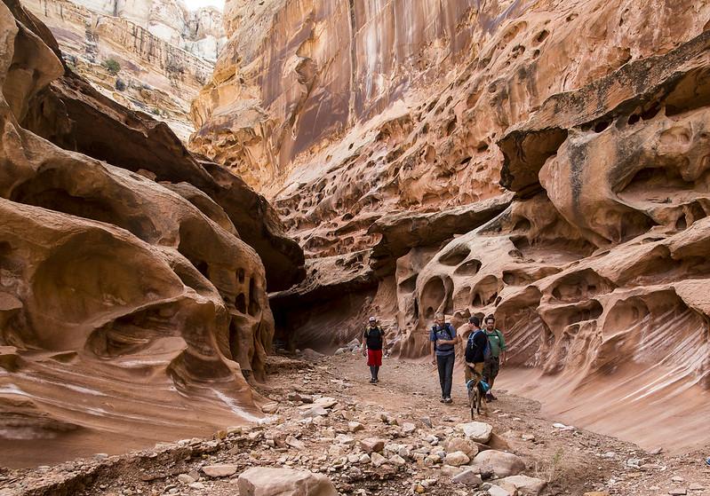
The WSA includes colorful badlands of eroded soils, cliffs, and rock monuments, including fins which form a sawtooth sandstone ridge, and knobs, caves, and arches. Canyons from 200 to 500 feet deep cross the Reef and the WSA, narrowing in places to clefts with bottoms constantly in shadow. Canyons from 200 to 500 feet deep cross the Reef, narrowing in places to clefts with bottoms constantly in shadow and exposing geologic strata and arches, caves, and narrow twisted and textured pathways. Small pictograph or petroglyph panels are within the WSA.
Visitation Information
The WSA is located in Emery County, about 15 miles north of Hanksville, UT and directly west of Goblin Valley State Park. From Green River, Utah travel west on I-70 approximately 11 miles to exit 149. Then head south on highway 24 for approximately 24 miles to Temple Mountain Road. Turn west (right) at Temple Mountain Road and travel approximately 5 miles to the intersection of Temple Mountain Road and Goblin Valley Road.
Visitor Advisory
High-clearance 4WD and all-terrain tires are recommended for all vehicles, although 2WD low clearance vehicles can also reach the Little Wild Horse/Bell Canyon, and Ding and Dang Canyon Monitoring Areas. Chute Canyon cannot be accessed without a 4WD, high-clearance vehicle.
Flickr Album