Plan Your Visit
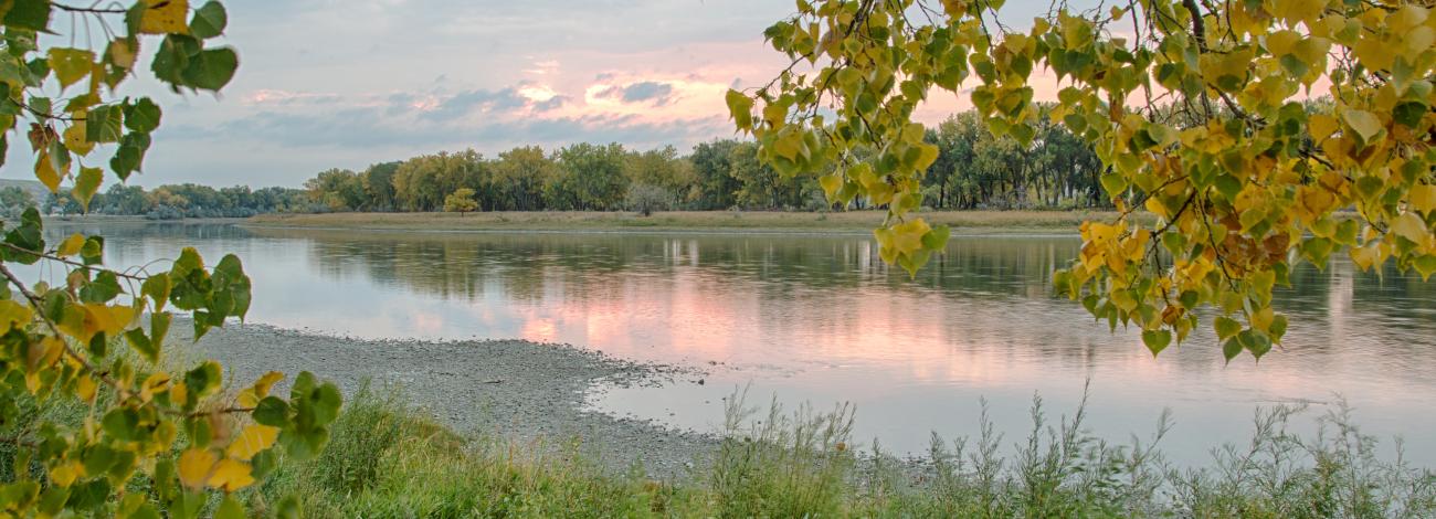
The Upper Missouri River Breaks National Monument plays an important role in the local lifestyle and economy, offering a wide range of outdoor activities such as floating the river, fishing, hiking, hunting, camping, and sightseeing. Boating is especially popular, providing access to scenic views, remote campsites, historic homesteads, and excellent fishing and hunting opportunities. Driving the Missouri Breaks National Back Country Byway is also a great way to experience the majestic vistas of the monument.
Many areas are accessible only by gravel or unimproved roads, and large portions have no road access at all, encouraging exploration on foot. Visitors should stop by the Missouri Breaks Interpretive Center in Fort Benton or local BLM field offices in Lewistown or Havre for maps, safety tips, and current conditions. Since BLM, state, and private lands are intermingled, it's important to respect private property and be aware of boundaries while exploring.
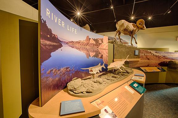
Call the Missouri Breaks Interpretive Center for help with planning your visit at 406-622-4000.
- Types of Watercraft
Both non-motorized and motorized boats are welcome on the Upper Missouri River.
Non-Motorized: Canoes or kayaks are the preferred craft and allow the average floater to travel 15-20 miles per day. Rafts and drift boats are not recommended due to the generally slow current and the potential for upriver winds.
There are no restrictions on the use of non-motorized boats on the Upper Missouri River.
Motorized: Jetboats or other shallow draft boats are preferred because of shallow waters, frequent gravel and mud bars, and poor water clarity.
Since 1976, there have been seasonal boating restrictions on the "wild and scenic" segments of the Upper Missouri National Wild & Scenic River. The following restrictions apply annually to motorized watercraft:
- Open year-round
- Fort Benton to Pilot Rock (river mile 0-52)
- Deadman’s to Holmes (river mile 84.5-92.5)
- Seasonally Restricted (June 15-September 15)
- Pilot Rock to Deadman’s Rapids (river mile 52-84.5): Motorized watercraft may travel downstream only at no-wake speeds (daily)
- Holmes Council Island to Fred Robinson Bridge (river mile 92.5-149)
- Sundays-Wednesdays: No motorized watercraft travel
- Thursdays-Saturdays: Motorized watercraft may travel downstream only at no-wake speeds
When restrictions are in place, upstream travel by motorized watercraft is limited to administrative, emergency or law enforcement watercraft only.
If you are planning a trip with a motorboat and are unfamiliar with the river, please contact the BLM at 406-622-4000.
- Open year-round
- River Access and Launch Sites
Public access to the Upper Missouri River is limited and remote – plan ahead for challenging weather and travel conditions.
Use public access points only. The main launch sites are:
- Fort Benton Canoe Launch (river mile 0)
- Fort Benton Motorboat Launch (river mile 1)
- Wood Bottom (river mile 20.3)
- Coal Banks Landing (river mile 41.5)
- Judith Landing (river mile 88.5)
- James Kipp Recreation Area (river mile 149)
- Additional: Virgelle Ferry (river mile 39.1), McClelland Ferry (river mile 101.8)
Visitors may use the river up to the ordinary high-water mark. Do not cross or camp on private land without permission.
- Boater Guides and Maps
Boater Guides: Two guides to the Upper Missouri River are available, both digitally for downloading (free) and printed. The guides include maps, land ownership, campsites, hiking, and more.
- Fort Benton to Judith Landing (river miles 0 – 88.5)
- Judith Landing to James Kipp Rec Area (river miles 88.5 – 149)
Maps: Along with the interactive online map of the monument, there are two detailed transportation maps available for digital download (free) and printed:
- Upper Missouri River Breaks National Monument - East Half
- Upper Missouri River Breaks National Monument - West Half
Waterproof printed versions of the guides and maps are available for $10 each. They can be purchased in person, by credit card over the phone or by mailing a check. Call the Missouri Breaks Interpretive Center at 406-622-4000 for more information.
- Permits and Fees
River Use: $5/person/day. Please pay at fee sites by picking up a blue envelope at any fee site, placing cash or check payment inside, depositing the envelope into the security lock box, and retaining the tab as proof of payment.
Campgrounds: $20/site/night at Coal Banks, Judith Landing, and James Kipp. Reservations are not taken in advance. Please pay in the same manner as the river use fee, but using the yellow envelopes available at the campground entrance.
Large Groups: Groups of over 30 people require a Special Recreation Permit. Apply by contacting the Missouri Breaks Interpretive Center at 406-622-4000 or by email to [email protected]. Additionally, group size limits apply June 15-Aug. 1 at Coal Banks and Judith Landing: groups of over 20 people may launch only Wednesdays through Fridays.
Commercial Groups: A Special Recreation Permit is required for all fee-based operations. Contact the Missouri Breaks Interpretive Center at 406-622-4000 or by email to [email protected] for a current list of Authorized Outfitting and Vending Services, including shuttle services.
Registration: Registration is not required, but it’s encouraged for safety and statistics. Register at the Missouri Breaks Interpretive Center in Fort Benton, Fort Benton Canoe Launch, Fort Benton Motorboat Launch, Wood Bottom, Coal Banks Landing, or Judith Landing. If BLM employees are not present, please use the self-registration boxes at these locations.
- Safety
Road Conditions
Vast portions of the monument are serviced only by graveled and unimproved roads. Much of the monument is not accessible by any road, inviting visitors to explore on foot. Some of the roads are not suitable for low-clearance vehicles, and many roads cross soils that become impassable when wet. Off-road driving (cross-country travel) is not allowed in the monument.
River Conditions
The Upper Missouri is considered an easy river to float. The rapids are Class I, which is defined as low risk with easy opportunities for self-rescue. The rapids are fast moving with riffles and small waves, and obstructions are generally easy to avoid. However, vigilance is still needed because hazards such as submerged rocks, tree snags, and powerful undertows may occasionally lurk beneath the surface.
At the ferry crossings at river miles 39.1 and 101.8, watch for low-hanging cables and strong currents. Stay away from the upstream side of each ferry because the strong undercurrents they create can easily submerge small watercraft.
The average mid-summer current moves at 3-½ mph. Current stream flow information is reported by the United States Geological Survey based on data from gauges located at Fort Benton, Virgelle (near Coal Banks Landing), and Landusky (downstream from James Kipp Recreation Area).
Weather & Emergencies
Weather can be one of the most hazardous factors on the river. Temperatures during the floating season can range from 32 degrees to 100 degrees. Be prepared to deal with sudden storms, strong winds, hail, and flash floods.
Bring layered clothing, rain gear, sun protection, and thermal wear.
Cell service is poor along most of the river, although in some areas it is improved by hiking to the rim. It is recommended to bring a device with a satellite connection.
BLM park rangers and law enforcement rangers frequently patrol the river and may be able to help in case of emergency. However, response time will be determined by your location and your ability to call for help.
Gear & Behavior
Approved personal flotation devices are required for every boater. Children under 12 must wear a life vest at all times.
It is recommended to bring adequate drinking water (one gallon per person per day). There is potable water at Coal Banks Landing access site (river mile 41.5), but there are no other potable water sources on public land. Water filters and chemical treatment options may also be used, but may not be effective in removing agricultural and industrial contaminants.
Dispersed hiking can be enjoyed anywhere on public lands along the river corridor. There are no established trails.
Fishing is permitted for Montana State residents and non-residents with a fishing license. Common sportfish available include walleye, sauger, northern pike, channel catfish, smallmouth bass, shovelnose sturgeon and paddlefish.
Stay off the river during storms. Avoid trees if there's lightning. Ensure tents, boats, and gear are secured against strong winds and flash floods.
Watch for rattlesnakes, slippery or crumbly sandstone, and hypothermia or heat exhaustion symptoms.
- Camping
Campsites
Camping is allowed in developed campgrounds or at dispersed, undeveloped sites on public land anywhere along the river corridor. There is not a campsite reservation system – campsites are first-come, first-served.
There are primitive three-sided wooden shelters available at Hole-in-the-Wall and Slaughter River campsites.
Concentrate campsites as much as possible to reduce impacts and allow others to enjoy the area. When using developed campsites, try to concentrate use around one fire ring.
Campsites should be away from cottonwood trees due to falling limbs.
Camping is discouraged on islands April 1-July 31 to protect nesting birds.
It is recommended to use existing metal fire rings for open fires, and to use cook stoves where possible. Fire restrictions for public safety may be issued at any time.
Dishwater & Waste
Trash must be packed out in keeping with Leave No Trace principles. Dumpsters are available at Coal Banks, Judith Landing, and James Kipp.
Strain dishwater. Pack out the solids and scatter the liquids 200 feet from river.
Portable toilets are mandatory for overnight campers. The portable toilet must be either a washable, reusable toilet system that allows for the carry-out and disposal of solid human waste via an authorized sewer system or an approved degradable bag system specifically designed for human waste disposal.
- Respect and Protect
Etiquette on the River
Be courteous and efficient at boat ramps by preparing gear before reaching the ramp, only using one side of the ramp, and keeping gear concentrated and out of the way.
Floaters have the right of way, but all users should be respectful.
- Floaters: When possible, pull aside and group up to allow motorboats to pass, particularly in shallow sections where power boats can only travel in narrow channels.
- Motorized boats: Give a wide berth and slow to no-wake speeds at docks and boat landings.
Group Travel Best Practices on the River
Keep your group compact with a lead and sweep boat.
Don’t spread out more than half the river’s width for safety and courtesy to passing motorboats and other groups.
Consider lashing boats together in wind and towing slower paddlers.
Wildlife and Land Use
Respect wildlife habitats. Common species that may be spotted along the river include mule and whitetail deer, pronghorn antelope, elk, bighorn sheep, coyotes, mountain lions, red fox, badger, raccoon, skunk, beaver, porcupine, muskrat, prairie dogs, waterfowl, songbirds, raptors, and reptiles.
You are likely to see cattle grazing near the river. on public lands. Most livestock are not people-friendly and are private property. Please, leave them be.
The BLM manages the river according to multiple use and sustained yield principles, balancing the preservation of natural and cultural resources with uses like livestock grazing and recreation.
- Accessibility
Decision Point
This site has a flat gravel parking area with a concrete pad that leads to a dirt path, which transitions to a compacted gravel pathway taking visitors to 2 scenic overlooks.
The part of the path leading to the Marias River overlook is relatively flat and about 250 feet long. As it continues on to the overlook at the confluence of the Marias and Missouri rivers, the path, which is about 4/10 of a mile from the parking area, has a steeper incline. The grade varies from 10 to 17 degrees with an elevation gain of 39 feet.
There are 3 interpretive panels and 2 benches without armrests along the path.
There is no toilet or running water at this site.