


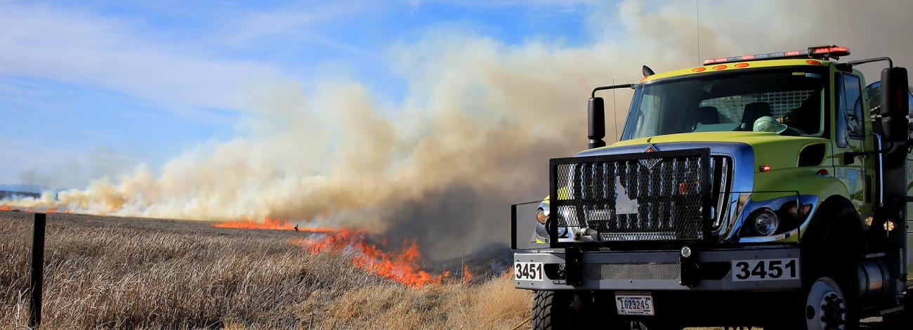
Idaho Prescribed Fire
Fire has always been part of the environment, and one of the most important natural agents of change. Fire plays a vital role in maintaining healthy ecosystems. Native Americans understood this and used fire to hunt game, maintain rangelands, and keep forests healthy.
Prescribed fire is a planned fire. A prescribed fire is one of the most important tools used to reduce wildfire risk to communities, restore habitats, and to achieve land-management objectives. Fire management specialists consider objectives such as public and employee safety, weather, topography, fuels, size, the precise environmental conditions under which it will burn, and conditions under which it may be suppressed.
Prescribed fire is generally less expensive and yields ecological benefits that cannot be achieved by other means, such as mechanical thinning or logging. Prescribed fires restore some of the ecological benefits that were historically gained from naturally occurring fires. There are many potential goals that can be achieved by using prescribed fire. Here are a few examples:
- Reduce surface and ladder fuels that contribute to increased risk of uncharacteristically severe wildfire.
- Reduce risk local communities from wildfire.
- Help protect natural resources such as timber and critical habitat.
- Promote native species and reduce encroachment of invasive species.
- Enhance landscape resiliency and recovery from a wildfire event.
- Improve firefighter ability to safely and effectively respond to and suppress wildfire.
Prescribed Fires by District
All prescribed burns are carefully planned and only carried out when weather, fuel conditions, and air quality are within safe parameters. Firefighters use a combination of natural features and constructed control lines to keep the fire contained, with protocols in place to minimize smoke impacts on nearby communities.
- Boise District
Beginning in December 2026, and continuing through March 2027, the Bureau of Land Management in coordination with the US Wildland Fire Service will conduct a series of prescribed burns across southwestern Idaho on BLM lands. Burn activities, listed below, will proceed as weather, staffing, and on-ground conditions allow; acreages are approximate:
- Antelope Unit (19 acres) - Approximately 3 miles SE of Triangle, ID
- Buckaroo Unit (27 acres) - Approximately 12.5 miles S of Oreana, ID
- Goose Unit (153 acres) - Approximately 15.5 miles E of Jordan Valley, OR
- Trout Unit (67 acres) - Approximately 9 miles NE of Jordan Valley, OR
Read the full release here: BLM Conducts Prescribed Burns to Reduce Wildfire Risk in Southwestern Idaho | Bureau of Land Management.
- Coeur d'Alene District
Beginning as early as Friday, November 13, 2026, and continuing through December 2026, the following prescribed burns will proceed as weather, staffing, and on-ground conditions allow:
Coeur d'Alene Field Office
- Blackwell Hand Piles (4 acres) – Coeur d’Alene, ID.
- Mica Bay Hand Piles (13 acres) – Coeur d’Alene, ID.
- Pine Solo Hand Piles (145 acres) – Pinehurst, ID.
- High and Dry Machine Piles (50 acres) – Pinehurst, ID.
- Pine Solo Machine Piles (50 acres) – Pinehurst, ID.
- Blue Creek Machine Piles (1 acre) – Coeur d’Alene, ID.
- Windy Bay Hand Piles (11 acres) – Worley, ID.
- Huckleberry Campground Hand Piles (1 acre) – Calder, ID.
- Killarney Hand Piles (1 acre) – Cataldo, ID.
Cottonwood Field Office
- Admin sites along the Salmon River/Highway 95 corridor
- Buffalo Gulch Hand Piles (34 acres) – Elk City, ID.
- Happy Trails Hand Piles (257 acres) – Adams County, ID.
- Happy Trails Machine Piles (338 acres) – Adams County, ID.
- Marshall Mountain Hand Piles (85 acres) – Riggins, ID.
- Off the Rail Machine Piles (15 acres) – White Bird, ID.
For more information contact contact BLM Coeur d’Alene District Office at 208-769-5000, and visit the North Idaho Prescribed Fire story map.
- Idaho Falls District
Fire managers will implement the controlled burns over multiday periods from Sept. 30 through Dec. 30. Actual burn dates and times will be determined by weather and fuel conditions. Smoke may be visible for several days following each burn.
The following burns are scheduled during this time window:
- Challis Field Office – 208-756-5499
- South Butte Broadcast Burn, 200 acres located in Squaw Creek north of Clayton, ID
- Bayhorse Pile Burn, 130 acres of piles located around the Bayhorse Townsite in Custer County.
- Pocatello Field Office – 208-478-6340
- Sheep Creek Broadcast Burn, 290 acres in the Pleasantview Hills
- Morgan Jones South Broadcast Burn, 170 acres in the Pleasantview Hills
- Pleasant View Pile Burn, 40 hand & machine piles in the Pleasantview Hills
- Salmon Field Office – 208-756-5400
- Salmon Admin Pile Burn, approx. 20 piles to burn around various BLM Administrative Sites and Campgrounds.
- Upper Snake Field Office – 208-524-7500
- South Fork Pile Burn, 72 acres of piles in the Spring Creek drainage near Heise, ID
- Shotgun Valley Pile Burn, 500 acres of piles located West of Harriman State Park & South of the Clark County A-2 / Yale-Kilgore Road
- Challis Field Office – 208-756-5499
- Twin Falls District
No prescribed fires are planned at this time.