
BLM and partners finalize second travel management plan in southwestern Idaho
Organization:
BLM Office:
Media Contact:
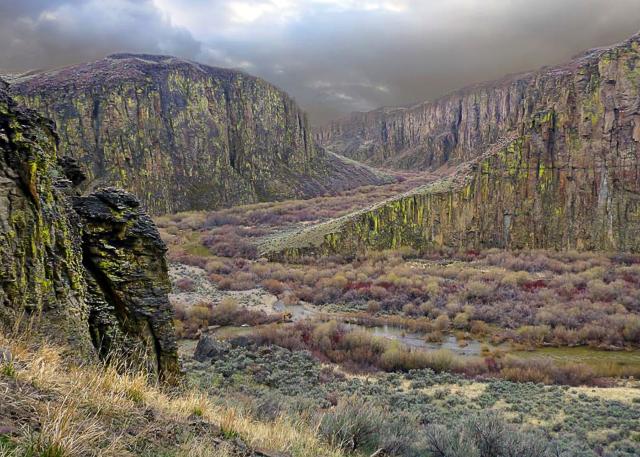
BOISE, Idaho—After extensive work with local partners, the Bureau of Land Management today finalized the second of five plans that taken together will define a comprehensive system of existing motorized routes through Owyhee County in southwestern Idaho. The Canyonlands West Travel Management Plan provides for hunting, hiking, biking, and off-highway vehicle access, while also supporting working rangelands and minimizing user and resource conflicts.
The strategy, developed under a collaborative effort that engaged Owyhee County Commissioners, motorized user groups, Tribes, and various state and federal agencies, would designate 1,305 miles of BLM-managed routes within Owyhee County. Designated routes are defined by more than physical characteristics such as paved surfaces, but also include usage, size, condition, and popularity considerations. The BLM designated 1,089 route miles as open for motorized vehicles, providing access to 677,000 acres of BLM-managed public land. The BLM will allocate 41 miles specifically for ATV/UTV use and 36 miles for single-track use, such as motorcycles or e-bikes.
“We value the feedback from our partners and the public in evaluating designated routes in Owyhee County. Our aim is to balance access for everyone, offering spaces for both motorized and non-motorized activities, while ensuring the land is protected from overuse,” said Acting BLM Boise District Manager Beth Maclean. “Together, we’ve shaped a travel management plan that minimizes user conflicts and promotes diverse activities on BLM-managed public lands for current and future generations."
Under the plan, BLM will decommission and restore approximately 164 miles of trails and roads, both paved and unpaved, to their natural state. This decision was informed by detailed evaluations of each route, accounting for factors such as usage, condition, and environmental impact. The process prioritized routes that could naturally regenerate, with additional restoration efforts contingent on available funding. By reducing route density, this initiative aims to protect wildlife, native plants, and cultural resources, thereby creating a more sustainable network for public access.
The BLM has divided Owyhee County into five segments to analyze for travel management planning. Canyonlands West is the second plan to be reviewed, and will be followed by National Conservation Area South, Silver City, and Grand View. The goal is to complete all plans by spring 2024.
The BLM allowed the public a chance to review and weigh in on alternatives to the plan during a 45-day public comment period this fall. The final plan and decision record are available at the BLM National NEPA Register. For additional information, please contact Aaron Rasmussen at 208-384-3300 or Ammon Wilhelm at 208-896-5912.
The BLM manages about 245 million acres of public land located primarily in 12 western states, including Alaska, on behalf of the American people. The BLM also administers 700 million acres of sub-surface mineral estate throughout the nation. Our mission is to sustain the health, diversity, and productivity of America’s public lands for the use and enjoyment of present and future generations.