
BLM Colorado Grand Junction Field Office Travel Management Map Set
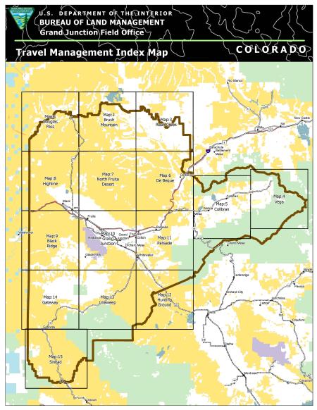
This map set includes the symbolized route designation for all the positive travel in the BLM Grand Junction Field Office. The map label the roads and trails with the BLM road/trail numbers. There is an overall index map as well as 15 maps to cover the whole GJFO. The maps include: Douglas Pass, Brush Mountain, Roan Creek, Vega, Collbran, De Beque, North Fruita Desert, Highline, Black Ridge, Grand Junction, Palisade, Whitewater, Unaweep, Gateway and Sinbad.
Download Files
Publication Date
Region
Grand Junction FO
Organization
Collection: Public Room
Category: Map
Keywords
Travel Management