
Burn Canyon Trails
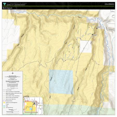
The Burn Canyon trail system contains 15 miles of routes geared towards hiking, horseback riding, and mountain biking on lands managed by the Uncompahgre Field Office of the Bureau of Land Management. It’s located west of Norwood, Colorado and 30 miles northwest of Telluride. The mountain bike, hiking, and horse trails are located on a plateau bordered by Burn Canyon to the west and Naturita Canyon to the north. The hiking and horse only trail is in and to the east of McKee Draw. All of these trails have amazing views of Naturita Canyon. This area is closed to motorized and mechanized travel on BLM-managed routes from December 1 to April 30 to protect big game winter range.
Download Files
Publication Date
Region
Colorado
Uncompahgre FO
Organization
Collection: Public Room
Category: Map
Keywords
Horseback Riding
Hiking
Mountain Biking
Equestrian