



Arizona Strip Visitor Map [East]
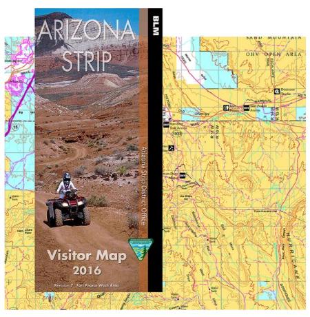
The Arizona Strip Visitor Map covers a large area of northwestern Arizona, including the Vermilion Cliffs National Monument, Grand Canyon-Parashant National Monument, Grand Canyon National Park, and the Kaibab Plateau. It extends north to the Utah border and includes portions of the Grand Staircase-Escalante National Monument in Utah. The map uses color-coding to show which agency manages each parcel of land across the Arizona Strip.
Paved highways, improved dirt roads, primitive roads, and trails are shown on the map. Road conditions and accessibility vary significantly across the Arizona Strip, and many routes require high-clearance or four-wheel-drive vehicles. In several areas of the Arizona Strip, off-highway vehicle use is limited to roads and trails designated by signs. These Areas of Critical Environmental Concern (ACECs) in the western Arizona Strip contain significant desert tortoise habitat and scenic and riparian resources. In these areas, camping is only allowed in existing or already impacted areas. Vegetation collection is not allowed. The ACEC along the rim of Marble Canyon in the eastern Arizona Strip and wilderness areas are closed to all motorized vehicles.
A recreation site information table is included on the map listing facilities and amenities available at sites across the Arizona Strip.
The brochure panels include information on cultural history, the Great Western Trail, the Arizona National Scenic Trail, Vermilion Cliffs National Monument, Paria Canyon and Coyote Buttes, outdoor conduct, safety, and recreation site information.
The map was produced by the BLM Arizona Strip District Office. The coordinate system is NAD 1983 UTM Zone 12N. An inset map in the lower left shows the location of the east half map area within the full Arizona Strip region. This map is the east half of a two-map series covering the Arizona Strip. A companion west half map is also available.
No warranty is made by the Bureau of Land Management as to the accuracy, reliability, or completeness of these data for individual use or aggregate use with other data.