
New paper shows vegetation trends on BLM allotments across 30 years
Story by Emily Kachergis, Assessment, Inventory and Monitoring (AIM) Coordinator; and Justin Shirley, Range Management Specialist.
Trends in vegetation cover and production for all Bureau of Land Management (BLM) rangeland allotments in the Western U.S. from 1991 - 2020 are available for the first time, thanks to recently published work by a team of researchers. Representatives from the Bureau of Land Management, USDA’s Agricultural Research Service, and scientists at the University of Montana (affiliated with USDA’s Natural Resources Conservation Service’s Working Lands for Wildlife) are excited to share their work across the land management community. These findings are documented in a paper titled Long-Term Trends in Vegetation on Bureau of Land Management Rangelands in the Western United States, published in December 2022 in the journal Rangeland & Ecology Management.
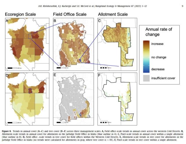
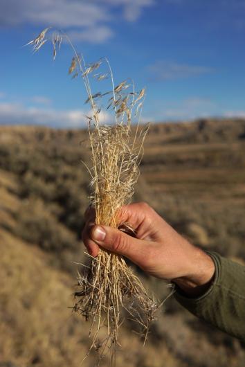
This is the first ecological assessment of vegetation trends at broad and fine scales across BLM allotments. It can show managers where conservation and restoration actions can be focused to have the most impact for native rangelands, wildlife, and public land user groups. The research team used newly developed remote sensing tools that found widespread increases in cover and production of annual grasses and forbs, declines in herbaceous perennial cover, and expansion of trees. Researchers found that cover and production of herbaceous annual plants now exceed that of perennials on nearly 52 million acres of BLM rangeland, marking a fundamental shift in the ecology of these public lands and implications for more frequent and intense wildfires.
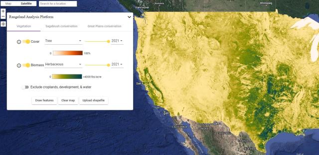
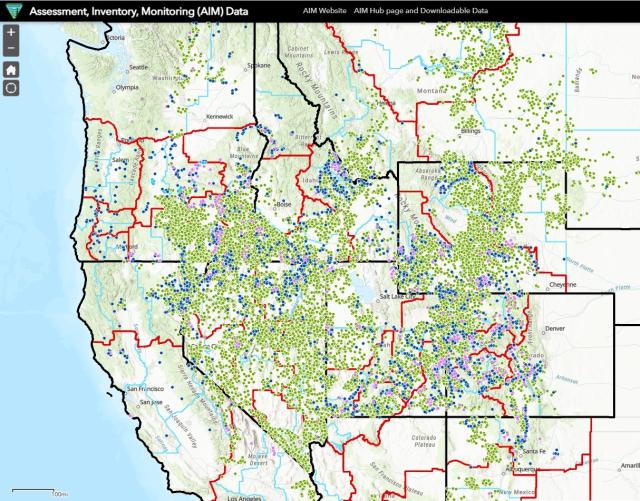
Collecting sufficient data to understand how vegetation is changing across western rangelands is a significant challenge due to the diversity and expanse of land managed by the BLM. The BLM’s Assessment, Inventory and Monitoring (AIM) program was created to inform land managers about rangeland ecosystems and how they are changing. Researchers used BLM’s AIM data, which was used to train and validate a remote sensing tool called the Rangeland Analysis Platform (RAP), for this entire analysis.
The purpose of this research is to get the most recent and detailed information about vegetation changes into the hands of land managers and decision-makers. The paper and its authors specifically discuss conditions on BLM allotments and provide management implications for conservation and restoration planning. Grazing management was not analyzed in this paper; there are no findings or interpretations provided.
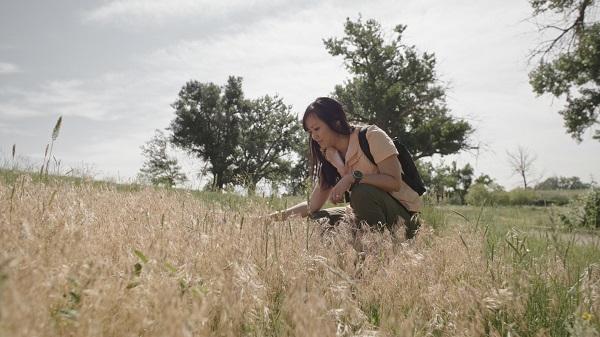
While remote sensing data is a powerful tool for measuring rangeland status and trends, the continued collection of field data through the AIM program will remain essential for understanding BLM rangelands. New field data remains a precious commodity essential for the development and improvement of remote sensing algorithms and for the additional detail that field data provide. Rather than thinking of satellite-based data as an alternative to field data, the two are complementary and both will play an important role in managing BLM rangelands into the future.
This body of science shows the power of new remote-sensing tools for monitoring rangelands and developing effective strategies for adaptive management and conservation. The long-term changes in vegetation observed on public rangelands argue for a more proactive approach to management, emphasizing preventative treatment and restoration to conserve rangeland habitats and functions. This analysis primarily focused on BLM allotments (excluding Alaska) including other land ownership types within allotment boundaries.
Click here to access Long-Term Trends in Vegetation on Bureau of Land Management Rangelands in the Western United States.
Related Stories
- BLM, Partners Enhance Public Access at Popular Recreation Area
- Volunteers and Partners Retrace 250 Years of History on the Anza Trail
- Celebrating 2026 National Trails Day volunteers
- Strengthening Partnerships: BLM Connects with Industry at Key Oil and Gas Meetings in Ohio and Pennsylvania
- Reel Partners: BLM and Wyoming Game and Fish Cast a Line for Kemmerer’s Next Generation
Office
1849 C Street NW
Washington, DC 20240
United States