
Prescribed burns help promote healthy public lands in Canyon Country
BLM’s Canyon Country District uses favorable conditions to conduct a prescribed burn on Ray Mesa
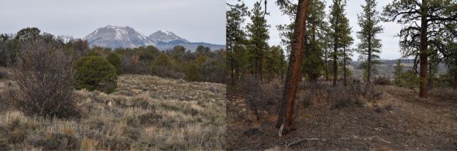
Early on a cold November day, firefighters traveled to a forested part of San Juan County to complete a prescribed burn. Ray Mesa, also referred to by some as Wrey Mesa, is just west of the Colorado border and known for its rugged terrain, old-growth Ponderosa, and wildlife habitat.
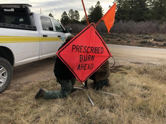
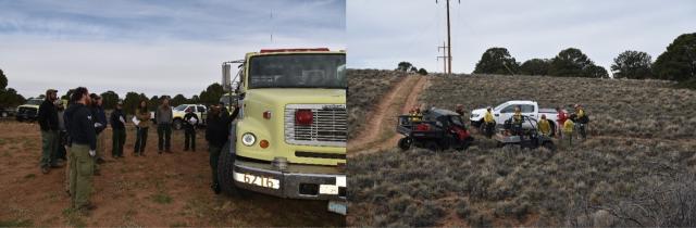
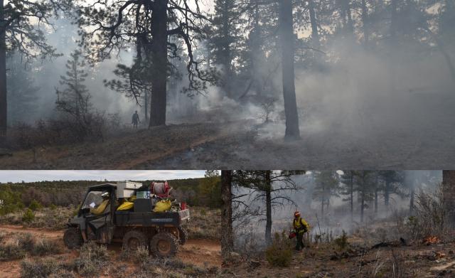
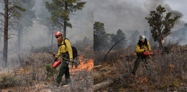
The firefighters arrived early to ensure everything was ready prior to operations planned for mid-morning. Crew members arrived from Moab, Monticello, and even travelled from as far as Montrose, Colorado and Price, Utah. All participants met to discuss the days’ operation, safety, and to ensure each person understood their role. While everyone wanted to get started, each person in attendance recognized the importance of their planning and preparations to completing a successful burn. While many participants were tasked with putting fire on the ground (lighting small patches of fuels within the burn area), others oversaw the work, documented the burn, and completed other important tasks to help ensure safety and a successful outcome.
While an extensive amount of work and time went into planning this burn in the fall of 2021, the effort really started years earlier. The Ray Mesa Project has been ongoing since 2004. Adjacent to the communities of Old La Sal and the Woodlands in the La Sal Subdivision, juniper and pinyon woodlands had encroached into other native plant communities to the extent that the Ray Mesa ecosystem was in jeopardy of destructive wildfire. The dense continuous fuel buildup also posed a severe fire hazard to nearby homes. Since 2004, the BLM has partnered with the adjacent community to address the issue and to encourage homeowners to mitigate risks on their property. This 19-acre burn was just a small part of the larger effort to protect Old La Sal and the local ecosystem.
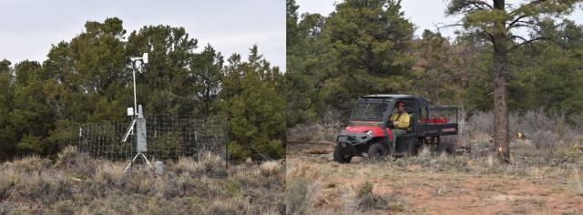
In the weeks prior to the planned burn, firefighters monitored conditions. They collected weather information from a temporary weather station installed at the site, visited to define the burn area, create a containment line, and monitored conditions on the ground. These planning efforts and other details, including safety, resources, and staff needs, are outlined in a document called a ‘burn plan’ prepared for this (and every) prescribed burn operation. The burn plan outlines what conditions that are necessary to decrease risks associated with the burn. If the conditions aren’t right, the prescribed burn would be postponed until the conditions were right. Fortunately, conditions were favorable for this burn, so it was completed as planned.
Throughout the day, firefighters strategically lit brush and fuels while monitoring the interior and the containment line. While smoke could be seen from the area, the fire remained small. BLM firefighters carefully monitored conditions and the burning debris. Firefighters continued to monitor the burned area throughout the week to ensure that the residual burning vegetation burnt out over time.
Burn operations are completed for many reasons, but essentially, they are used to help simulate more natural conditions. Through development, climate change, and fire suppression, humans have altered the landscape in this area. A few hundred years ago, smaller naturally occurring fires would likely have cleared brush and small trees, allowing many of the large Ponderosas in this region to continue to grow, basically untouched. However, fire suppression and changing conditions have allowed brush, smaller trees to fill in the area surrounding the large ponderosas. They may become what firefighters refer to as ladder fuels. Without active management, these ladder fuels, can build up and fuel higher intensity fires that are more likely to reach the crowns of large trees and spread quickly.
As conditions allow, the BLM may conduct another larger burn in this area later this winter. Prescribed burns, like the one on Ray Mesa, help protect rural communities from wildfires and support the growth of native plants. The BLM and our partners continue to responsibly manage public lands for future generations with prescribed burning and through other active management activities.
Related Stories
- Nine Miles of Prevention: The Fuel Break that turned the Fire
- Firefighters and Archaeologists Collaborate to Protect Historic Mining Site during Monroe Canyon Fire
- Community, Fire, and Enforcement
- BLM, U.S. Wildland Fire Service celebrate more than 20 years of wildland fire training partnership with Phoenix schools
- New Life for the Front Lines: How Surplus Engines are Saving Utah’s West Desert
Office
82 East Dogwood
Moab, UT 84532
United States