
Scientists take AIM at natural resources on BLM-managed land
Story by David Hercher, Public Affairs Specialist. Photos by the Paria River District.
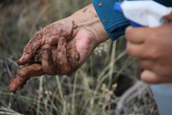
As a soil scientist, Raven Chavez is responsible for studying various aspects of soil around the Paria River District's Grand Staircase-Escalante National Monument and Kanab Field Office. As one would imagine, this requires many hours in the field digging in the dirt analyzing soil composition, distribution, development and behavior to determine how soils interact with organisms, animals and plants across the landscape. This is accomplished through the Assessment, Inventory, and Monitoring (AIM) strategy, which was created to inventory and assess the condition and trend of natural resources across BLM-managed public lands.
AIM data is used to guide BLM in justifying land uses, policy actions, and adaptive management decisions at the local, state, and national level. Terrestrial and Aquatic AIM protocols exist and can be adjusted to individual study needs. To help with this massive amount of data collection, Chavez contracts support from both Terrestrial and Aquatic field crews annually. Members of these specialized crews are also trained to identify and analyze the different characteristics of soil, vegetation and hydrological systems within the district.
Terrestrial AIM Data within the Paria River District is collected by contracted crews of three people. These crews generally have a natural resources background and an innate love for working in hot, unpredictable weather conditions. The crews work with Chavez to help familiarize themselves with PRD resources (i.e., vegetation, soils) as well as logistical planning throughout the season.
AIM data is collected at sites selected by using spatially balanced, random sampling approaches that provide an unbiased representation of PRD’s terrestrial resources. Once a site is located, a soil pit is dug near the center of the site for soil data collection, and three transects are established for vegetation data collection.
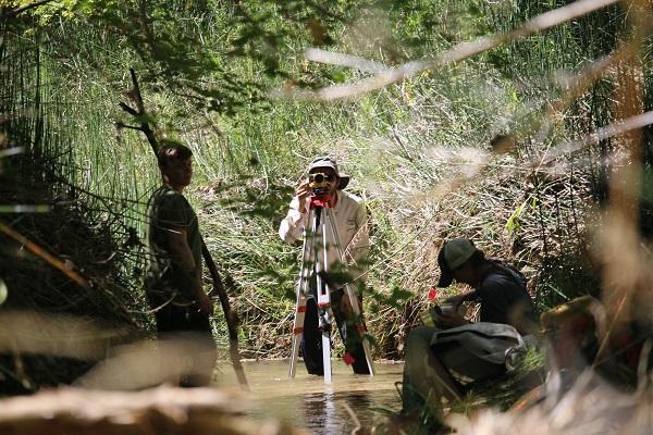
Aquatic AIM Data within the Paria River District is collected by contracted crews that typically consist of two to three people. These crews work directly with the Aquatic Ecologist and Soil Scientist to familiarize themselves with PRD resources (i.e., vegetation, hydrologic systems) and logistical planning throughout the season. This data is collected at locations that are selected by the Aquatic Ecologist and Soil Scientist as targeted sites as well as by using spatially balanced, random sampling approaches.
AIM data has many uses that can help determine resource health and trends occurring through time. The Paria River District has used AIM data to support vegetation treatment decisions, guide allotment renewals, avoid threatened and endangered vegetation species, and gain insight on potential vs. actual establishment of biological soil crusts. These are just a few examples of how the data can be used to guide management decisions. The Paria River District plans to continue the AIM effort to assess conditions and trends both at the district and project levels.
Read the full story and see more photos at the story map here.
Related Stories
- Birding Aravaipa Canyon: A morning of songs, color, and creekside adventure
- Volunteers and Partners Retrace 250 Years of History on the Anza Trail
- More time travel for the nation’s 250th: Exploring BLM back country byways in Oregon and California
- Voyages of discovery for the nation’s 250th: Exploring America’s landscapes on BLM back country byways
- Artist in Residence celebrates ‘place of special value’ in southwest Colorado