
Gardner Mountain Wilderness Study Area
Values
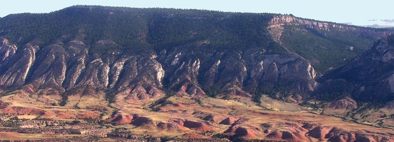
The area is generally rugged terrain of the southern Big Horn Mountains with pine, scattered mountain mahogany, and meadows. The eastern portion of the WSA is characterized by steep forested terrain with both small and large grassy meadows. The western portion consists almost entirely of open, gently sloping grassy parks. Bald eagles and peregrine falcons, both classified as endangered species, have been known to migrate through the area. The Red Fork of the Powder River and Beartrap Creek flow through the WSA and are considered “important trout waters-fisheries of regional importance” by the Wyoming Game and Fish Department. Portions of Dull Knife Battlefield, a national historic site significant with early Indian-settler battles, extends into the southern boundary of the WSA.
Visitation Information
There is no direct public access to the Gardner Mountain Wilderness Study Area (WSA). Access is predominately controlled by adjacent private landowners and landowner permission is required to cross any private lands. However, the Gardner Mountain WSA may be legally accessed via the Gardner Mountain Foot and Horse Trail in combination with cross-country travel. The trail is accessed via WY-191/Mayoworth-Slip Road north of Kaycee. Take WY-191 west from Kaycee to the community of Mayoworth. Fork left onto Slip Road and continue 6.7 miles up a series of switchbacks. Turn left and head downhill to the parking area.
The route requires hiking or horseback riding approximately seven miles from the Gardner Mountain Trailhead. A land status map and compass or GPS unit are strongly recommended. Motorized travel is expressly prohibited. Additionally, the WSA is closed to mineral entry, including gold panning.
Visitor Advisory
Access to wild lands inherently requires good navigational skills and four-wheel drive or high-clearance vehicles. Visitors should be prepared for adverse weather and road conditions. The WSAs in the BLM Field Office are primarily accessed by unnamed or unsigned two-track roads that in many cases may be difficult to find without sufficient navigational skills and equipment.
Wilderness Study Areas
WSAs are undeveloped federal lands that retain their primeval character and influence, without permanent improvements or human habitation, and are managed so as not to impair their suitability for preservation as wilderness. Backcountry recreation is a common use along with Leave no Trace Outdoor ethics. Please be advised these areas are restricted and do not allow for the use of motorized and mechanized equipment.