Whipple Mountains Wilderness | California

The large east-west oriented Whipple Mountains comprise the dominant land form within this wilderness. Whipple Peak is the highest point in the range at an elevation of 4,131 ft. Landforms are diverse and range from valley floors and washes to steep-walled canyons, domed peaks, natural bridges, and eroded spires.

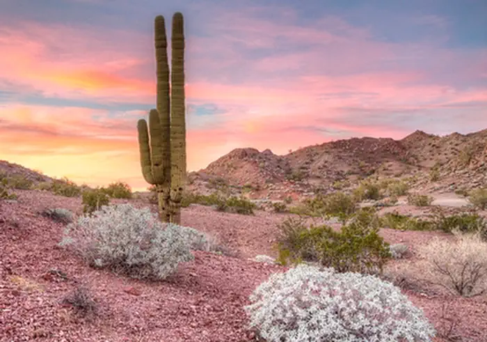
Two major vegetative associations are present within the wilderness area, the Sonora creosote bush scrub and Sonoran thorn forest. Dominant vegetation is creosote bush scrub, palo verde, ironwood, smoke tree, and numerous species of cacti including cholla, saguaro, foxtail, and prickly pear.

Wildlife species include bighorn sheep, mule deer, wild burros, coyote, black-tailed jackrabbits, ground squirrels, kangaroo rats, quail, roadrunners, owls, the threatened desert tortoise, and several species of rattlesnakes and lizards. The Whipple Mountains provide superior nesting and foraging habitat for a number of raptors; including prairie falcons, golden eagles, red-tailed hawks, and Cooper's hawks. The wilderness is located in the south eastern corner of the sector and consists of 77,520 acres. It is cooperatively managed with the Havasu Field Office.

Photos

Whipple Mountains
Whipple Mountains
Bob Wick, BLM

Adventure is at Your Fingertips

Activities

Iconograph of a tent.
CAMPING
Iconograph of two people wearing backpacks and using walking sticks
HIKING
Iconograph of a person looking through a scope on a rifle
HUNTING
Iconograph of binoculars
WILDLIFE VIEWING
Iconograph of three evergreen trees
WILDERNESS
Iconograph of a camera
PHOTOGRAPHY
Iconograph of a horse and a tent
HORSE CAMPING

Addresses

Bureau of Land Management
Needles Field Office
1303 South U.S. Hwy 95
Needles
California
92363

Geographic Coordinates

34.314202, -114.411211

Directions

From Needles, CA, take U.S. Highway 95 south approx. 20 miles to Havasu Lake Road. Turn left on Havasu Lake Road and drive approx. 5 miles to BLM Route NS683 - Parker to Needles Wagon Road. Turn right on NS683 and drive approx. 10 miles to BLM Route NS520. Turn left on NS520 and drive approx. 2 miles. A wilderness kiosk sign will be on your right hand side.