
Trilobite Wilderness | California
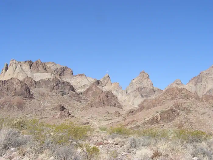
The Trilobite Wilderness covers the Marble Mountains, a narrow volcanic range extending 12 miles in a northwest-southwest direction. Alternating dark brown and light brown striations have been tilted by geologic processes and give a marbled appearance to the range. Through the center, several yellowish sandstone peaks with long talus slopes are prominent. Trending eastward from the mountain range, the wilderness includes low rolling hills and sloping bajadas. Wildlife is also typical for the Mojave Desert. The area does have a very stable permanent population of bighorn sheep last estimated at around 150, and the eastern portion of the wilderness provides critical habitat for the threatened desert tortoise. The wilderness is located in the central portion of the sector and consists of 37,308 acres. It is bordered by a gas pipeline on the north, Kelbaker Road on the west, and a few BLM routes to the south.
Photos
Contact Us

Activities


Addresses
Bureau of Land Management
Needles Field Office
1303 S. Highway 95
Needles
California
92363
Directions
From Needles, CA, take I-40 west approx. 65 miles to Kelbaker Road. Exit southbound on Kelbaker Road and drive approx. 1.5 miles to BLM Route NS203-Needles to Ludlow Truck Trail. Turn left on NS203 and travel approx. 1 mile. A wilderness kiosk sign will be on your right hand side.