
San Joaquin River Gorge Special Recreation Management Area | California
NOTICE: Between February 2nd to February 12th, high water flows and potential flow fluctuations are expected in the San Joaquin River below the Kerckhoff Dam. The BLM advises all visitors to stay out of the water during this time.
Overview
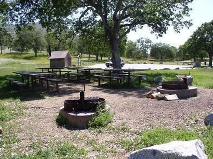
The scenic San Joaquin River Gorge Special Recreation Management Area straddles the San Joaquin River just upstream from Millerton Lake State Recreation Area and includes lands in both Fresno and Madera Counties. Multiple campground and day-use sites are available for your enjoyment including: Ya-Gub-Weh-Tuh Campground, Aholul Group Campground, Equestrian Campground, River Access Day-Use, and a Visitor Center with extensive opportunities for educational experiences for visitors, schools, and other groups. With over 20 miles of outstanding multi-use trails that weave their way through the management area, there's a trail waiting your next adventure.
Fee Schedule
- Day Use (per vehicle)………..$5
- Annual Pass…………………..$25
- Individual Campsite…………..$10
- Double Campsite (2 tables)….$15
- Equestrian Campsite…………$25
- RV Camping (Equestrian Camp)...$25
- Group Campground*…………$175
- Nuckahee Learning Center*…$300
- America the Beautiful Annual Pass...$80
*The Group Campground and Nuckahee Learning Center require reservations. Please contact the Visitor Center at 559-855-3492 for more information.
Trails of the Gorge
The Dumna and Kechayi Native Americans once called the Gorge home and are still active in the area, practicing their cultural traditions which include ceremonies on site. It is from their language that we derive the names of the trails contained within the Management Area. All trails are multi-use, shared by hikers, mountain bikers and equestrian users. Motorized use on trails is prohibited.
Foot Bridge Trail
- Distance: 1 Mile to Foot Bridge
- Round Trip from Ya-Gub-Weh-Tuh parking: 2 Miles
The Foot Bridge is one of the most sought-after sites here at the San Joaquin River Gorge. Please remember while the slope is gradual downhill to the Bridge, it is up-hill on the way back. Be sure to plan accordingly and bring plenty of water!
Pa'san Ridge Trail
- Distance: 6 mile loop (begins across the Foot Bridge)
- Round Trip from Ya-Gub-Weh-Tuh parking: 8 Miles
The Pa'san (pine nut) Ridge Trail is a six-mile loop trail. This trail takes one into the chaparral clothed uplands where they will encounter mountain lilac (ceanothus), manzanita, mountain mahogany, and many other shrubs and wildflowers.
Wuh-ki'o Trail
- Distance: 4 miles
- Round Trip from Ya-Gub-Weh-Tuh parking: 11 Miles
The Wuh-ki'o (Dumna/Kechayi word for San Joaquin River) Trail starts from the west side of the loop on the Pa'san Ridge Trail. About four miles long, it connects with Millerton Lake State Recreation Area on the Madera County side of the reservoir. The trail follows along the river and leads the traveler through oak woodlands with their mixture of foothill pines, shrubs and numerous wildflowers.
San Joaquin River Trail
- Distance: 2 miles (to BLM boundary)
- Round Trip from Ya-Gub-Weh-Tuh parking: 4 Miles
A portion of the San Joaquin River Trail (SJRT). Access to the trail is across the road from the Ya-Gub-Weh-Tuh parking and guides you into the Millerton Lake State Recreation Area. When complete the San Joaquin River Trail will eventually connect Highway 99 to the Pacific Crest Trail near the Devils Postpile National Monument. Portions of the trail cover prehistoric trade routes of the Mono Indians.
River Access Trail
- Distance: 1/2 mile
- Round Trip from River Access Parking: 1 mile
A short switchback trail leading down to the San Joaquin River's edge through the oak woodlands and grass understory. Day use parking is available at this trail head.
Photos
Accessibility Description (ABA/ADA)
River Access Day Use Parking
This parking area serves as the trailhead for the River Access Trail, which was not designed to be accessible.
The parking area has an accessible toilet and a picnic table with an extended end to accommodate wheelchair users.
Other San Joaquin River Gorge Recreation Sites
For accessibility information about other recreation sites in the San Joaquin River Gorge Special Management Area, please follow these links:
- Aholul Group Campground
- Equestrian Campground
- Nuckahee Learning Center
- Ya-Gub-Weh-Tuh Campground
Note: Accessibility descriptions and photos uploaded June 2026. Please note that actual on-the-ground conditions may vary due to natural events (e.g., weather, wildfires, erosion), normal wear and tear, or site improvements.
KNOW BEFORE YOU GO
Accessibility:
Restrooms and campsites are fully accessible. Please call for further information regarding accessibility.
Camping and Lodging Facilities:
There are three campgrounds available:
- The main campground, Ya-Gub-Weh-Tuh, is first come, first camp and is located at the main trailhead with five walk-in tent sites. Sites one and two are single table sites and allow eight people per site. Sites three, four, and five are double table sites and allow 16 people per site.
- The equestrian campground is also available with three sites, first come, first camp. Large trailers or RVs, please park in the equestrian area for $25/night.
- The group campground is available for large gatherings and must be reserved in advance. Potable water is available at all the campgrounds.
For further questions call the visitor center office at 559-855-3492.
Food and Supplies:
Food and supplies are available in Auberry. Drinking water is available at campsites. We recommend you bring your own firewood.
First Aid:
Nearest medical facility is located in the town of Clovis approximately a one hour drive from San Joaquin River Gorge.
Additional Information:
All trails are closed to motorized use. No off-highway vehicle travel is permitted within the management area.
Target shooting is prohibited within the San Joaquin River Gorge Management Area. Hunting of game species only is allowed in accordance with the regulations of the California Department of Fish & Wildlife.
All trails are shared by hikers, equestrian and mountain bike users with heaviest use occurring on weekends.
Contact Us

Activities


Directions
40060 Smalley Road, Auberry, California
The San Joaquin River Gorge Recreation Area is located approximately five (5) miles northwest of the town of Auberry. Google Maps accurately locates the visitor center.
From Fresno, take CA-168 north. One mile after the town of Prather, turn left onto Auberry Road. Follow Auberry Road 2.9 miles through the town of Auberry and turn left at the "Y" onto Powerhouse Road. After 1.8 miles, turn left onto Smalley Road and follow it down into the recreation area.
Fees
The San Joaquin River Gorge is a Fee Use site and requires that fees are paid promptly upon arrival. The fee permit envelope needs to be filled out with fees placed inside the permit envelope or pass information written on the permit. The permit envelope is then placed in the iron ranger fee box available at the campgrounds and trailhead. The detachable permit stub receipt is placed on the vehicle dashboard or rear-view mirror. Please see the Fee Schedule on this page for pricing. The Fee Schedule is also posted on all Kiosks on site.