
McCoy Flats Trailhead | Utah
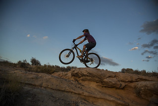
McCoy Flats Mountain Bike Trail System, located at the edge of the Uinta Basin west of Vernal, UT, offers 35 miles of interconnecting loops for riders of all skill levels. The trail system provides an ideal mix of flowing single track to technical rocky sections. With trail names like 'Got Milk' and 'And Cookies' you will leave hungry for more.
Flickr Album
Featured Video
Accessibility Description (ABA/ADA)
View images of accessibility features in a new window.
Cell phone reception is generally good throughout the area.
The site includes a main trailhead, with a large, packed gravel parking lot that can hold 25-30 vehicles, and secondary trailheads to the south and north, with smaller gravel lots. None of the parking spaces at the lots are designated as accessible, but the surface can likely accommodate people using wheelchairs and other mobility devices.
There are 4 toilets in all: 2 at the main trailhead, and 1 each at the southern and northern secondary trailheads.
Kiosks at all the trailheads display maps as well as site rules and requirements, and the main trailhead also has several interpretive panels.
The single-track mountain bike trails in the McCoy Flats trail system are not considered accessible.
Main trailhead
The main trailhead has a 24 by 32-foot picnic shelter in the middle of the parking area. The shelter sits on a concrete pad and covers 6 picnic tables, most or all with extended ends for wheelchair users. Erosion may cause a lip between the parking lot and the concrete floor of the shelter.
There are 2 accessible single-vault toilets in two corners of the parking lot. The toilet in the northwest corner is newer, so the surface by the concrete entrance may be somewhat loose. The other toilet, in the northeast corner, sits on surface that is more packed.
A concrete pad with bike tools is located between the 2 toilets. Though the surface of the pad is approximately 4-6 inches off the ground, visitors with mobility impairments should be able to reach the tools.
South (“lower”) trailhead
The secondary trailhead to the south has a shade structure covering 2 picnic tables with an extended end. Nearby is an accessible single-vault toilet. Erosion may cause a lip between the surface of the parking lot and the concrete pad near the entrance to the toilet.
North (“campground”) trailhead
The secondary trailhead to the north has a shade structure covering 2 picnic tables that can accommodate people in wheelchairs. Nearby is an accessible double-vault toilet. Erosion may cause a lip between the surface of the parking lot and the concrete pad near the entrance to the toilet.
A concrete pad with bike tools is located near the shade shelter. Though the surface of the pad is approximately 4-6 inches off the ground, visitors with mobility impairments should be able to reach the tools, which are at the edge of the pad.
Descriptions and photos uploaded April 2026. Please note that actual on-the-ground conditions may vary due to natural events (e.g., weather, wildfires, erosion), normal wear and tear, or site improvements.
Contact Us

Activities


Addresses
Geographic Coordinates
Directions
From Vernal, UT travel approximately 3 miles West on Highway 40. Turn left (south) at McCoy Flat Road and travel for 3.2 mi. to the main trailhead.
Fees
No fee