Fortification Creek WSA | Wyoming
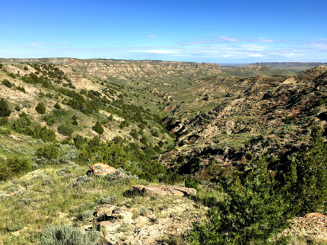
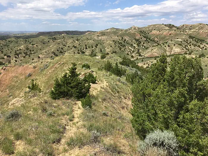
The Fortification Creek Wilderness Study Area (WSA) encompasses 12,419 acres of public land and a 640 acre inholding of state land. The landscape of the WSA is a steeply sloping, highly dissected and gullied terrain. Narrow ridges and numerous drainages dominate the area. Moderate to heavy stands of juniper are found in the larger drainages, with sagebrush and grasses on the open slopes and flats. The area is crucial winter range for elk.
The combination of size and ruggedness of terrain in the WSA affords outstanding opportunities for primitive and unconfined types of recreation. Opportunities exist for hiking, backpacking, hunting, horseback riding, and sightseeing.
Note: There are no reliable water sources adjacent to or within the WSA. Existing water tanks are for authorized use only - please do not adjust or interfere with them.
There is no direct public access to the WSA. Access is controlled by adjacent private landowners and landowner permission is required to cross any private lands. It is possible to reach the WSA by foot or horseback via a 9 mile route through State and BLM lands off Fortification Road (a county road). See map to find public land route and avoid trespassing.
Photos
Know Before You Go
Contact Us

Directions
It is possible to reach the WSA by foot or horseback via a 9 mile route through State and BLM lands off Fortification Road (a county road).
Fees
No Fee.
Additional Information
Fortification Creek WSA Photos