
Fort Sage Off-Highway Vehicle Area | California
Overview
The Fort Sage Off-Highway Vehicle Area is located in the high desert region of northeastern California outside the town of Doyle. The area is about 45 miles south of Susanville, California and 45 miles north of Reno, Nevada. Visitors should utilize Laver Crossing Road to access the area due to a bridge restriction off the Doyle Loop Road. The Special Recreation Management Area consists of approximately 29,000 acres of public land that is managed for off-highway vehicle use such as motorcycles, ATV's, Side by Sides, and 4wd.
There are developed OHV staging areas within Fort Sage with graveled access roads accessible to 2-wheel drive vehicles and green/red sticker legal vehicles. Per county ordinance 2011-007 OHV's can legally ride on the CR 327 Fort Sage Road and CR 344 Summers Road.
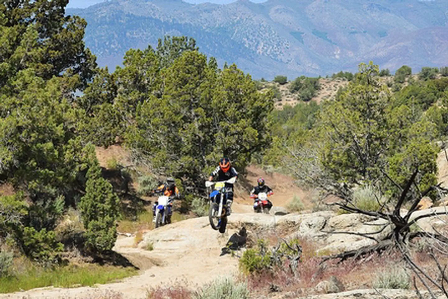
Vehicle use within the recreation area is limited to the 100 miles of designated roads and trails and is appropriate for motorcycle, all-terrain vehicles (ATV), Utility Terrain Vehicles (UTV), and 4-wheel drive vehicles. The trails are marked with numbered signs displaying difficulty rating and recommended vehicle type depending on the width of the trail. The routes traverse a wide variety of terrain including flat, sandy, high desert sagebrush country and rocky, steep canyons and gulches.
See more photos of the Fort Sage OHV Area.
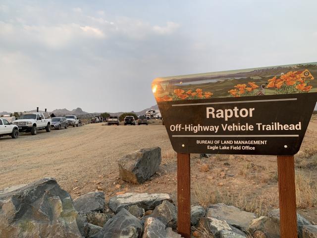
Operation and maintenance of the facilities, roads and trails within the Fort Sage OHV area are funded in part, by the State of California Off-Highway Motor Vehicle Recreation Division. The BLM Eagle Lake Field Office recently finished constructing the Raptor Trailhead located on the Fort Sage entrance road about .03 miles east of the Fort Sage Trailhead. An updated 2018 brochure and map is now available, please stay on the signed trails.
For more information or to review current and past grants visit the: CA State Parks
For information about ATV safety visit the: ATV Safety Institute.
For safety information or Recreational Vehicle training visit: Recreational Off-highway Vehicle Association
Visit these other BLM Managed Off-Highway Vehicle Areas:
Photos
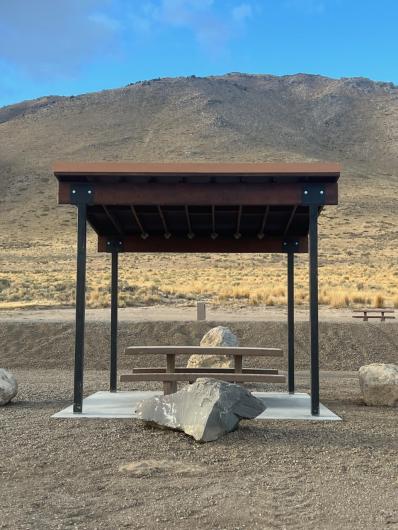
TRAILHEAD AND STAGING AREAS
Fort Sage OHV Trailhead
- Vault toilet
- Double unloading ramp
- Bulletin board with OHV and area information
- Trash receptacles
- Six sites with fire pits, picnic tables and BBQ’s
Diamondback OHV Trailhead
- Vault toilet
- Small unloading ramp
- Bulletin board with OHV and area information
- Trash receptacles
- Three sites with fire pits, picnic tables and BBQ’s
Land of David
- Small parking area
- Bulletin board with OHV and area information
- Picnic table
Widowmaker OHV Trailhead
- 3 lower camp spots with BBQ's and picnic tables
- Small unloading ramp and Information Panel
- Large upper parking area suitable for events and large RV's
- 1 shade structure with a picnic table and barbecue
**Upgrades to the Widowmaker OHV Trailhead will begin May 2026 with the installation of a new vault toilet facility and 3 shade structures.
Raptor OHV Trailhead
- 4 sites with fire pits, picnic tables and BBQ’s
- Large lower parking area
- Double vault toilet
- Information Panel
- Trash Cans
Funding for the OHV trailhead improvements were paid for, in part by the California State Parks Off-Highway Vehicle Recreation (OHMVR) Division Grants Program. For more information visit the CA State Parks website.
Potable water and electricity are not available within the Fort Sage OHV area.
CAMPING
Camping is allowed throughout the recreation area up to 14 consecutive days, however all vehicles must remain on designated routes and trails. The trailheads afford level parking, bbq's, fire pits, picnic tables and vault toilets.
Camping near springs or guzzlers will prevent wildlife from using the water source. To ensure you do not displace wildlife and livestock camp at least 300 yards from any water source. Camping is not allowed within the Doyle Wildlife Area.
CAMPFIRES
Campfires are allowed within the Fort Sage Mountains provided you have a current campfire permit. Seasonal fire restrictions may prohibit campfires during periods of high fire danger. To check on fire restrictions call Susanville BLM at (530) 257-0456. Fires are not permitted within the Doyle Wildlife Area.
OHV REGULATIONS
Visitors are responsible for knowing area rules and regulations. The regulations are enforceable under U.S. Code of Federal Regulations and violations are punishable with fines up to $1,000 and/or imprisonment for not longer then 12 months.
- Vehicle use is limited to roads and trails designated by fiberglass sign posts and stickers showing vehicles allowed on the route. Please do not ride on routes that are not signed.
- All off road vehicles must have a CA Green Sticker, Red Sticker or be legally registered in another state.
- All off road vehicles must be equipped with a properly installed U.S. Forest Service approved spark arrestor that is not modified.
- It is illegal to ride or drive under the influence of alcohol, narcotics, or other drugs.
- State law requires the use of helmets while riding ATV's.
- State law does not allow passengers on ATV's unless the ATV was specifically designed for two or more people.
All vehicles must meet state and federal noise standards. If you would like to have your ATV or motorcycle tested for sound compliance, Please call the Eagle Lake Field Office at (530) 252-5303 to set up an appointment.
STATE AND PRIVATE LANDS
Some sections of the trail pass through private lands as well as the Doyle Wildlife Area, managed by California Department of Fish and Wildlife. Please obey signs and stay on the trails. Please respect the rights of private land owners and signs posted in these areas.
HUNTING
Hunting is a popular sport throughout the upper Fort Sage Mountains. Please share the area and watch for OHV riders when hunting in the area. Shooting is prohibited within a quarter mile of any developed trailhead or over or across any road or trail.
FORT SAGE MOUNTAINS
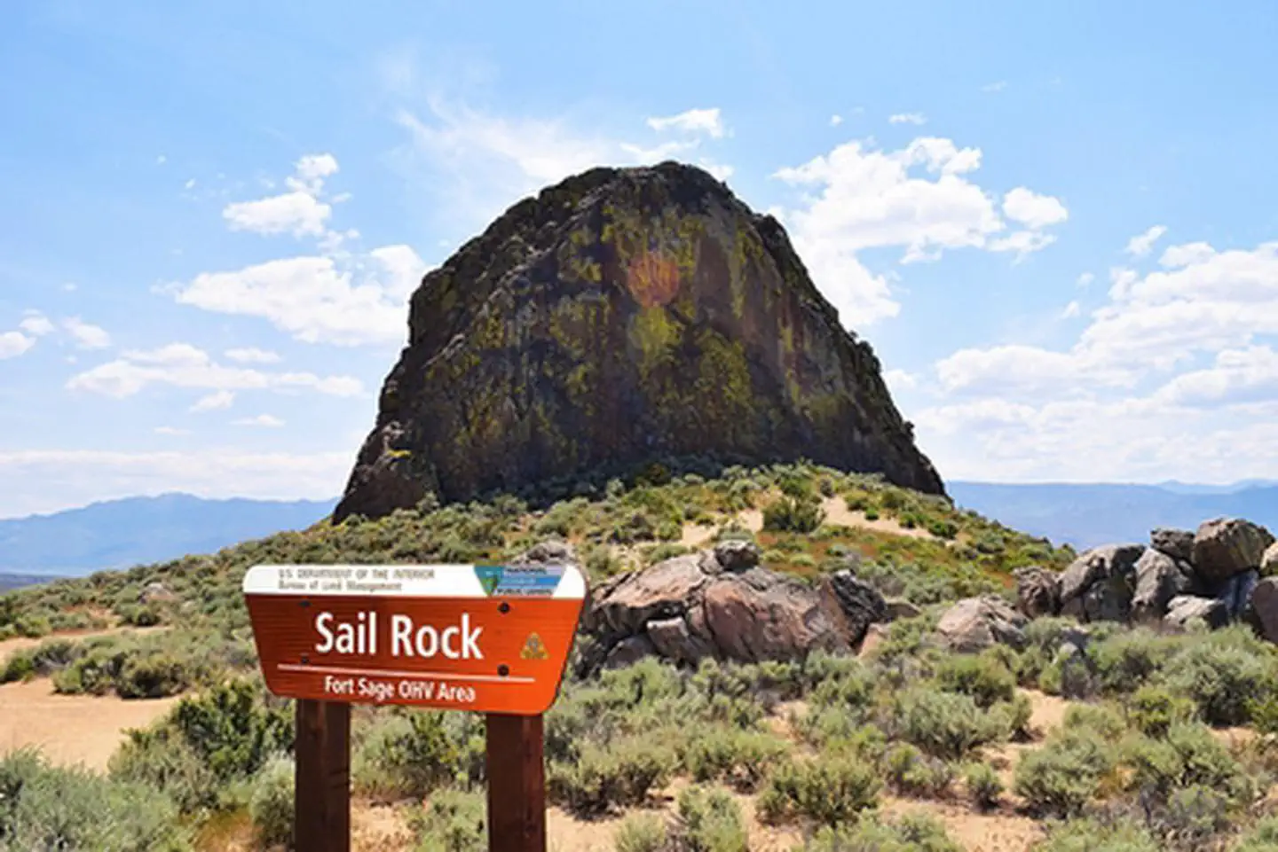
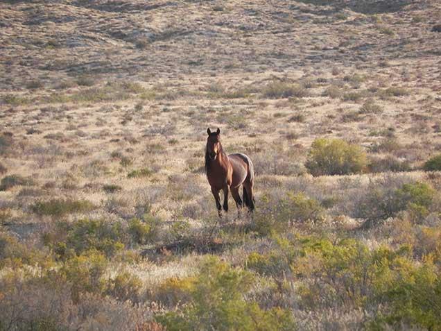
The Fort Sage Mountains are located east of the managed Off-Highway Vehicle (OHV) area trails and are often utilized by hunters, hikers, horseback riders, rock climbers, and wildlife photographers. Visitors are attracted to the area because of its many unusual weathered granite boulders, volcanic outcrops, expansive desert vistas and good opportunities for viewing wildlife and wild horses.
Contact Us

Activities

Addresses
Directions
From Susanville
Travel 38 miles on U. S. Highway 395 south. Turn East (left) on Laver Crossing road (0 .8 miles north of Doyle) and travel 1.4 miles to Hackstaff Road. Turn south (right) and travel approximately 1.2 mile to Fort Sage Road. Turn east (left) travel 1.1 mile to the entrance of the Fort Sage OHV Area. Turn east (right) and travel about 1 mile to the Diamondback trailhead, the Fort Sage trailhead is .05 miles up the road.
From Reno
Travel 45 miles on U. S. Highway 395 north from the intersection of U. S. HWY 395 and U. S. I-80. Turn North (right) on Doyle Loop Road and travel 1/2 mile to Hackstaff Road. Turn east (right) and travel 2.1 miles to Fort Sage Road. Turn East (right) and travel 1 mile to the entrance of the Fort Sage OHV area. Turn east (right) and travel about 1 mile to the Diamondback trailhead, the Fort Sage trailhead is .05 miles up the road.
Fees
Camping and day use at this site are free. For fee and permit information, contact the BLM Eagle Lake Field Office.