
Cottonwood Creek Campground | Wyoming
The Cottonwood Creek Campground and Day-Use site are located near the Cottonwood Creek Trailhead. The campground features an interpretive kiosk, five campsites with fire rings, picnic tables toilet facility, four horse corrals, a horse watering trough and food storage boxes.
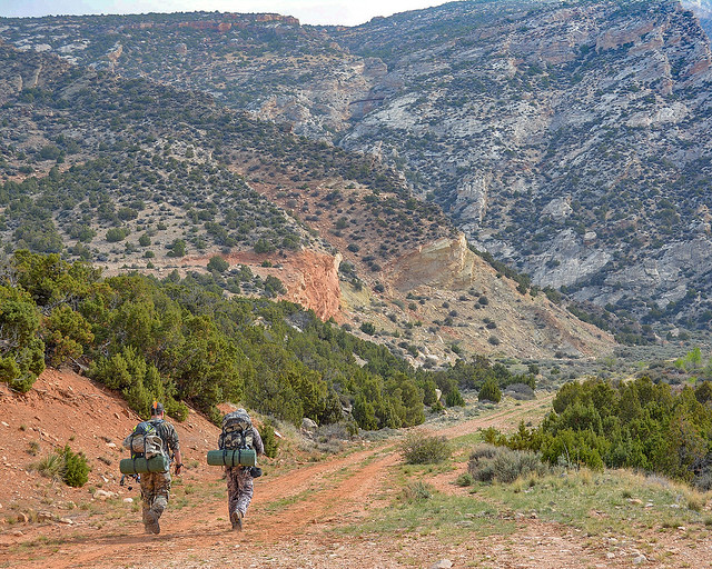
The highly scenic trail is suitable for hiking and horseback riding (advanced riders). Cottonwood Canyon has steep, vertical cliffs. The elevation at the mouth of the canyon is 4,800 feet with the top of the canyon wall at 7,200 feet. At the upper end of the trail, the elevation at the creek is 7,000 feet and the top of the canyon wall is 7,900 feet.
COTTONWOOD CREEK TRAIL PHOTOS
BLM WYOMING KNOW BEFORE YOU GO
Contact Us
This site is managed by Cody Field Office; visit their page for office hours and directions.

Activities


Addresses
Cody Field Office
1002 Blackburn Street
Cody
Wyoming
82414
Geographic Coordinates
44.869439, -108.072033
Directions
From Lovell, take Highway 14A for approximately 10 miles. Immediately after the causeway on the east side of Bighorn Lake, turn left onto John Blue Canyon Road/BLM Road #1122. Take the first road on the right, and travel this road for roughly five miles until you reach the campground and trailhead.