
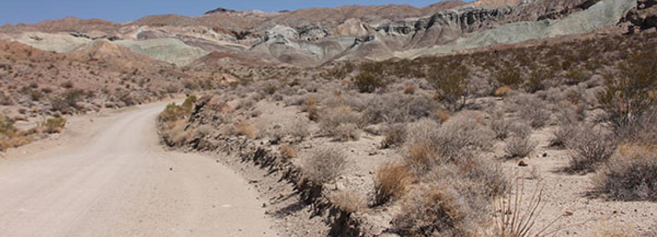
West Mojave Route Network Project
The West Mojave Planning Area for this project is located in Southern California, and comprises approximately 9.4 million acres of land. The BLM administers approximately 3.1 million acres of public lands within this Planning Area.
The Proposed Land Use Plan Amendment (LUPA) and Final Supplemental Environmental Impact Statement (FSEIS) for the West Mojave Route Network Project (WMRNP) was prepared by the Bureau of Land Management (BLM) in consultation with various government agencies and organizations, taking into account public comments received during the planning effort.
The WMRNP considers seven planning decisions amending the motor vehicle access, recreation and livestock grazing elements within the California Desert Conservation Area (CDCA) Plan for the West Mojave Planning Area.
The WMRNP also includes implementation-level decisions, including designation of a route network and associated travel management plans.
The approved Record of Decision for the WMRNP will supplement the 2006 West Mojave Plan and will guide the management of transportation and travel management in the West Mojave Planning Area into the future.
West Mojave OHV Routes Update
A federal court order requires the BLM to close desert tortoise and Lane Mountain milk-vetch critical habitats to off-highway vehicle (OHV) recreation in the Western Mojave (WEMO) planning area.
The BLM is taking steps to comply with the order. Beginning March 24, 2026, and until further notice:
- All routes in desert tortoise and Lane Mountain milk-vetch critical habitat are closed to
OHV recreation. OHVrecreation includes street legal vehicles used for recreation (view map). - A free permit is required for OHV recreation in Rand Mountains Management Area. The permit is available to download and sign here.
- The BLM will implement a compliance monitoring program and submit semi-annual reports to the court.
- The BLM will prepare a revised analysis and issue a new route network decision.
- Designated county roads and highways, and all routes needed to provide access for established easements, administrative access, emergency access, and other permitted uses will remain open, but not to public OHV recreational use.
About 63% of OHV routes in the WEMO planning area remain open for OHV recreation. In addition, the following designated OHV recreation areas remain accessible:
The OHV recreation closures impact about 37% of OHV routes designated in the WEMO Route Network Project plan. These OHV recreation closures are on BLM-managed public lands in desert tortoise and Lane Mountain milk-vetch designated critical habitat.
Frequently Asked Questions
- Why is the BLM closing OHV recreation routes in the WEMO planning area?
The BLM has been ordered by a federal court to close all routes in desert tortoise and Lane Mountain milk-vetch designated critical habitat to OHV recreation.
- Do OHVs include street legal vehicles?
Yes. Off-road vehicles (ORV and OHV are synonymous for the BLM) are defined in 43 CFR § 8340.0-5(a) as any motorized vehicle capable of, or designed for, travel on or immediately over land, water, or other natural terrain.
- What does the BLM consider “recreation”?
The BLM defines “recreation” in the Manual for Planning for Recreation and Visitor Services (MS-8320, appendix g, page 3) as the “Use of leisure time to freely engage in activities in a variety of settings that provide personal satisfaction and enjoyment and contribute to the renewal and refreshment of one’s body, mind, and/or spirit.”
- Can I access my private land using routes closed to OHV recreation?
Yes. Designated county roads and highways, and all routes needed to provide access for established easements, administrative access, emergency access, and other permitted uses will remain open, but not to public OHV recreational use.
- Can I access my mining claim using routes closed to OHV recreation?
Yes. If you have an existing mining claim, designated county roads and highways, and all routes needed to provide access for established easements, administrative access, emergency access, and other permitted uses will remain open, but not to public OHV recreational use.
- Is Owl Canyon Campground closed?
No. OHV recreation is not permitted but camping at Owl Canyon campground is a permitted use and the area can be accessed using designated routes (view map).
- Where can I get information?
Please visit the BLM California Desert District website for information and updates. https://www.blm.gov/office/california-desert-district-office