
Wisconsin River Islands | Wisconsin
Welcome to your public lands! Wisconsin is home to over 15,000 lakes, 84,000 river miles, and countless islands. Many islands in this region were omitted from the original land surveys conducted in the 1830s and 1840s and were later designated as public lands. The BLM manages over 500 islands in the rivers and lakes of Wisconsin. These lands are public and open to recreational use.
BLM’s islands are in the Black, Chippewa, Crawfish, Flambeau, Fox, Illinois Fox, Menominee, Milwaukee, Montreal, Oconto, Pelican, Pensaukee, Peshtigo, Rock, St. Louis, Sheboygan, Tomahawk, Wisconsin, and Wolf Rivers. Lake islands are in Barron, Door, Jefferson, Langlade, marathon, Marinette, Marquette, Polk, Walworth, Waupaca, Waushara, Waukesha, and Winnebago Counties.
Please note, island ownership varies, please check to make sure islands are public before use. Refer to the map at the top of the page. Use your mouse to scroll and zoom in on islands. Those highlighted yellow are public.
Wisconsin River
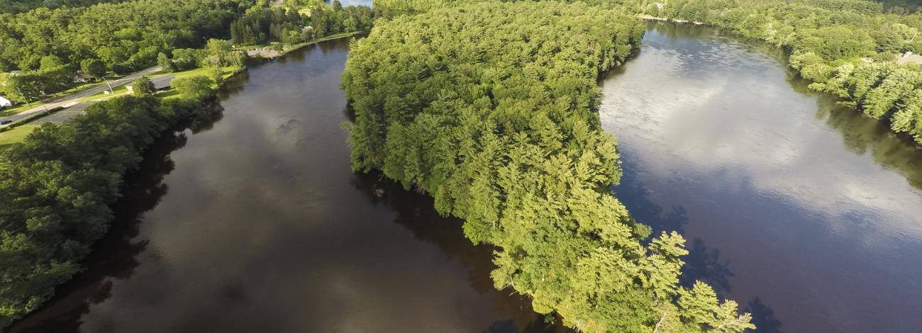
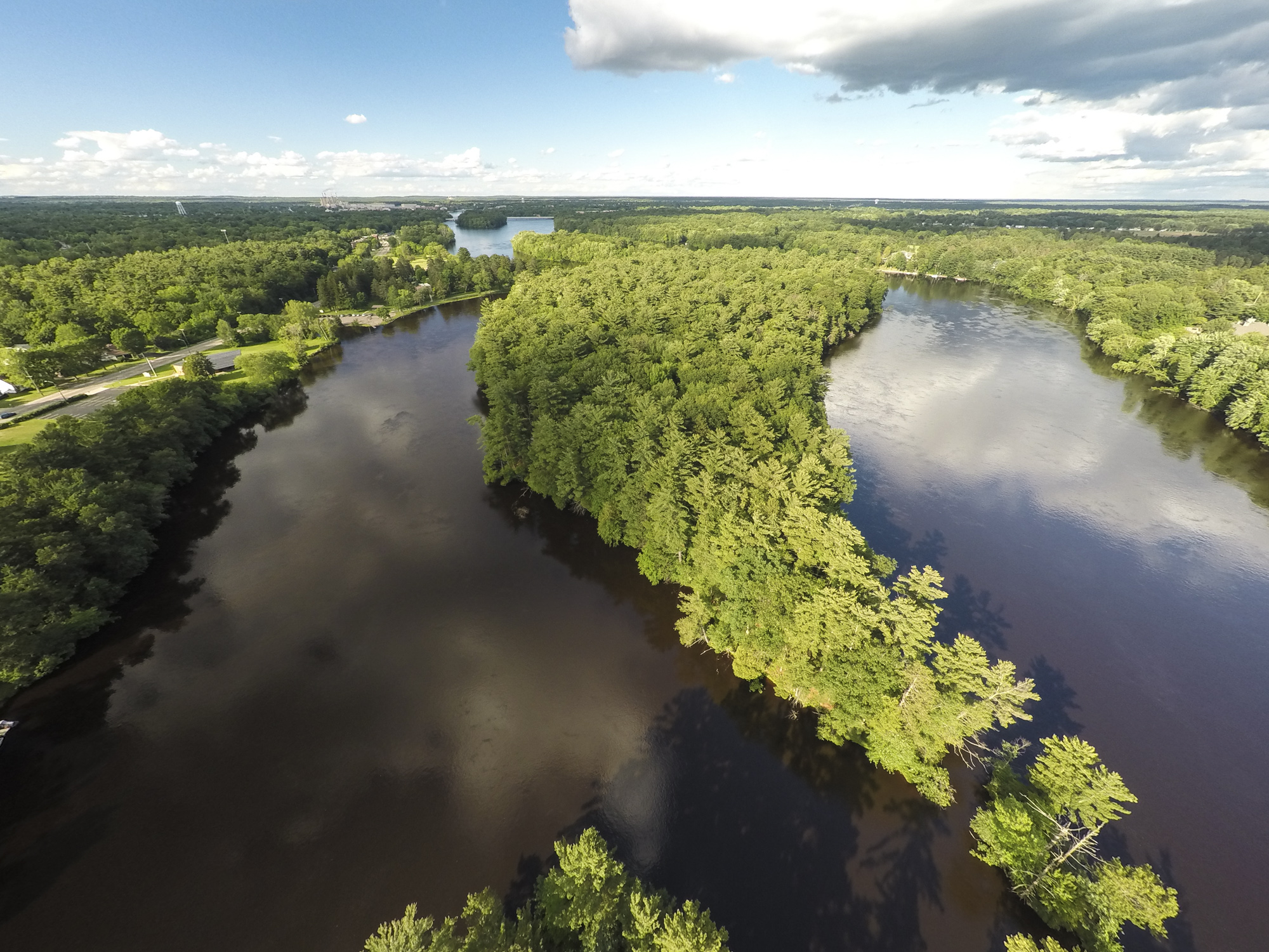
There are BLM public islands spread throughout the Wisconsin River. There are clusters of islands near Stevens Point, Wisconsin Rapids, Portage, and along the Lower Wisconsin State Riverway, among other areas. Islands vary in size, shape, and makeup, from willow patches and hardwood stands, to wide, shifting sandbars. Some islands even have remnant prairie and savanna vegetation.
Lower Wisconsin State Riverway
A 92-mile stretch of the Wisconsin River, including over 95,000 acres of land, from below the Prairie du Sac dam to the confluence with the Mississippi River has been designated as a State Riverway. This designation recognizes the scenic beauty, recreational opportunities, and nature resource value of the area. The Lower Wisconsin is the longest free-flowing stretch of river in the Midwest.
This stretch of the river is extremely popular for kayaking, canoeing, floating, and other forms of flatwater recreation. Estimates range from tens to hundreds of thousands of visitors annually.
This stretch of river has also been recognized for its ecological significance. The Lower Wisconsin Riverway Floodplain Wetlands have been designated as a Wetland of International Importance. These wetlands are recognized for their rarity, uniqueness, or importance for conserving biological diversity, and are prioritized for conservation efforts.
Wisconsin River Recreation
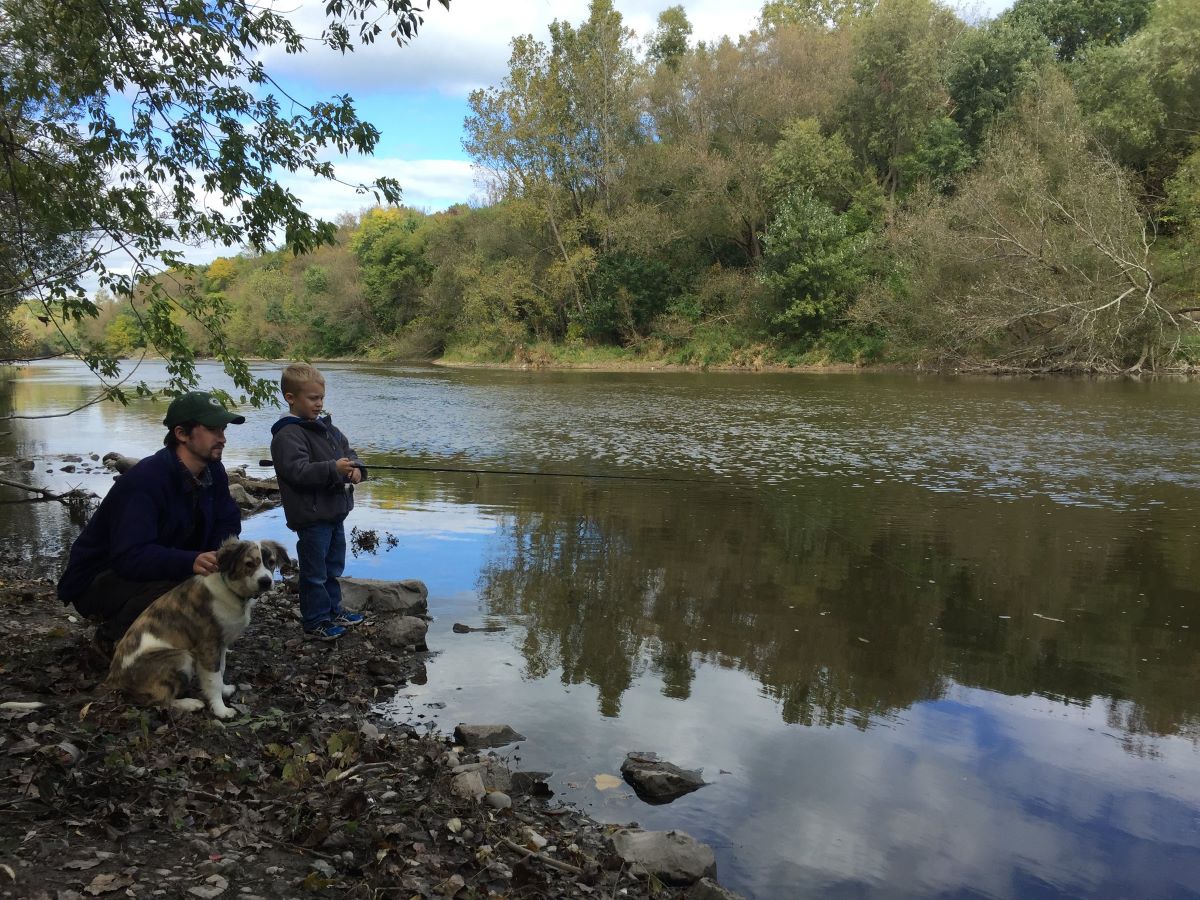
Public islands are open to recreational use unless otherwise posted. The Wisconsin River is popular with boaters, paddlers, and floaters. BLM public islands are perfect stops for day-uses like swimming and picnicking.
There are great opportunities for hunting and fishing in and along the Wisconsin River. Fish species include walleye, bass, muskellunge, pike, catfish, and a variety of panfish. Please refer to WI DNR guidelines for hunting and fishing.
The Wisconsin River is known for birding, earning an IBA or Important Bird Area designation. Look for bald eagles, sandhill crane, gulls, waterfowl, and other migratory birds.
BLM public islands are also available for overnight camping. Please follow WI DNR guidelines for island camping: https://dnr.wisconsin.gov/topic/lands/lowerwisconsin/recreation/camping
Guidelines
- Camping is limited to 3 days
- No glass containers
- Pack out all debris, including toilet paper
- Pack out human waste or bury 6 inches in an area with soil and vegetation
- Douse, do not bury campfires, as this can burn future visitors
- Poison ivy is very common on public islands, exercise caution
- Watch for ticks, mosquitoes, and sun exposure
Please note, there are no visitor amenities or services offered at this time, please plan accordingly. Basic signing and dispersed campsite amenities may be considered for some islands at a later date.
Flickr Album

Photos

Great Pinery Heritage Waterway
The Great Pinery Heritage Waterway is a navigable water trail located in central Wisconsin on the Wisconsin River and its tributaries. BLM public islands are located along the route for recreational use. The trail was designated as a National Recreation Trail by the Department of Interior in 2025.
Refer to the website for more information: https://greatpinery.com/
Contact Us

Activities


Addresses
Directions
Portage
From Interstate 39 take exit for Hwy 33 east toward Portage. Just before crossing the river, turn right into the Wisconsin Department of Natural Resources carry-in boat launch.
Stevens Point
Take Interstate Highway 39 North and exit onto U.S. Route 10, headed west. From central Stevens Point, take County Road HH across the Wisconsin River. Turn left onto River Road. Proceed approximately 1.5 miles to the Portage County boat launch.
Wisconsin Rapids
Take Interstate Highway 39 North and exit onto U.S. Route 10, headed west. From central Stevens Point, take County Road HH across the Wisconsin River. Turn left onto River Road. Proceed approximately 1.5 miles to the Portage County boat launch.
Fees
No fees or permits are required. All areas are first come, first served.
Stay Limit
Access and Safety
There are numerous public boat access locations for the Wisconsin River. The Wisconsin DNR boat access map provides detailed information. Be sure to select “Non-DNR Boat Access Sites” to include all public access points.
Weather, water levels, sandbars, and currents can vary and change rapidly. Please be cautious and follow all state river and boating safety laws and guidelines.
Flow conditions can be monitored on the USGS website.