
Wild Rivers Back Country Byway | New Mexico
The Wild Rivers Back Country Byway is a 13 mile closed-loop road providing access to BLM's Wild Rivers Recreation Area within the Rio Grande National Monument. The double-lane, low-speed, paved road provides the visitor with access to scenic views and recreational facilities in the Recreation Area. For information regarding what you will see, or the public lands you will have access to along the byway, see BLM's Wild Rivers Recreation Area website.
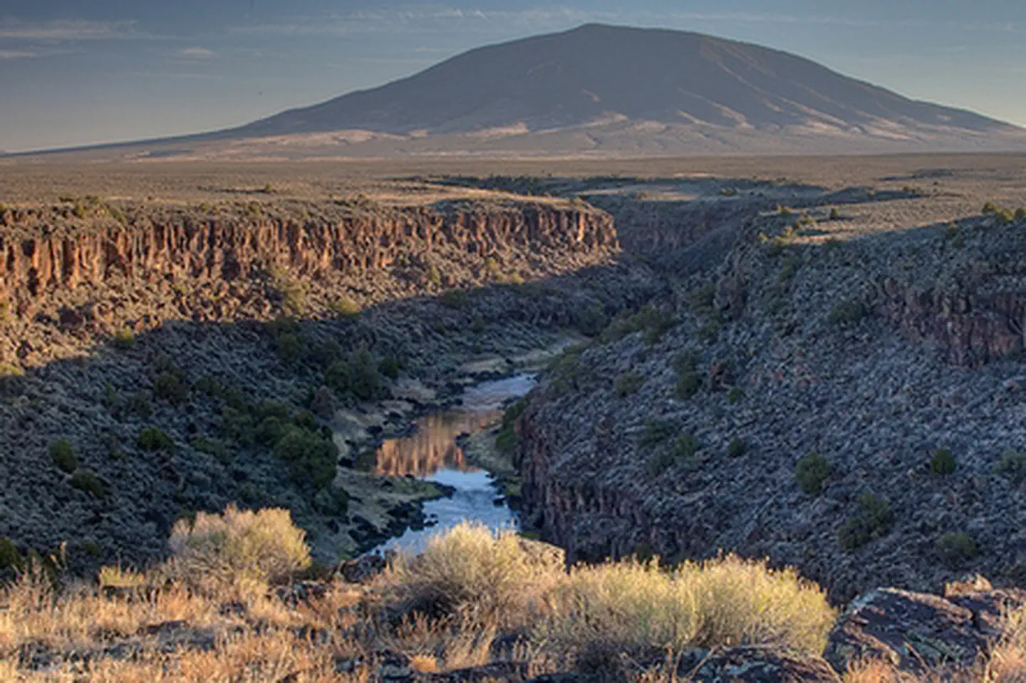
Photos
Accessibility Description (ABA/ADA)
The Wild Rivers Backcountry Byway is a 13-mile two-lane, paved road that provides visitors access to two Day Use Parking areas at the beginning of the byway and through the entire Wild Rivers Recreation Area with a visitor center, five campgrounds, and a scenic overlook.
To enjoy this area, visitors need to be able to drive or ride in a vehicle for 13 miles on a paved road, at a moderate speed, while being mindful of pedestrians, cyclists, and/or wildlife.
Know Before You Go
Fees
- The Wild Rivers Backcountry Byway is free to travel, however if you decide to use the Visitor Center, Day Use Parking Areas, and/or campgrounds then the fees below apply.
Self-service pay stations are located at developed camping, picnic and trailhead areas.
- Day Use: $3.00/day per vehicle.
- An annual day use pass, good for the calendar year, is available for $20.00.
- Camping: $7.00/night for up to two vehicles. Maximum two vehicles and 10 people per site.
- Additional vehicles may park in day use parking for $3.00/day.
- Annual day use passes do not apply to camping fees.
Wild Rivers Inner Gorge Primitive campsites: $5.00/night.
- Wild Rivers, La Junta, and Aguaje group shelters: $30.00 per day, $40.00 per night.
- Group shelter reservations are made by submitting a request through [email protected].
Facilities
- Sheep Crossing Trailhead, Overlook, and Day Use Parking Area.
- Chiflo Trailhead and Day Use Parking Area with a vault toilet.
- Wild Rivers Zimmerman Visitor Center
- Currently open only Saturdays and Sundays 10 a.m. to 3 p.m. due to staff shortages. Additional open days TBD depending on staffing. Inclement winter weather may impact these hours.
- For more information, contact the Taos Field Office at 575-758-885.
- Wild Rivers Recreation Area
Nearby Amenities
The nearest location to acquire food, gas, and water is ~15 miles away in Questa, NM via NM-378 E.
Season/Hours
- Open year-round.
- The road is maintained during winter months; however, snow can temporarily restrict access pending the availability of snow clearing equipment.
Special Rules
Pets must be kept under control and on a leash at all times.
Discharge of fireworks or firearms is prohibited within the Recreation Area.
Receptacles for trash are located at all campgrounds and picnic areas. Pack out what you pack in!
- Cultural sites and artifacts dating back many centuries have been found within the Recreation Area.
- Please protect these valuable resources of the past. Removal or disturbance of these artifacts destroys valuable information and is punishable by fines and/or imprisonment.
Brochures, Maps, and Publications
Wildlife in Area
Coyote
Bighorn sheep
Elk
Mule deer
Golden eagles
Red-tailed hawks
Contact Us

Activities


Addresses
Directions
The Wild Rivers Back Country Byway is located in northern New Mexico, 26 miles north of Taos and 17 miles south of the Colorado-New Mexico state line, near the town of Questa. From New Mexico Highway 522, turn west onto NM 378 approximately 2 miles north of Questa. The Byway is an extension of NM 378 into BLM's Wild Rivers Recreation Area.
Fees
Photo Album
