
Tres Alamos Wilderness | Arizona
The 8,300-acre Tres Alamos Wilderness Area is in Yavapai County, 80 miles northwest of Phoenix, Arizona, and six miles south of the Santa Maria River.
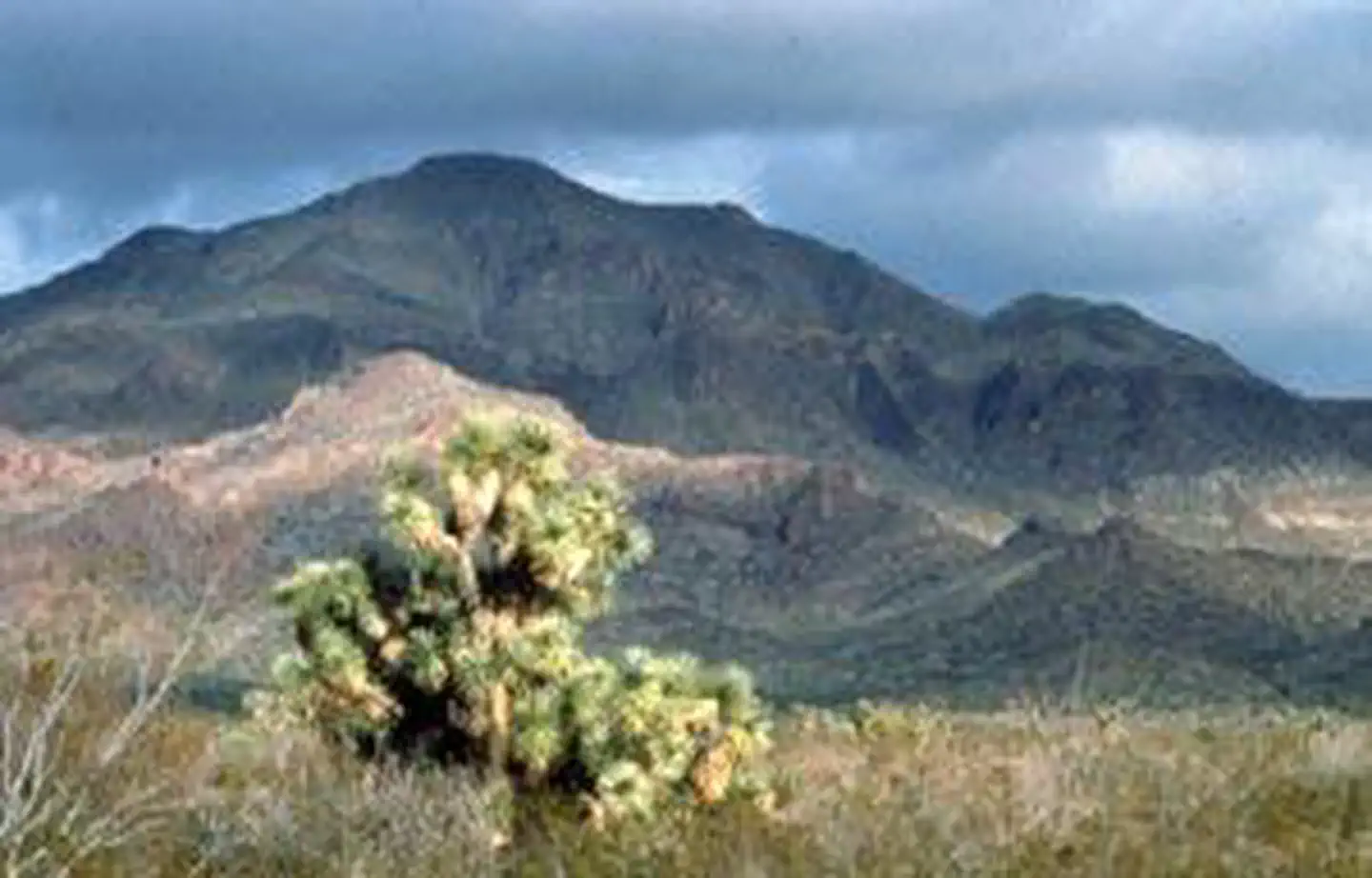
The eastern part of the wilderness takes in the scenic ridgelines, canyons and washes of the southern Black Mountains, whereas the western side consists mainly of lower desert bajada and plains. Sawyer Peak at 4,293 feet, is the highest point in the wilderness and in the Black Mountains. The colorful monolith of Tres Alamos is the area's most striking landscape feature. Saguaro and paloverde cover the hills and bajadas; Joshua trees and creosote bush dot the plains, and mesquite and acacia line the washes.
Wildlife includes the Gila monster, prairie falcon, and golden eagle, and possibly Cooper's hawks and kit fox.
Tres Alamos Wilderness offers landscapes suitable for hiking, backpacking, sight-seeing, photography and camping. Bajadas and plains provide suitable terrain for equestrian use. The area is equally enjoyed by both experienced and novice backcountry users.
Know Before You Go
- A four-wheel drive vehicle is strongly recommended to gain access to this wilderness.
- The terrain in Tres Alamos Wilderness is extremely rugged. A few old vehicle ways provide hiking routes in some places, but the most commonly used routes are the sand washes which dissect the area. Burro trails can sometimes be located and followed on uplands. No formal hiking trails exist in this wilderness unit.
- The summer climate in this wilderness unit is harsh. Daytime temperatures during the summer months are over 100 degrees. Temperatures are more moderate between October 1 and April 30th.
- Water is relatively scarce in this unit. Pack all water needed for a trip and purify any water found in the wilderness.
- Please follow the regulations in place for this area, and use Leave No Trace techniques when visiting to ensure protection of its unique natural and experiential qualities.
- Motorized equipment and equipment used for mechanical transport are generally prohibited on all federal lands designated as wilderness. This includes the use of motor vehicles (including OHVs), motorboats, bicycles, hang gliders, wagons, carts, portage wheels, and the landing of aircraft including helicopters. Contact the agency for more information about regulations.
- Some lands around and within the wilderness are not federally administered. Please respect the property rights of the owners and do not cross or use these lands without their permission.
Photos
Accessibility Description (ABA/ADA)
Because the primary purpose of this site is to provide a primitive experience within an undeveloped natural setting, the site may present challenges to accessibility.
Contact Us

Activities


Addresses
Directions
The Tres Alamos Wilderness is located east of Alamo Lake State Park. From Wickenburg, follow highway 60 west to Wenden. Turn north onto a paved road toward Alamo Lake State Park. Turn right (east) onto a bladed dirt road at milepost 28. Drive 3 miles to the intersection with Alamo Lake Road at the Wayside RV Park. Turn right (south) on Alamo Lake Road, drive 0.5 miles and turn left (east) onto Palmerita Road. Drive 5.3 miles and turn right at intersection. Drive 13 miles to the western boundary of Tres Alamos Wilderness. A four-wheel drive vehicle is strongly recommended to gain access to this wilderness.
Fees
There are no permits, passes, or fees required to visit this wilderness area. It is free.
However, commercial, competitive, and large organized group events require a special recreation permit. Contact the local managing field office for more information about special recreation permits.