

ZOLD - Red Spring Picnic Area | Nevada
Overview
The Red Spring Picnic Area features spectacular views of the red and tan sandstone cliffs of Calico Basin. The area is tucked between the gray limestone La Madre Mountains to the north, the red sandstone Calico Hills to the west, and a desert ridge to the south.
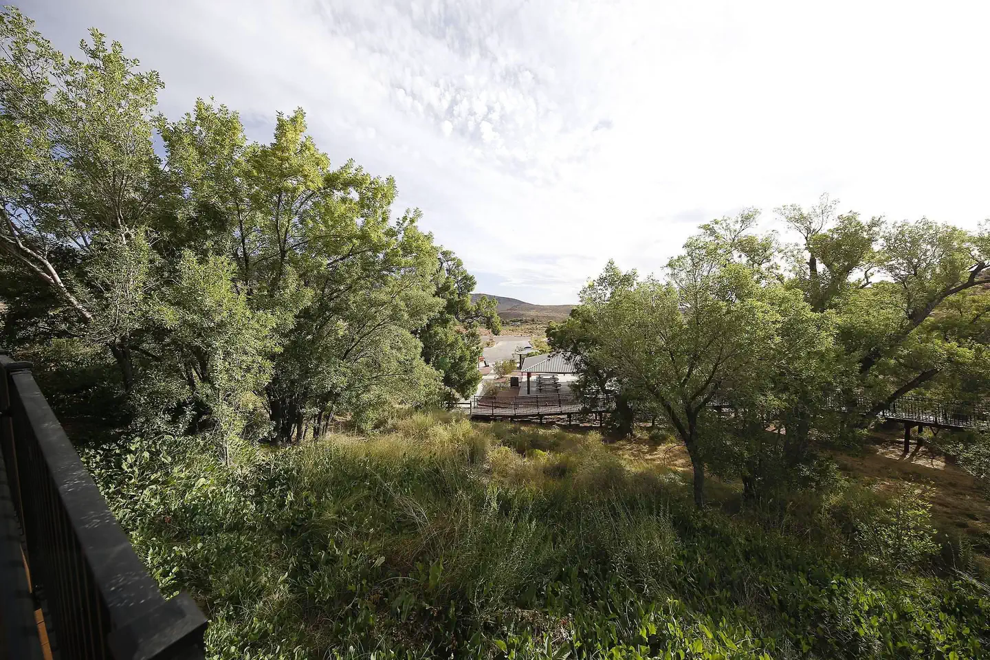
The Calico Basin area is fed year round by water from three permanent springs: Red Spring, Calico Spring, and Ash Spring. The water from these springs support large cottonwood trees, ash trees, scrub live oak, honey mesquite, and saltgrass meadows. Red Spring flows from a shallow tunnel in the rocks along the Red Spring Boardwalk trail, feeding a beautiful marshy grassland and attracting a variety of wildlife.
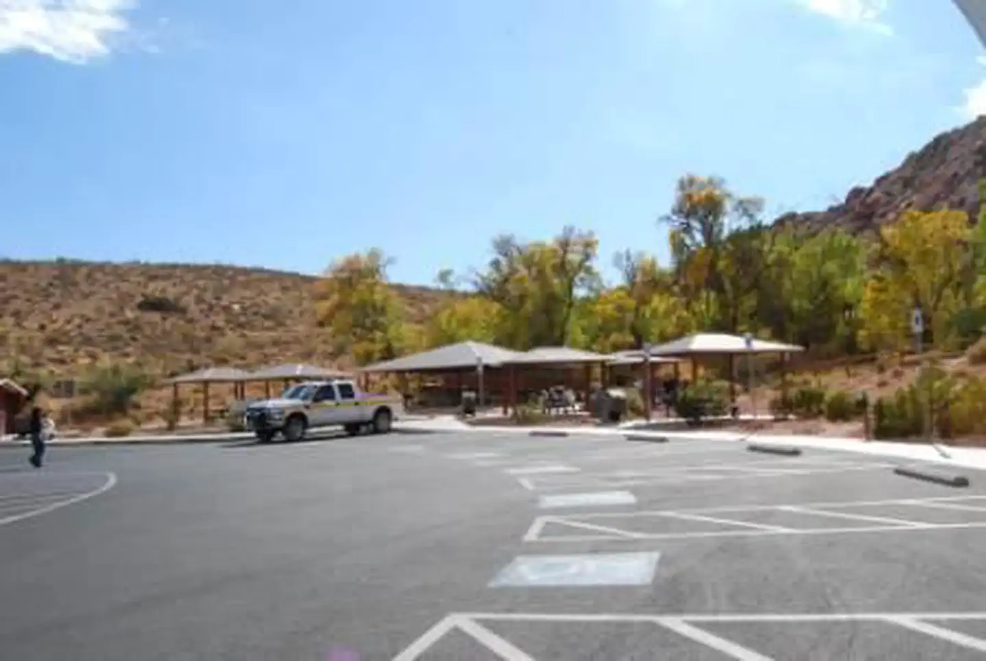
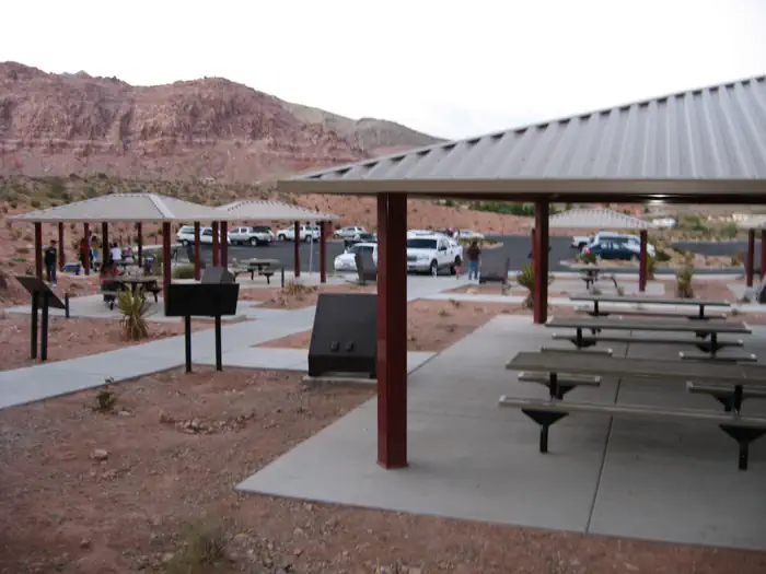
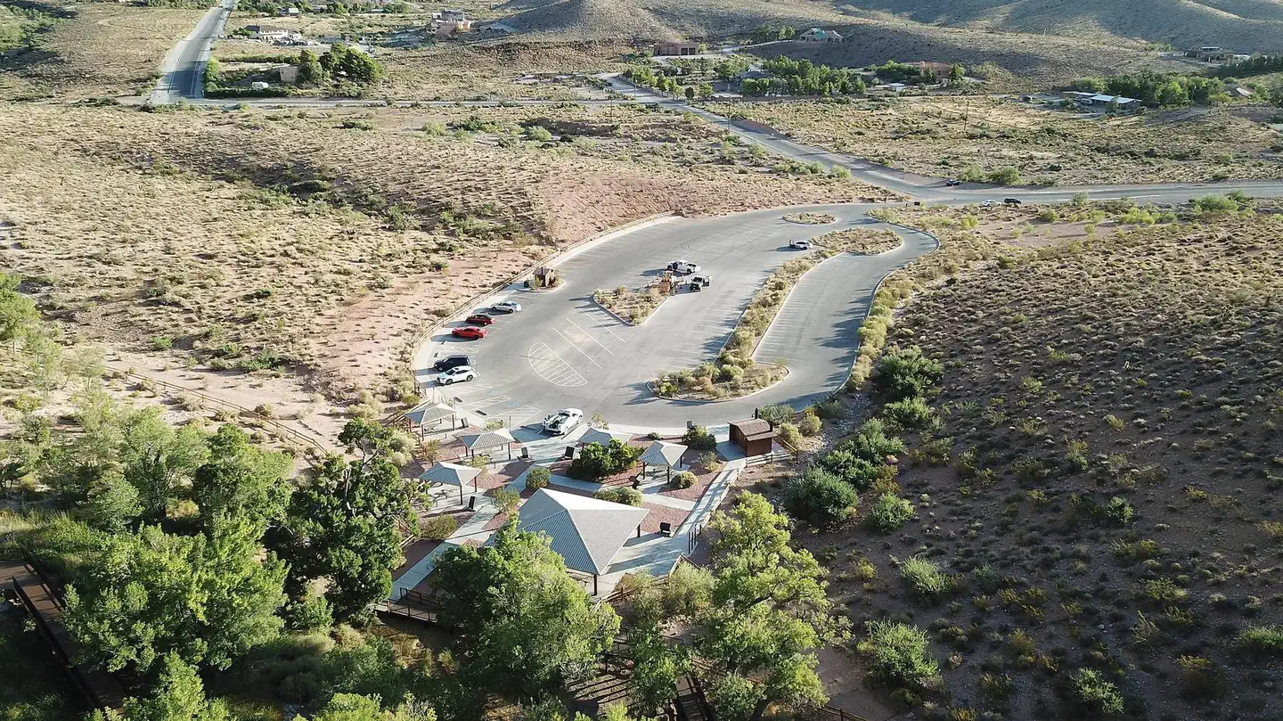
The Red Spring Picnic Area contains picnic tables, metal barbeque grills, trash cans, and restrooms adjacent to the parking area. The area is a good place to see native peoples use of the area including petroglyphs.
Note: Picnic Area reservation holders do not need to book a Red Rock Canyon National Conservation Area Scenic Timed Entry ticket in order to access Red Spring Picnic Area. If while visiting the area you would like to visit the Scenic Drive, you will need to make a timed entry reservation.
Recreation
The Red Rock Scenic Drive and Visitor Center, as well as the Red Rock Canyon Campground, are all located within three (3) miles of the Red Spring/Calico Basin area by hiking trails and paved roadways. Activities available at the Red Spring/Calico Basin area include hiking, equestrian use and rock climbing. Guided hikes, climbing and educational programs are open to the public.
Facilities
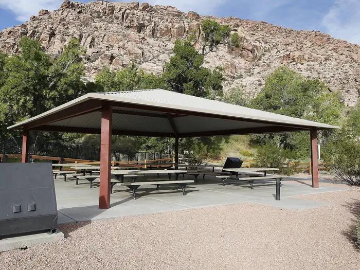
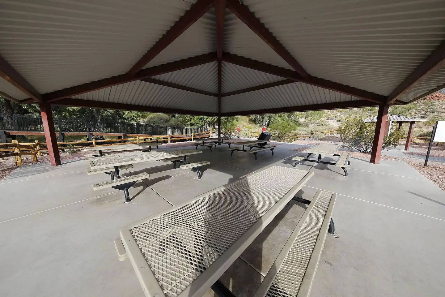
Red Springs Picnic Area offers one group shelter with approximately 8 tables. The Picnic Area does not have power or water. It is fully Accessible and comfortably accommodates up to 50 people with a view of the Red Spring Boardwalk. There are other nearby picnic shelters, which are not included as reservable. There are Accessible vault toilets located at the Picnic Area as well.
Natural Features
The year round Red Spring is fed by snow and rainfall. This precipitation soaks into the limestone mountains and moves through the rock until it reaches an impermeable layer. This then forces the water into a more concentrated stream, creating the permanent spring we see today. Due to the permanent and reliable year round water source, the area is home to a variety of endemic plants and an abundance of animals, making Red Spring an important area for more than six thousand years.
Nearby Attractions
The Red Rock Canyon National Conservation area contains over 70 miles of hiking trails, over 2000 documented rock climbing routes, picnic areas, mountain and road biking trails, horseback riding trails, and scenic byway tours.
Charges & Cancellations
Cancellations*: *cancellation becomes a "late cancellation" at 12:01 am EST on the day before arrival.
- $10.00 fee if reservation is changed/cancelled earlier than the day before arrival.
- $10.00 plus first night's camping fee is charged if reservation is cancelled the day before or the day of the arrival, except when the reservation is only for 1 night (in which case only the first night's camping fee is charged).
- No Shows: customer does not arrive and/or does not cancel reservation by check out time (11 :00am) the day after the scheduled arrival date.
- $20.00 service fee charged and forfeit the first night's user fee.
- If requested before the late cancellation window: NRRS will handle
- If requested during the late cancellation window (day before arrival, or day of arrival): Customer will be charged first night's use fee, and refunded the rest.
- If requested after arrival, during or after departure from site: recreation.gov processes the refund and the field office has to approve it.
Photos
Contact Us

Activities


Addresses
Geographic Coordinates
Directions
From downtown Las Vegas take Charleston Blvd (SR159) west for 17 miles, (about 1.5 miles east) of the entrance to the Scenic Drive of Red Rock). Turn right onto Calico Basin Road and drive north, then west, for about 1 mile to where the paved road makes a 90-degree turn to the right. At this point turn left, drive through the gate, and enter the picnic area. Red Spring is located at the far side of the parking lot adjacent to the boardwalk.
Fees
Fees: $9.00 for reservations made through call center; $8.00 for reservations made through recreation.gov
(internet) Passes: No Discounts