San Lorenzo Canyon | New Mexico
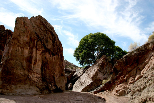
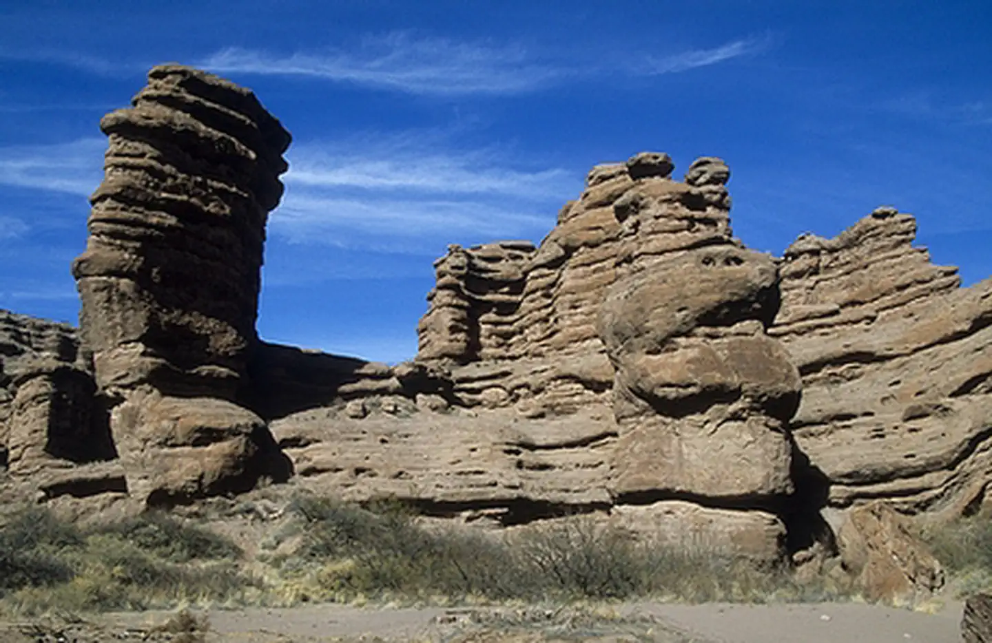
San Lorenzo Canyon is jointly managed by the U.S. Fish and Wildlife Service and the Bureau of Land Management as a primitive recreation area. This scenic east-west canyon offers ample outdoor opportunities for hiking and primitive camping. Not only a destination for hikers, the Canyon offers outstanding opportunities for photographers. Millions of years of Earth’s history unfold in San Lorenzo Canyon, a picturesque area of sandstone cliffs, arches, and hoodoos. The cottonwoods indicate there may have been a reliable water source at one time in the area. The area has remnants of old ranches and homesteads; springs and tiny creeks are hidden in the canyon bottoms and washes. High clearance and/or 4-wheel drive vehicles are recommended. There are no restrooms or drinking water.
Photos
Accessibility Description (ABA/ADA)
- A high-clearance vehicle, such as a truck or a 4-wheel drive vehicle, is recommended as this road is rugged in several areas and can be difficult to navigate when wet.
- To hike the area, one needs to be able to walk across uneven, rocky, and silty ground and maneuver or climb through canyon cracks for several miles.
- This area does not have any ADA-compliant facilities or interpretive displays. The most accessible way to enjoy the area is to travel by vehicle.
Know Before You Go
Fees
- None.
Facilities
- None; restrooms and drinking water are not available.
Nearby Amenities
- The nearest place to get food, gas, and water is in Lemitar, 13 miles away.
Season/Hours
- Open year-round.
- Be careful in wet conditions. Roads may become slick, and flash flooding can occur in the canyon.
Special Rules
- The road is an annually maintained dirt road. A high-clearance vehicle, such as a truck or a 4-wheel drive vehicle, is recommended. Use particular caution when the road is wet.
- No fireworks, discharge or use of firearms, or any other weapons.
- Pets must be on a 6ft leash.
- Please make sure to carry out any litter.
Brochures, Maps, and Publications
Wildlife in Area
- Bees
- Red-tailed hawks
- Turkey vultures
Contact Us

Activities


Addresses
Directions
The site is northwest of Socorro and about 5 miles northwest of Lemitar, NM. The area can be reached by taking the western frontage road north from Lemitar (along I-25) and driving about 5 miles. At that point, you follow a maintained dirt road west which will take you to the main canyon.
Fees
No Fees.
Additional Information
Photo Album