
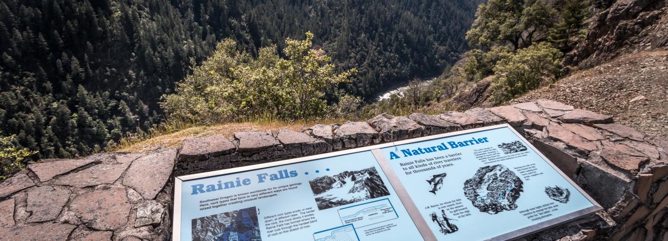
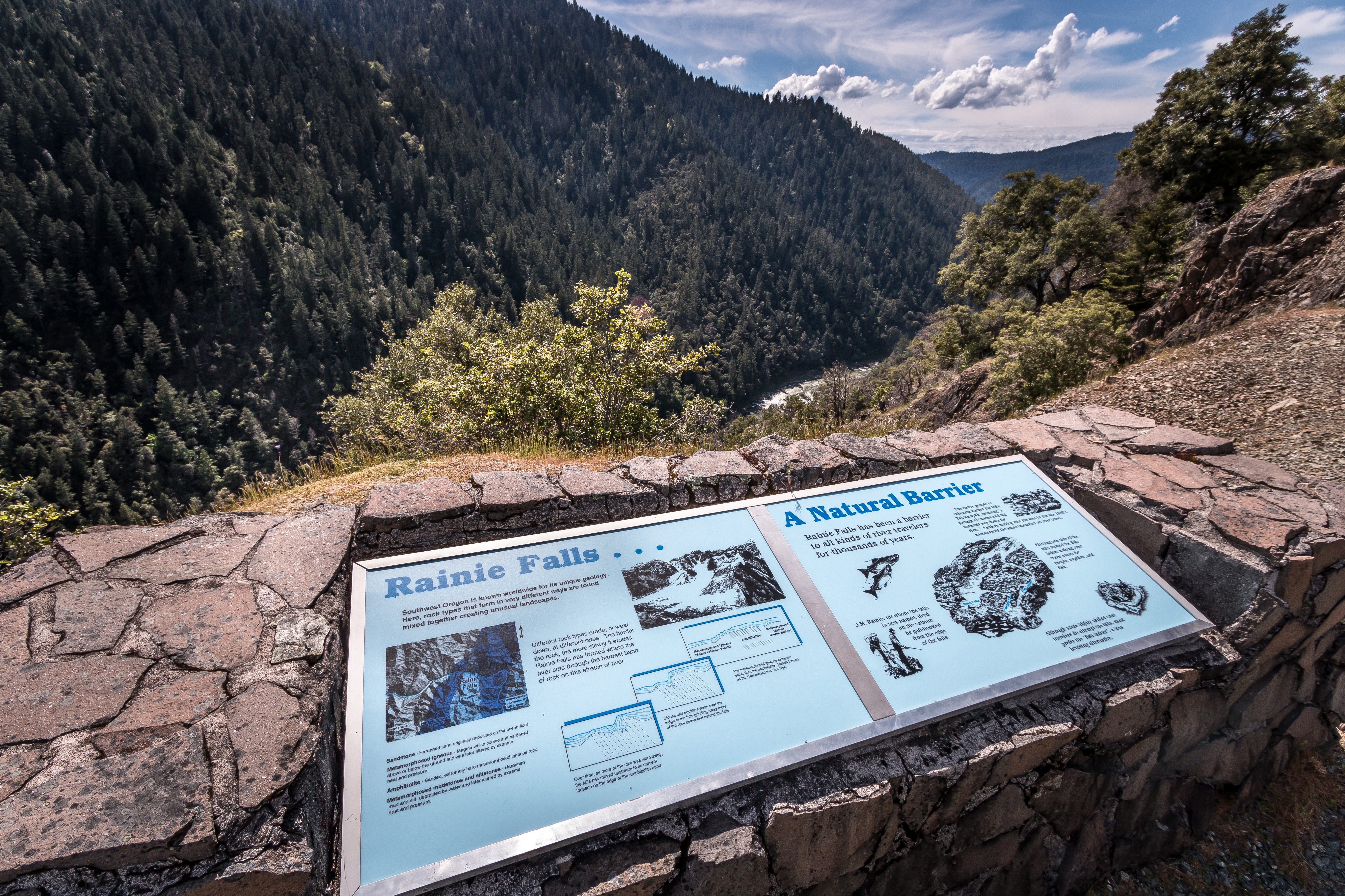
Rainie Falls Overlook | Oregon
Rainie Falls Overlook is located along the Grave Creek to Marial Back Country Byway 1.3 miles above the Grave Creek Boat Ramp. This overlook offers spectacular views of the mighty waterfalls, surrounding forests, and the Wild and Scenic Rogue River. Interpretive signs at the overlook explain the formation of the falls. Rainie Falls Overlook is well above the class V rapid bearing its name. With a 10 foot drop, boaters can use two alternative routes for floating through this cataract.
Know Before You Go
- Day-use only and open year-round. No facilities are available.
- There is no river access from the overlook. A 2-mile trail to Rainie Falls can be accessed at the Graves Creek bridge.
Point of Interest
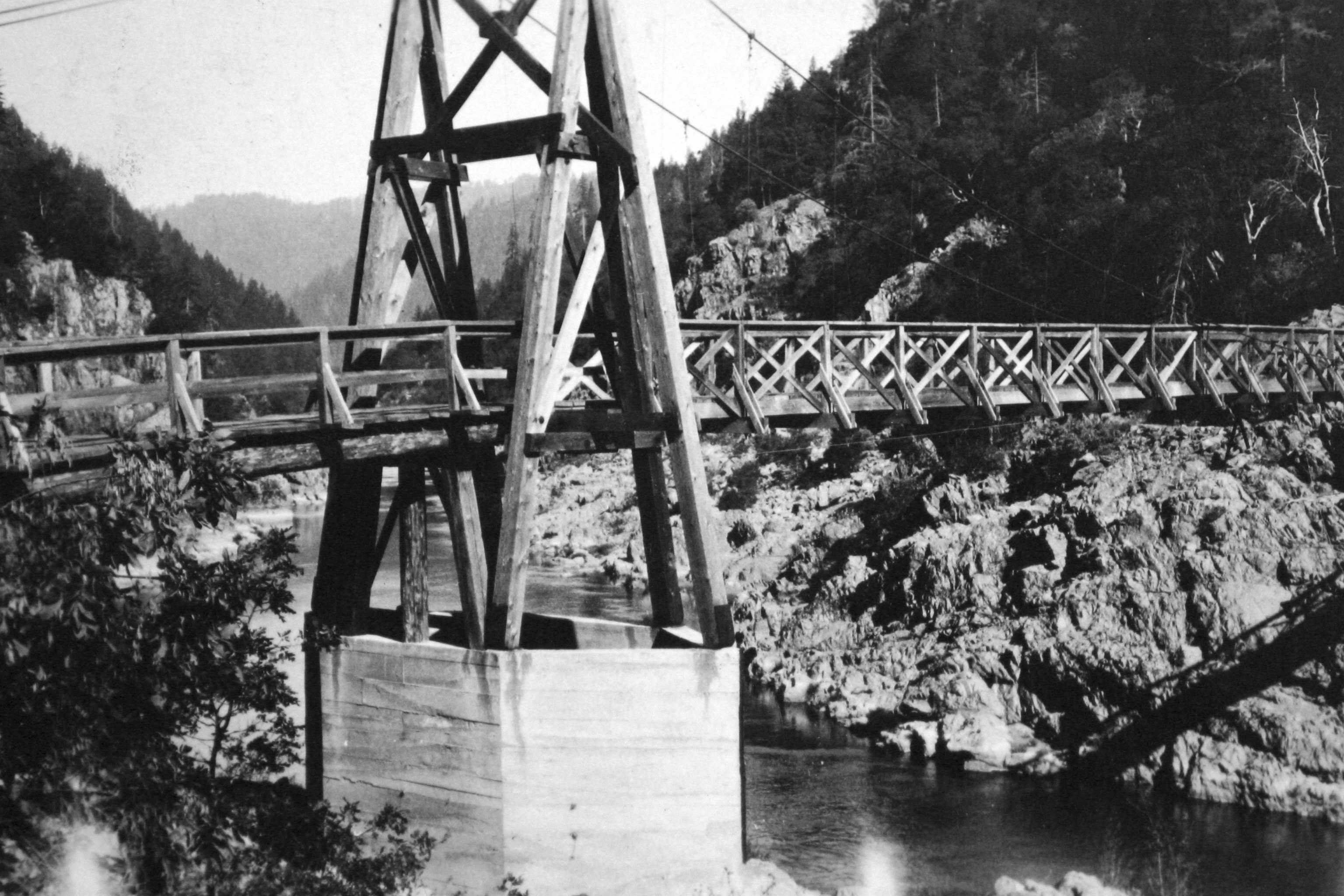
If you take a look across the river and upriver from the overlook, the keen observer will espy a hexagonal structure just above the river. This 13-foot tall abutment is one of the few remnants of a suspension bridge constructed in 1908 but washed out by the flood of 1927.
Photos
Accessibility Description (ABA/ADA)
No accessible facilities.
Contact Us

Activities


Addresses
Geographic Coordinates
Directions
From Grants Pass, Oregon: Take I-5 north to exit 61, Merlin exit. Turn left and continue northwest on the Merlin-Galice Road for 23 miles. Continue across the Graves Creek Bridge. Turn left onto the Mt. Reuben Road (BLM 34-8-1) for 1.3 miles. Rainie Falls Overlook is on the left-hand side of the road.
External Map
Fees
No fees.