
Iron Mountain Divisional Camp -Patton | California
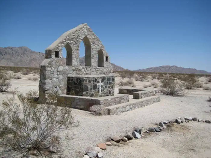
This site was designated as an ACEC due to the historical significance of the area. Camp Iron Mountain is the best-preserved divisional camp today, and is famous for being one of two camps that have rock chapels that still stand. The chapels that are found are of Protestant and Catholic denomination. A large relief map is also found at the site. The map is 200 feet by 175 feet and represents the entire Desert Training Center/California-Arizona Maneuver Area to scale. The map also had wooden signs that represented large topographic features including Divisional Camps. Highways, railroads, and the Metropolitan Water District (MWD) aqueduct were also displayed.
Photos
Contact Us

Activities


Addresses
Bureau of Land Management
Needles Field Office
1303 South U.S. Hwy 95
Needles
California
92363
Directions
From Needles, CA, take U.S. Highway 95 south approx. 45 miles to CA State Highway 62. Turn right on Hwy 62 and drive west approx. 35 miles to BLM Route NS812. Turn right onto NS812. A monument plaque for the Patton Camp will be on your right hand side.