
Cerbat Foothills Recreation Area (CFRA) | Arizona
The 11,300-acre Cerbat Foothills Recreation Area (CFRA) is a mixture of federal, state, county, city, and private lands. The area is cooperatively managed by the City of Kingman and the Bureau of Land Management.
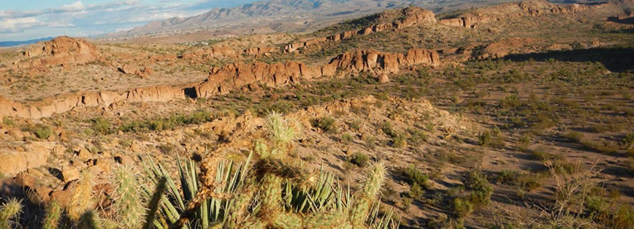
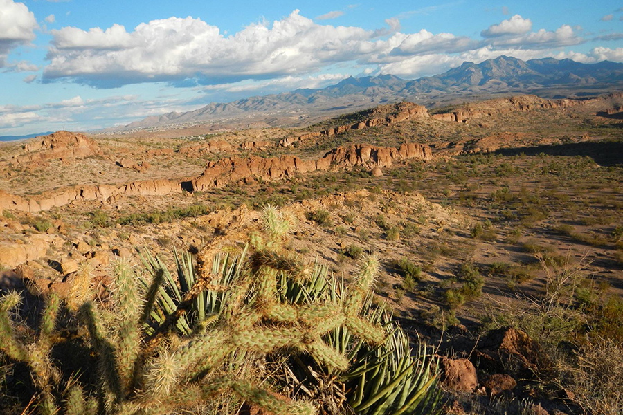
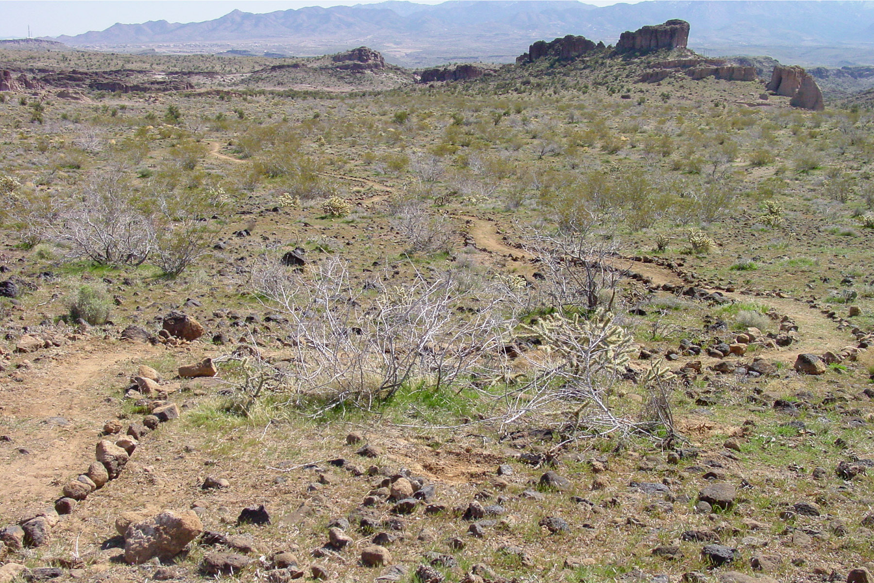
The CFRA is in a Mohave Desert scrub/semi-desert grassland, with yucca, beavertail, prickly pear, creosote, and mesquite. The area provides habitat for mule deer, Sonoran Desert tortoise, coyotes, foxes, Gambel’s quail, mourning dove, several types of raptors, and many smaller mammals, birds, and reptiles.
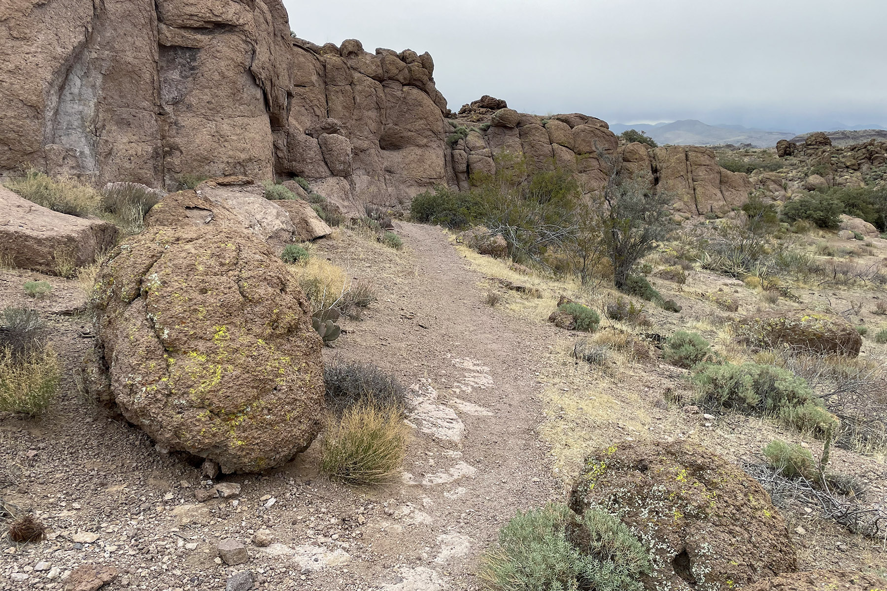
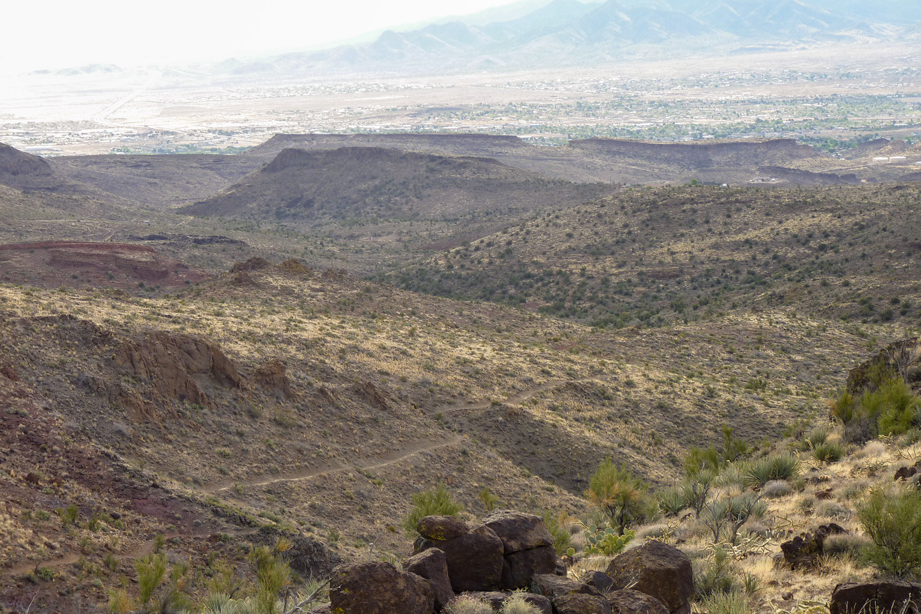
The CFRA includes a trail system that traverse the foothills of the Cerbat mountains. Nearby attractions and amenities include the Fort Beale, downtown Kingman Visitor Center, and the City of Kingman White Cliffs Wagon Wheel Trail System.
City of Kingman trails:
- Camp Beale Divider Trail (1.0 miles)
Bureau of Land Management trails:
- Badger Trail (3.20 miles)
- CFRA Interpretive Trail (0.3 miles)
- Monolith Garden Trail (8.4 miles)
- Igneous Connector Trail (0.5 miles)
- Powerline Connector Trail (0.4 miles)
- Metwell Spur Trail (0.8 miles)
- Baby Bottle Connector Trail (0.1 miles)
- Foothills Rim Trails (10.4 miles)
- Sidewinder Trail (3.3 miles)
Jointly managed trails:
- Castle Rock Trail (6.10 miles)
- Camp Beale-Monolith Connector Trail (1.5 miles)
- Rattler Trail (5.0 miles)
Download a free georeferenced map of the recreation area in the BLM Avenza Map Store or from the BLM website.
While planning your trip, be sure to check with the Kingman Field Office for more information about local conditions, regulations, and recreation resources.
Hours and Seasons
The CFRA is open all year but the best time to visit is between October and April.
Temperatures from May to September often exceed 100°F. During this time, lightning and flash flooding can occur during summer monsoon storms. These storms are usually in the afternoon and can bring significant amounts of rain.
Features and Services
- Drinking Water: There is no drinking water available in the CFRA, please pack all the water that you will need for your trip.
- Toilets: A restroom facility is located at the Coyote Pass Trailhead.
- Cell Phone and Internet: There is no public internet or Wi-Fi. Cellular reception can be intermittent throughout the area. Always plan ahead and let someone know your estimated return time.
- Pets: Pets are allowed and must be kept on a leash at all times. Service dogs are legally permitted anywhere that visitors can go. Please pack out all animal waste.
Safety and Conditions
You are responsible for your own safety. Call 911 to contact local law enforcement, obtain emergency services, or report a fire. While enjoying your visit, keep in mind that there is no first aid available on-site.
Expect potential hazards such as venomous reptiles and invertebrates, extreme heat or cold, and flash floods. Be prepared for changes in weather and stay informed on weather warning alerts. Make sure you have the appropriate gear, food and water.
Respect and Protect
The area is home to many species of wildlife. Please remember to practice outdoor ethics and recreate responsibly. Help us protect this unique environment by leaving no trace during your visit.
Check for fire restrictions before your visit. Using exploding targets, fireworks, sky lanterns, tracer ammunition and other incendiary devices is prohibited on BLM-managed public land in Arizona.
Photos
Accessibility Description (ABA/ADA)
The CFRA interpretive trail is currently being upgraded to be more accessible to visitors with disabilities. The trail was recently surfaced with a semi-hard asphalt base. There are currently no handrails for areas of the trail that exceed 5% and there is no shade along the 0.3-mile trail segment. One accessible hard-packed gravel parking space is available that provides access to the trail. Accessibility is limited throughout the rest of the area due to terrain.
Descriptions and photos uploaded December 2025. Please note that actual on-the-ground conditions may vary due to natural events (e.g., weather, wildfires, erosion), normal wear and tear, or site improvements.
Contact Us

Activities


Addresses
Directions
The CFRA features four trailheads all accessible by sedan. Three trailheads area managed by BLM while one trailhead is located on city property. Vehicles 40 feet in length are not recommended at the Badger, Coyote Pass, and Metwell trailheads.
Coyote Pass Trailhead: Follow I-40W to US-93 N/W Beale St. in Kingman. Take exit 48 north from I-40W. Continue on US-93 for 5.9 miles, use the Agua Fria Drive crossover to proceed back south on US-93 toward Kingman. Continue on US-93 for 4.1 miles. Using the turn lane, turn right into the Coyote Pass Trailhead parking area.
Metwell Trailhead: Follow I-40W to US-93 N/W Beale St. in Kingman. Take exit 48 north from I-40W. Turn left on Metwell Drive and quickly veer right, continue 0.3 miles. Turn right at the Monolith Gardens trailhead sign.
Camp Beale Loop Trailhead: Follow I-40W to US-93 N/W Beale St. in Kingman. Take exit 48 north from I-40W. turn right on Fort Beale Drive, continue for 1.3 miles and turn left up the steep paved hill for 0.3 miles, parking is on the right.
Badger Trailhead: Follow I-40 W to US-93 N/W Beale St. in Kingman. Take exit 48 north from I-40W. Continue on US-93 for 4.2 miles. Turn right into the Badger trailhead parking area located just after the US-93/ST Route 68 interchange.
Fees
Cerbat Foothills Recreation Area is free (no fee required) for general visits by the public.
However, commercial, competitive, and large organized group events require a special recreation permit. Contact the local managing field office for more information about special recreation permits.
Stay Limit
Areas open to dispersed camping or designated campgrounds in the Kingman Field Office are limited to a 14-day stay limit.