
Agua Fria National Monument | Arizona
Plan Your Visit
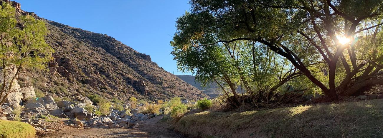
Visitors to Agua Fria National Monument can hike in rugged landscapes, view rock art, and experience wide‑open desert vistas with few built facilities. Because the area is remote and minimally serviced, visitors should plan ahead and be prepared for changing weather and rough roads.
Things to Do
- Hike and explore: Walk sandy washes and rocky routes to river corridors and mesa‑top dwellings. Trails are mostly undeveloped; carry plenty of water and wear sturdy footwear.
- View cultural sites: Visit mesa‑top pueblos and petroglyph panels. Look, photograph, and leave artifacts in place. Featured sites include:
- Badger Springs Trailhead: Short route down Badger Springs Wash to the Agua Fria River and a petroglyph panel at the confluence.
- Pueblo La Plata Cultural Site: A large mesa‑top village reachable by high‑clearance road, followed by a rocky walk.
- Riverbend Recreation Area and 1891 Schoolhouse: Quiet riverside site near Cordes Lakes with a short walk to the historic schoolhouse foundation.
- Teskey Home Site: Remains of a chimney and foundation from a 1940s family homestead along Big Bug Creek.
- Birdwatch: The Agua Fria riparian corridors are an Audubon‑designated Important Bird Area, with more than 180 documented species and strong seasonal migration.
- Camp: Undeveloped areas are available for dispersed camping with a 14‑day limit. Check local regulations for fire and camping guidelines.
- Take a Scenic Drive: Travel unpaved roads like Bloody Basin Road for canyon and mesa views between Interstate 17 and the Tonto National Forest. High‑clearance is recommended beyond the first graded miles.
- Hunt and Fish: Allowed with the proper license and permits. Follow Arizona Game and Fish Department regulations.
Features and Services
- Hours and Seasons: Open year‑round, 24 hours a day. Spring and fall offer milder temperatures, and summers are hot and dry.
- Access and Road Conditions: Bloody Basin Road is graded for the first 5 miles; beyond that, expect rough conditions where high‑clearance or four-wheel drive may be needed. Road conditions change with weather.
- Cell Service: Service is limited and unreliable.
- Toilets: Accessible vault toilets are available at Badger Springs Trailhead and at Silver Creek along Bloody Basin Road.
- Drinking Water: Not available – bring your own.
- Pets: Pets are welcome. Please keep them under control and clean up waste.
- Special Use Permits: Permits are required for organized events or visiting groups of 25 or more. Motorized vehicles must stay on numbered, designated roads; driving in washes is prohibited. Contact the Hassayampa Field Office for current information.
Safety and Preparedness
Expect rough, rocky terrain and remote conditions. In summer, temperatures can exceed 110 °F, so carry and drink plenty of water, use sun protection, and start early. Rattlesnakes may be active as early as February. Avoid washes during storms due to flash‑flood risk. Check road conditions before you go.
Contact Us

Activities


Directions
Agua Fria National Monument is about 40 miles north of central Phoenix via Interstate 17. Main access points are Badger Springs Road (Exit 256), Bloody Basin Road (Exit 259), and the Cordes Lakes/3M Ranch area near Exit 262.
Fees
The Agua Fria National Monument is free (no fee required) for general visits by the public.
Stay Limit
Agua Fria National Monument
Maps and Brochures
Photo Album

Respect and Protect
Please leave cultural artifacts and rock art undisturbed and do not climb on walls or structures. Motorized vehicles must stay on numbered, designated roads; driving in washes is prohibited. By practicing responsible outdoor ethics, you help ensure future visitors can enjoy this remarkable site.