



U.S. Wildland Fire Service Wildland Firefighters are Working to Contain Weiser Knoll Fire in Fremont County
Organization:
Media Contact:
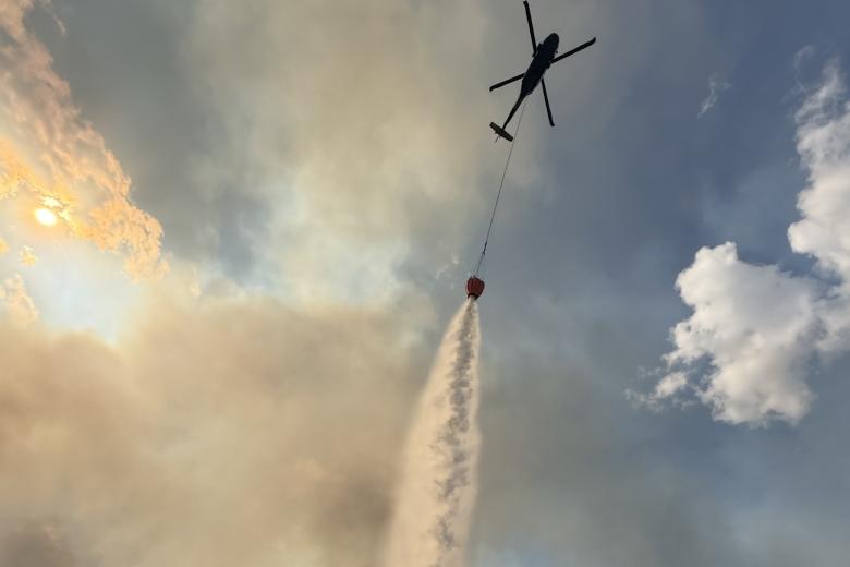
LANDER, WY — U.S. Wildland Fire Service wildland firefighters in collaboration with local cooperators and other federal agencies are responding to the Weiser Knoll Fire, which was reported on August 9, 2026, at approximately 2:15 p.m. The fire is located 13 miles southeast of Lander, Wyoming. The fire is estimated to be approximately 13,350 or more acres and is 0% contained.
Closures / Public Safety
Go-Level 3-Evacuation Order is currently in place for all residents in the Twin Creek drainage area east of Highway 28 at Jonny Lees Corner and south of Highway 287. For the most up to date evacuation information please visit Fremont Conty Wyoming Emergency Management Agency at www.facebook.com/FremontCountyWYEMA.
Response Actions
Crews are actively working to suppress the fire and protect life, property, and natural and cultural resources. This fire is being managed under a full suppression strategy using direct extinguishment tactics including ground resources actively working at the fire’s edge to slow and stop its spread. In addition, multiple aircraft including Type 1, and Type 3 helicopters as well as SEATs and Large Airtankers have assisted with the suppression efforts.
Additional wildland firefighting resources have been ordered to support suppression efforts.
Current Conditions
The National Weather Service in Riverton issued a Red Flag Warning for Fremont County that remains in effect until 9 p.m. tonight, August 10. A combination of strong winds, low relative humidity, and warm temperatures can contribute to extreme fire behavior with wind-driven runs, and short-range spotting. Motorists are encouraged to remain alert to fire traffic when traveling on local roadways, including Highway WY 28 and US 287.
For updated fire information, visit Wywbd Weiser Knoll Fire Information | InciWeb.
Public Information
Active wildfire areas are always a No Drone Zone. When unauthorized drones are detected in the area, aerial firefighting operations are immediately grounded for safety, delaying response efforts and limiting our ability to protect lives, property, and natural resources.
Air Quality & Smoke Information
For current air quality forecasts and smoke advisories please visit www.airnow.gov.
The BLM manages about 245 million acres of public land located primarily in 12 western states, including Alaska, on behalf of the American people. The BLM also administers 700 million acres of sub-surface mineral estate throughout the nation. Our mission is to sustain the health, diversity, and productivity of America’s public lands for the use and enjoyment of present and future generations.