
Slinkard Fire Update
Organization:
BLM Office:
Media Contact:
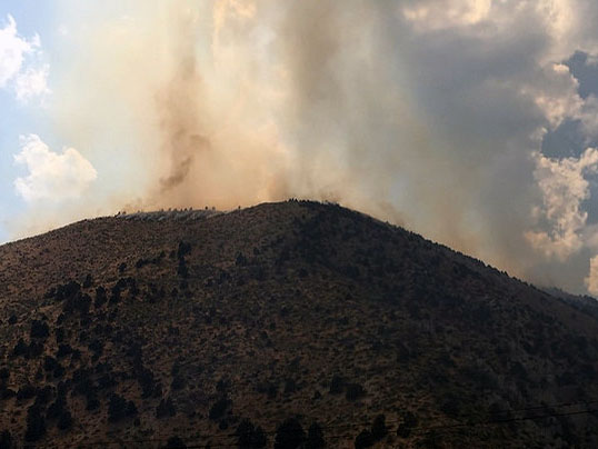 TOPAZ, Calif. - The Slinkard Fire is now estimated to be 3,000 acres and 0% contained. It is located in the Slinkard Valley, west of Topaz in Mono County, California. The fire is burning in cheat grass, sagebrush and pinyon/juniper.
The fire crossed Hwy 89 and moved east towards Topaz with the afternoon down canyon winds. Fire crews continue to put in dozer line along the eastern edge of Topaz and numerous engines are in place for structure protection. This evening’s winds were not as strong as predicted and this is assisting fire crews in their efforts. Crews will continue these efforts tonight with the focus being on protecting the town of Topaz.
Topaz has been evacuated north of Hwy 89 to the Nevada state line.
For public safety, Hwy 89 remains closed between Hwy 395 and Hwy 4 (at Monitor Pass). Hwy 395 is closed from the junction of State Route 182 in Bridgeport to the Nevada state line.
There are five hand crews, numerous engines, three helicopters and support staff assigned to the fire. A Type 3 Incident Management Team is en route. A Type 1 Incident Management Team is being ordered. This appears to be a lightning-caused fire.
The BLM manages about 245 million acres of public land located primarily in 12 western states, including Alaska, on behalf of the American people. The BLM also administers 700 million acres of sub-surface mineral estate throughout the nation. Our mission is to sustain the health, diversity, and productivity of America’s public lands for the use and enjoyment of present and future generations.