


New Interactive Map Opens the Door to More Accessible Outdoor Adventures
Organization:
Media Contact:
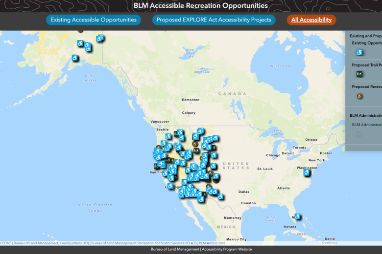
WASHINGTON — A new interactive map is making it easier for visitors to discover accessible trails, facilities, and recreation opportunities on America’s public lands. In support of All Americans Outside and the Expanding Public Lands Outdoor Recreation Experiences (EXPLORE) Act, the Bureau of Land Management developed this tool to help more Americans, regardless of ability, enjoy and connect with their public lands. This work helps pinpoint where reducing accessibility barriers can deliver the greatest benefits for surrounding communities, strengthening both outdoor opportunities and local economies.
“Public lands belong to all of us, and expanding accessible recreation is essential to ensuring everyone has the opportunity to explore and enjoy these spaces,” said BLM Director Steve Pearce. “Different visitors need different options, fewer barriers, and accurate information. This new interactive tool is one step toward providing an outdoor recreation system that truly serves all Americans.”
In addition to identifying accessible trails and facilities, the map highlights proposed projects developed under the EXPLORE Act, which directs federal land management agencies to identify and advance opportunities that improve accessibility across public lands.
“Accessibility” on public lands means ensuring that all people can safely, equitably, and independently enjoy the recreational, cultural, and natural opportunities offered on federally, state, and locally managed lands, by removing barriers and providing reasonable accommodations. Improving accessibility on public lands not only broadens who can participate in outdoor recreation, but it also supports sustainable economic growth in the communities that depend on these landscapes.
The BLM recently completed an initial nationwide assessment to identify where accessibility improvements are most needed, evaluating known gaps, site readiness, and consistency with existing land use plans. The findings helped inform a list of proposed accessibility projects now viewable through the map, some of which are under construction or in the planning and funding phase. This new map reflects BLM’s commitment to ensuring that all visitors, including people with disabilities and communities that have historically faced barriers to outdoor recreation, can experience and enjoy the nation’s public lands. All projects will be in compliance with the Architectural Barriers Act.
The interactive map provides:
Existing accessible recreation sites
Proposed accessible trails and recreation projects identified through the EXPLORE Act
Areas where the All Americans Outside Initiative is helping identify additional accessibility needs
Searchable sites and features–search by state or BLM field office, and click on individual sites for project details, accessibility features, and planning status
As work progresses on enhancing accessibility on public lands, the BLM plans to engage a broad range of stakeholders—including disability advocates, local communities, tribal governments, partners, and recreation organizations—to gather feedback on project feasibility, design considerations, and partnership opportunities. Their participation will help refine cost estimates, strengthen project proposals, and inform which locations are best positioned to move toward implementation.
BLM offices nationwide will continue incorporating insights from the All Americans Outside Initiative into accessibility planning and outreach, ensuring that proposed improvements align with community needs and deliver the greatest benefit.
For further details on accessibility projects and local contacts, explore BLM’s accessibility information.
The BLM manages about 245 million acres of public land located primarily in 12 western states, including Alaska, on behalf of the American people. The BLM also administers 700 million acres of sub-surface mineral estate throughout the nation. Our mission is to sustain the health, diversity, and productivity of America’s public lands for the use and enjoyment of present and future generations.