Campfire Restrictions Increase to Stage 3 on Wild Portion of Lower Rogue River Beginning July 28
Organization:
BLM Office:
Media Contact:
Joint News Release
Bureau of Land Management, Medford District
U.S. Forest Service, Rogue River-Siskiyou National Forest
Oregon Department of Forestry, Southwest Oregon District
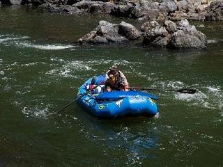
SW Oregon – As the weather continues to trend towards extreme warming and increasing drought conditions, officials with the Bureau of Land Management Medford District, Rogue River-Siskiyou National Forest and Oregon Department of Forestry Southwest Oregon District are increasing campfire restrictions on those lands located within the boundaries of the Wild section of the Rogue National Wild and Scenic River. The Wild section flows from Grave Creek to the mouth of Watson Creek.
Effective 12:01 a.m. on Wednesday July 28, 2021, building, maintaining, attending, or use of a fire is only permitted with the use of commercial stoves that use liquid fuel or propane. Cooking areas need to be naturally cleared of vegetation, and must be below the high water mark. As a preventative measure, groups traveling on the river must have a shovel and bucket. Charcoal briquettes will not be permitted.
Additionally, smoking is only permitted while on watercraft on waterways, or in areas that are on vegetation-free sand and gravel bars located between the river and high water mark.
The BLM administers the stretch of the river between Grave Creek and Marial, which is protected from fire by ODF Southwest. The Forest Service manages from Marial and downriver to the mouth of Watson Creek.
These restrictions will be in place through November 30, 2021, unless sooner rescinded.
For more information and to see the full text of the orders, see the RRSNF and BLM websites.
As conditions across SW Oregon continue to be hot and dry, and resources are actively suppressing multiple fires across the west, fire managers are reminding the public to be aware of fire danger, fire restrictions, and their important role in preventing human-caused fires.
Additional fire restrictions may be put in place as fire season progresses. Interested in more information regarding fire safety notifications and regulations on public lands in southwest Oregon? Helpful sites include:
- The RRSNF Alerts and Notices page;
- The BLM OR/WA Fire Restrictions Page;
- Region 6 Interactive Fire Closure Map;
- Follow the BLM, RRSNF and ODF on Facebook; and
- The SW Oregon ODF blog.
Those visiting public lands throughout the area are encouraged to be extremely vigilant due to widespread drought conditions and record-setting high temperatures. Don’t be the one spark that starts a wildfire!
The BLM manages about 245 million acres of public land located primarily in 12 western states, including Alaska, on behalf of the American people. The BLM also administers 700 million acres of sub-surface mineral estate throughout the nation. Our mission is to sustain the health, diversity, and productivity of America’s public lands for the use and enjoyment of present and future generations.

