
Agua Fria National Monument | Arizona
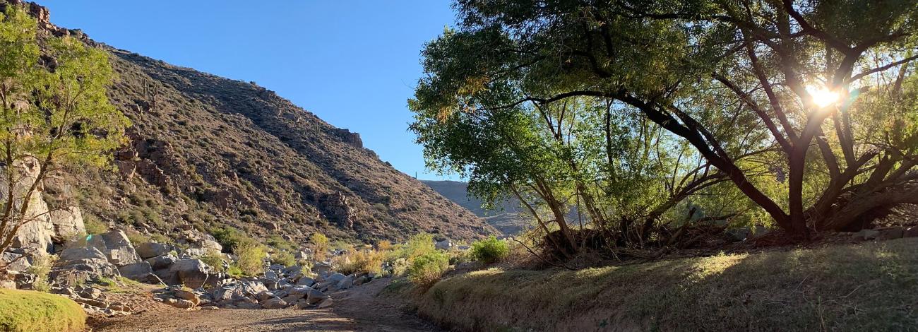
Adjacent to rapidly expanding communities, the 71,000-acre Agua Fria National Monument is about 40 miles north of central Phoenix. The monument encompasses two mesas and the canyon of the Agua Fria River. Elevations range from 2,150 feet above sea level along the Agua Fria Canyon to about 4,600 feet in the northern hills. The diversity of vegetative communities, topographic features, and a dormant volcano decorates the landscape with a big rocky, basaltic plateau. This expansive mosaic of semi-desert area one of the most significant systems of prehistoric sites in the American Southwest.
In addition to the rich record of human history, the monument contains outstanding biological resources. The area is the home to coyotes, bobcats, antelope, mule deer, javelina, a variety of small mammals and songbirds. Eagles and other raptors may also be seen. Native fish exist in the Agua Fria River and its tributaries.
Hours and Seasons
The monument is open 24 hours a day, year-round.
Places to Go
Getting Around
From the Badger Springs exit there is a maintained dirt road leading to the Badger Springs Trailhead. The Bloody Basin Road has a graded surface for the first five miles. Beyond that, a high-clearance vehicle is needed to travel the remainder of the road. Road conditions may change with the weather. Contact the monument office for latest road conditions.
Things to Do
Archaeological Site Viewing: There are hundreds of archaeological sites in the Agua Fria. We recommend exploring Pueblo la Plata as well as a site at the confluence of Badger Springs Wash and the Agua Fria River. Explore these sites but leave artifacts as they are. Please help protect these prehistoric and historic sites as an important part of the nation’s heritage.
Birding: The Agua Fria River and its tributaries within the monument are designated as an Important Bird Area by the Audubon Society. Try looking for birds along the Badger Springs Trail or at the Riverbend Recreation Area. Download a bird list from Friends of Agua Fria National Monument.
Driving and Biking: Roads in the monument are unpaved. High clearance or four-wheel drive may be required. Motorized vehicles must stay on numbered designated roads. Driving in washes is prohibited. Bicycles and other non-motorized vehicles must also stay on designated roads.
Hiking: Hiking is a popular activity at the monument. There are no developed trails. The terrain is very rough and rocky with steep cliffs, canyons and remote areas. Be prepared with plenty of water, supplies, and proper hiking equipment. Badger Springs Trail is a popular short hike.
Features and Services
Drinking Water: There is no drinking water available on the monument. Bring plenty of water.
Toilets: There are vault toilets at Badger Springs and along Bloody Basin Road at Silver Creek.
Cell Phone and Internet: Cell phone service may be unreliable. There is no public internet or Wi-Fi.
Camping
There are no campgrounds in the monument. Dispersed/primitive camping is allowed on the monument. You may pick your own campsite, but please use existing hardened sites and protect riparian areas by camping at least 200 feet from water sources. Learn more about camping on public lands. Be prepared and bring your own water for all your drinking and camping needs.
Safety and Conditions
If you're visiting in summer, you should drink plenty of water because temperatures may exceed 110ºF (43ºC). We recommend wearing sunscreen, sunglasses and a hat. Make sure your gas tank is full, carry additional water in your vehicle, and make sure your vehicle is in good condition. The hot desert sun stirs up rattlesnakes and other reptiles as early as February.
Flash floods caused by sudden storms can be dangerous in washes.
There are no first aid facilities on site. The nearest medical facilities are in north Phoenix.
Accessibility Description (ABA/ADA)
Badger Springs Trail is an uneven, rocky trail that follows a wash. The trail descends gradually to the Agua Fria River. Water may be present in the wash during wet seasons. A toilet near the Badger Springs Trailhead is accessible to wheelchairs.
The area around Pueblo la Plata is generally flat, thought trails may be rocky and uneven.
You can reach Teskey Home Site by crossing a walk-through gate and climbing a short series of wooden steps to the site. The area around the site is generally flat.
Flickr Album

Contact Us

Activities


Addresses
Geographic Coordinates
Directions
The Agua Fria National Monument is located 40 miles north of Phoenix, AZ. It is easily accessed by traveling to Interstate 17 to the Badger Springs (exit 256), Bloody Basin Road (exit 259), or Cordes Junction exits.
Fees
The Agua Fria National Monument is free (no fee required) for general visits by the public.
However, commercial, competitive, and large organized group events require a special recreation permit. Contact the Hassayampa Field Office for more information about special recreation permits.